| | | | | Arrive | Depart |
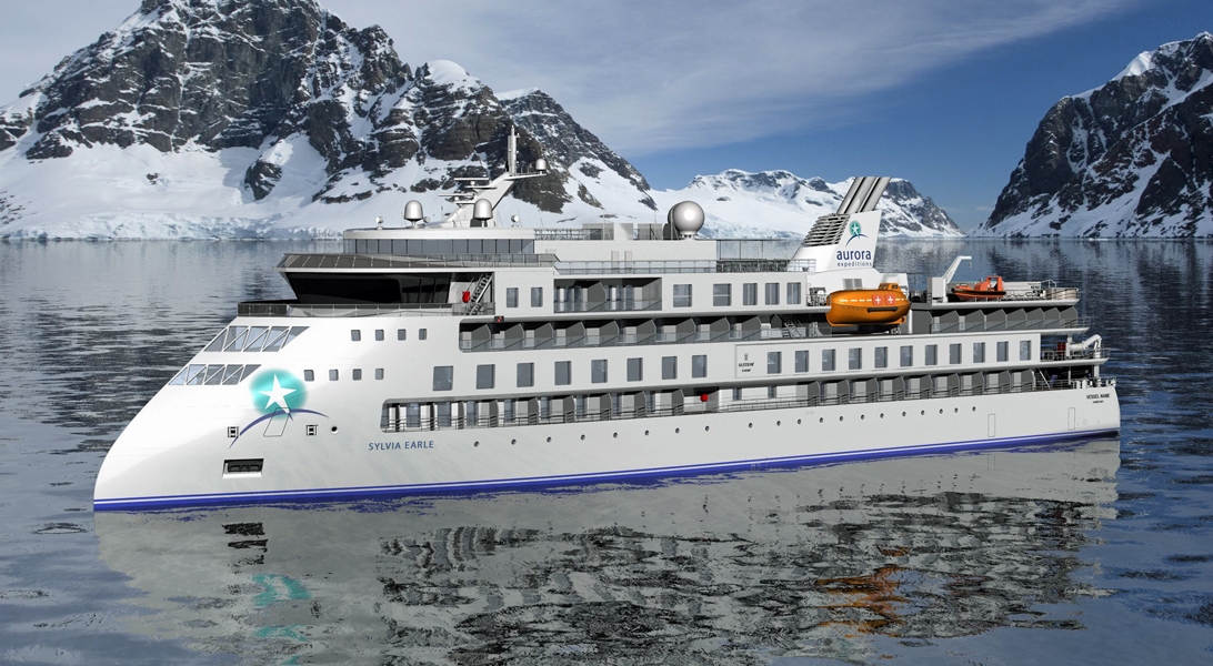
| 12th12 | SepSep | 202828 | Calgary, Alberta, Canada, embark on the Sylvia Earle | | |
On arrival in Calgary, you will be met by an Aurora Expeditions representative and transferred to the group hotel. Visit the Aurora Expeditions hospitality desk to collect your cabin luggage tags and speak with our ground operations team. They will share important pre-embarkation information for tomorrow’s charter flight and can assist with local dining suggestions or last-minute purchases. The remainder of the day is yours to enjoy at leisure. All meals today are at your own expense. Accommodation: Calgary hotel (to be advised). |
| 13th13 | SepSep | 202828 | At Sea | | |
| 14th14 | SepSep | 202828 | At Sea | | |
| 15th15 | SepSep | 202828 | Cambridge Bay, Nunavut, Canada | | |
Iqaluktuuttiaq, or Cambridge Bay, means ‘place of many fish’ and reflects the rich waters that have long drawn Inuit families to this part of Victoria Island. Today it is a vibrant regional centre where Inuinnaqtun language, harvesting traditions and contemporary northern life meet. The harbour is also linked with Roald Amundsen’s ship Maud, which remained here for decades after becoming trapped in ice and sinking. A locally guided visit may explore community history and culture before we return to the ship and continue east. |
| 16th16 | SepSep | 202828 | King William Island, Nunavut, Canada | | |
We aim to explore the western side of King William Island, known to Inuit as Qikiqtaq. This landscape is central to the Franklin story, but its history is far older and richer than the European search for a passage. Inuit travelled, hunted and camped throughout the region for generations, developing knowledge that later proved crucial to understanding the fate of HMS Erebus and HMS Terror. Weather and sea ice will determine our landing place. On shore, the Expedition Team may interpret archaeological features, expedition relics and the oral histories that connect this coast with one of polar exploration’s most enduring mysteries. We will also watch for caribou, Arctic foxes, seals and polar bears. |
| 17th17 | SepSep | 202828 | Bellot Strait, Nunavut, Canada | | |
Bellot Strait is one of the most storied waterways of the Northwest Passage. Barely two kilometres wide at its narrowest point, it separates Somerset Island from the Boothia Peninsula and is swept by strong tides and shifting ice. Safe conditions may allow us to transit or explore in the vicinity of Fitzroy Inlet, Bellot Strait or Strzelecki Harbour. Zodiac cruises and tundra walks reveal an austere landscape of cliffs, coves and tidal channels. This was a formidable obstacle for early navigators, yet part of a well-known homeland and travel network for Inuit. Scan the shore and water for polar bears, seals, beluga and seabirds. |
| 18th18 | SepSep | 202828 | Radstock Bay, Devon Island, Canada | | |
Devon Island is Canada’s sixth largest island and was first seen by Europeans in the early 17th century. The Thule culture had already settled there many centuries before, and left behind qarmat homes, made of rocks, whale bones, rock and sod walls, and skins for roofs that tell a story of over 800 years of human habitation. Other striking finds in this area are the many fossils of corals, crinoids and nautiloids that can be seen. Just across Lancaster Sound is Prince Leopold Island, a Canadian Important Bird Area, a federally listed migratory bird sanctuary, and a Key Migratory Bird Terrestrial Habitat site with large numbers of Thick-billed Murres, Northern Fulmars and Black-legged Kittiwakes that breed there. At Radstock Bay, beneath the limestone mass of Caswall Tower, archaeological remains reveal generations of Inuit life. Stone house foundations, caches and whale bones speak to sophisticated hunting practices, food storage and seasonal movement through the region. We hope to hike across raised beaches and tundra while our guides bring these traces into context. Wildlife also shapes our plans. Walrus may use parts of this coast as haul-out habitat, and access can be restricted to protect them. Musk oxen, Arctic hare, foxes and polar bears are also possible in the wider area, so the Expedition Team may select an alternative site on northwestern Somerset Island if required. |
| 19th19 | SepSep | 202828 | Maxwell Bay, Canada | | |
Maxwell Bay (Tasiujaq) cuts deeply into Devon Island and offers a choice of sheltered inlets, including Graham Harbour and Custance Inlet. By late September the tundra has taken on autumn tones and early snow may sharpen the island’s flat-topped mountains and glacial valleys. We may explore by Zodiac or on foot, watching for musk oxen, Arctic hare and foxes on land, and seals or walrus in the water. Polar bears move throughout this region, although every sighting is a matter of chance. Archaeological remains and historic sites may also reveal how Inuit travellers, traders and later government patrols used these protected waters. |
| 20th20 | SepSep | 202828 | Croker Bay, Nunavut, Canada | | |
At Croker Bay, a glacier descends towards a broad Arctic inlet. Conditions may favour a Zodiac cruise among sculpted ice or a landing beneath Devon Island’s distinctive mountains. Ringed seals and walrus may be present, with polar bears occasionally travelling the coast. We also hope to visit Dundas Harbour, where the remains of an RCMP post and former Hudson’s Bay Company activity represent a recent layer of history. Nearby archaeological features point to much older Inuit use of this coast. A tundra walk may bring encounters with musk oxen, Arctic hare and late-season birdlife. |
| 20th20 | SepSep | 202828 | Dundas Harbour, Devon Island, Nunavut, Canada | | |
Dundas Harbour is located in the southeast of Devon Island, Canada’s 6th largest island. It is a forlorn but starkly beautiful spot. The island was first sighted by Europeans in 1616 by the English explorers Robert Bylot and William Baffin. But it did not appear on maps until after explorer William Edward Parry’s exploration in the 1820’s. Parry named it after Devon, England. In the local Inuktitut language, the place is called Talluruti, which translates as “a woman’s chin with tattoos on it.” This refers to the deep crevasses and streaks on Devon Island, which from a distance resemble traditional facial tattoos. On land there are remains of a Thule settlement dating back to 1000 A.D., including tent rings, middens and a gravesite. There are also much more recent remains a Royal Canadian Mounted Police outpost. The first post was established in 1924 to monitor and control illegal activities, such as foreign whaling, in the eastern entrance to the Northwest Passage. But conditions were so isolated and severe that the post was abandoned in 1933. It was reopened in 1945, but again closed, this time permanently, in 1951. Today, Devon Island is the largest uninhabited island in the world. |
| 21st21 | SepSep | 202828 | At Sea | | |
| 22nd22 | SepSep | 202828 | Kullorsuaq, Greenland | | |
Our return to Greenland begins at Kullorsuaq, a small community set among islands, mountains and ice in the Upernavik Archipelago. The settlement takes its name from the distinctive mountain nearby: Kullorsuaq, or ‘the Big Thumb’, known in English as the Devil’s Thumb. A community visit may offer insight into life in one of Greenland’s northern settlements, where hunting and fishing remain closely tied to sea ice, weather and seasonal wildlife. Offshore, icebergs drift through intricate channels used by seals and whales, and the surrounding cliffs may hold ravens and seabirds. |
| 22nd22 | SepSep | 202828 | Devils Thumb, United States | | |
| 23rd23 | SepSep | 202828 | Nuussuaq Peninsula, Greenland | | |
A morning at sea allows time to watch the Greenland coast unfold and to learn more about its geology, wildlife and human history. Humpback and minke whales may be encountered in these waters, while changing ice and weather guide our progress. Later, we hope to explore around Nuussuaq. The peninsula’s immense basalt mountains and broad valleys preserve evidence of ancient movement and settlement along a coast that has supported Inuit communities for thousands of years. A late-day landing may offer a tundra walk, Zodiac cruise or community visit, subject to conditions and local arrangements. |
| 24th24 | SepSep | 202828 | Ilulissat (Jakobshavn), Greenland | | |
Known as the birthplace of icebergs, the Ilulissat Icefjord produces nearly 20 million tons of ice each day. In fact, the word Ilulissat means “icebergs” in the Kalaallisut language. The town of Ilulissat is known for its long periods of calm and settled weather, but the climate tends to be cold due to its proximity to the fjord. Approximately 4,500 people live in Ilulissat, the third-largest town in Greenland after Nuuk and Sisimiut. Some people here estimate that there are nearly as many sled dogs as human beings living in the town that also boasts a local history museum located in the former home of Greenlandic folk hero and famed polar explorer Knud Rasmussen. Today’s plans will be shaped by ice, weather and local conditions. We hope to visit Ilulissat, where people have lived beside the icefjord for more than 4,000 years. A walk towards the UNESCO World Heritage-listed Ilulissat Icefjord reveals a constantly changing procession of bergs calved by Sermeq Kujalleq. The nearby Sermermiut valley preserves traces of successive Inuit cultures and adds a powerful human story to this extraordinary glacial landscape. |
| 25th25 | SepSep | 202828 | Ukivik, Greenland | | |
At Ukivik, open tundra and an indented coast may offer a final wilderness walk, shaped by weather, wildlife and local conditions. Later, we hope to visit Nipisat, part of the UNESCO World Heritage property Aasivissuit–Nipisat: Inuit Hunting Ground between Ice and Sea. Archaeological layers document more than 4,000 years of human history and reveal how successive cultures adapted to seasonal resources between the Greenland Ice Sheet and the coast. It is a fitting place to reflect on Inuit resilience, knowledge and continuity at the end of our passage. |
| 25th25 | SepSep | 202828 | Nipisat Island, Greenland | | |
| 26th26 | SepSep | 202828 | Reykjavík, Iceland, disembark the Sylvia Earle | | |
Sprawling Reykjavík, the nation's nerve center and government seat, is home to half the island's population. On a bay overlooked by proud Mt. Esja (pronounced eh-shyuh), with its ever-changing hues, Reykjavík presents a colorful sight, its concrete houses painted in light colors and topped by vibrant red, blue, and green roofs. In contrast to the almost treeless countryside, Reykjavík has many tall, native birches, rowans, and willows, as well as imported aspen, pines, and spruces.Reykjavík's name comes from the Icelandic words for smoke, reykur, and bay, vík. In AD 874, Norseman Ingólfur Arnarson saw Iceland rising out of the misty sea and came ashore at a bay eerily shrouded with plumes of steam from nearby hot springs. Today most of the houses in Reykjavík are heated by near-boiling water from the hot springs. Natural heating avoids air pollution; there's no smoke around. You may notice, however, that the hot water brings a slight sulfur smell to the bathroom.Prices are easily on a par with other major European cities. A practical option is to purchase a Reykjavík City Card at the Tourist Information Center or at the Reykjavík Youth Hostel. This card permits unlimited bus usage and admission to any of the city's seven pools, the Family Park and Zoo, and city museums. The cards are valid for one (ISK 3,300), two (ISK 4,400), or three days (ISK 4,900), and they pay for themselves after three or four uses a day. Even lacking the City Card, paying admission (ISK 500, or ISK 250 for seniors and people with disabilities) to one of the city art museums (Hafnarhús, Kjarvalsstaðir, or Ásmundarsafn) gets you free same-day admission to the other two. |