This site uses cookies as defined in our Cookie Policy, by continuing to use this site you agree to their use.
Continue

Welcome to Aurora Expeditions’ Northwest Passage expedition. Arctic from Greenland to the Canadian High Arctic on a journey shaped by ice, human ingenuity and centuries of polar ambition. Follow waterways long travelled by Inuit, whose knowledge of seasons, wildlife and sea ice made life—and later exploration—possible in this immense region. Along the way, encounter places associated with Franklin, Amundsen and the RCMP schooner St Roch, while archaeological sites reveal far older stories of Inuit adaptation and movement. Wildlife remains wonderfully unpredictable: watch for polar bea... rs, walrus, musk oxen, seals, whales and Arctic birdlife as our route responds to weather and sea ice.
| Arrive | Depart | ||||||
| 30th30 | AugAug | 202828 | Reykjavík, Iceland, embark on the Sylvia Earle | ||||
Sprawling Reykjavík, the nation's nerve center and government seat, is home to half the island's population. On a bay overlooked by proud Mt. Esja (pronounced eh-shyuh), with its ever-changing hues, Reykjavík presents a colorful sight, its concrete houses painted in light colors and topped by vibrant red, blue, and green roofs. In contrast to the almost treeless countryside, Reykjavík has many tall, native birches, rowans, and willows, as well as imported aspen, pines, and spruces.Reykjavík's name comes from the Icelandic words for smoke, reykur, and bay, vík. In AD 874, Norseman Ingólfur Arnarson saw Iceland rising out of the misty sea and came ashore at a bay eerily shrouded with plumes of steam from nearby hot springs. Today most of the houses in Reykjavík are heated by near-boiling water from the hot springs. Natural heating avoids air pollution; there's no smoke around. You may notice, however, that the hot water brings a slight sulfur smell to the bathroom.Prices are easily on a par with other major European cities. A practical option is to purchase a Reykjavík City Card at the Tourist Information Center or at the Reykjavík Youth Hostel. This card permits unlimited bus usage and admission to any of the city's seven pools, the Family Park and Zoo, and city museums. The cards are valid for one (ISK 3,300), two (ISK 4,400), or three days (ISK 4,900), and they pay for themselves after three or four uses a day. Even lacking the City Card, paying admission (ISK 500, or ISK 250 for seniors and people with disabilities) to one of the city art museums (Hafnarhús, Kjarvalsstaðir, or Ásmundarsafn) gets you free same-day admission to the other two. On arrival in Reykjavík, you will be met by an Aurora Expeditions representative and transferred to the group hotel. Visit the Aurora Expeditions hospitality desk to collect your cabin luggage tags and speak with our ground operations team. They will share any important pre-embarkation information and can assist with local dining suggestions, cash withdrawals or last-minute purchases. The remainder of the day is yours to enjoy at leisure. All meals today are at your own expense. Accommodation: Reykjavík airport hotel (to be advised). | |||||||
| 31st31 | AugAug | 202828 | Kangerlussuaq Havn, Greenland | ||||
The name Kangerlussuaq means "Big Fjord" in the local Kalaallisut language. The settlement of about 500 people is located in western Greenland on flat land at the head of a fjord with the same name. Kangerlussuaq is the site of Greenland's largest commercial airport and most of the economy here is dependent on the air transportation hub and tourism. The rugged lands around the settlement support terrestrial Arctic fauna including muskoxen, caribou, and Gyrfalcons. Transfer to Keflavik Reykjavík Airport and board our charter flight to Kangerlussuaq, Greenland. Please ensure your main luggage is fitted with the cabin tags provided and keep valuables, travel documents, medication and anything required during the day in your hand luggage. On arrival, transfer to Sylvia Earle, waiting at the head of the 190-kilometre (118-mile) Kangerlussuaq Fjord. Settle into your cabin and join the mandatory safety briefings before meeting your Expedition Team and crew. As we sail through the long fjord, steep mountains and glacially carved valleys provide a dramatic introduction to Greenland. | |||||||
| 1st01 | SepSep | 202828 | Sisimiut (Holsteinsborg), Greenland | ||||
Located just north of the Arctic Circle, Sisimiut is the northernmost town in Greenland where the port remains free of ice in the winter. Yet it is also the southernmost town where there is enough snow and ice to drive a dogsled in winter and spring. In Sisimiut, travelling by sled has been the primary means of winter transportation for centuries. In fact, the area has been inhabited for approximately 4,500 years. Modern Sisimiut is the largest business center in the north of Greenland, and is one of the fastest growing Greenlandic cities. Commercial fishing is the lead economy in the town‘s thriving industrial base. North of the Arctic Circle, Sisimiut brings together a remarkably long human history and the energy of modern Greenland. Archaeological evidence records waves of settlement by Saqqaq, Dorset and later Thule cultures, while today the town remains an important centre for fishing, hunting, education and outdoor life. We hope to explore the historic quarter around the old blue church and museum, where turf-house reconstructions and local collections reveal how generations adapted to this demanding environment. | |||||||
| 2nd02 | SepSep | 202828 | Ilulissat (Jakobshavn), Greenland | ||||
Known as the birthplace of icebergs, the Ilulissat Icefjord produces nearly 20 million tons of ice each day. In fact, the word Ilulissat means “icebergs” in the Kalaallisut language. The town of Ilulissat is known for its long periods of calm and settled weather, but the climate tends to be cold due to its proximity to the fjord. Approximately 4,500 people live in Ilulissat, the third-largest town in Greenland after Nuuk and Sisimiut. Some people here estimate that there are nearly as many sled dogs as human beings living in the town that also boasts a local history museum located in the former home of Greenlandic folk hero and famed polar explorer Knud Rasmussen. Spend the morning on deck as we cross Disko Bay, watching for humpback and minke whales and for the first immense icebergs drifting south from Ilulissat Icefjord. The Expedition Team will introduce the geology, wildlife and human history of the region as we approach Ilulissat. In the afternoon, we hope to step ashore in Ilulissat, where people have lived beside the icefjord for more than 4,000 years. Walk across tundra and exposed rock towards viewpoints over the UNESCO World Heritage-listed Ilulissat Icefjord. Here, ice calved by Sermeq Kujalleq moves towards Disko Bay in a constantly changing procession of bergs. The nearby Sermermiut valley preserves traces of successive Inuit cultures and adds a powerful human story to this extraordinary glacial landscape. | |||||||
| 3rd03 | SepSep | 202828 | Aappilattoq, Greenland | ||||
Aappilattoq is a small settlement near the western end of Prins Christian Sund in southwestern Greenland. In the local Greenlandic language the name means, "sea anemone". This small village of 130 inhabitants, hidden behind a prominent rock, offers a good insight into the life of Greenlandic Inuit. A stroll through the village will reveal a small school and a church, along with the likely possibility of seeing a polar bear skin drying in the wind behind a local dwelling. People have lived off the land in the area around Aappilattoq since the 19th century. The tradition continues today as most people here hunt and fish to make a living. | |||||||
| 4th04 | SepSep | 202828 | At Sea | ||||
| 5th05 | SepSep | 202828 | Pond Inlet, Nunavut, Canada | ||||
Located in northern Baffin Island, Pond Inlet is a small, predo¬minantly Inuit community, with a population of roughly 1,500 inhabitants. In 1818, the British explorer John Ross named a bay in the vicinity after the English astronomer John Pond. Today Pond Inlet is considered one of Canada's "jewels of the North" thanks to several picturesque glaciers and mountain ranges nearby. Many archaeological sites of ancient Dorset and Thule peoples can be found near Pond Inlet. The Inuit hunted caribou, ringed and harp seals, fish, polar bears, walrus, narwhals, geese, ptarmigans and Arctic hares, long before European and American whalers came here to harvest bowhead whales. Pond Inlet is also known as a major center of Inuit art, especially the printmaking and stone carving that are featured in the town’s art galleries. After completing Canadian clearance formalities, we hope to visit Mittimatalik, known in English as Pond Inlet, on northern Baffin Island. Framed by mountains, glaciers and the waters of Eclipse Sound, the community is a gateway to Tallurutiup Imanga and a place where Inuit knowledge, language, art and harvesting traditions remain central to daily life. A locally guided visit may introduce community stories and contemporary life in the High Arctic. In the surrounding waters, we remain alert for narwhal, beluga, seals and seabirds, although all wildlife encounters are determined by season and chance. | |||||||
| 6th06 | SepSep | 202828 | Dundas Harbour, Devon Island, Nunavut, Canada | ||||
Dundas Harbour is located in the southeast of Devon Island, Canada’s 6th largest island. It is a forlorn but starkly beautiful spot. The island was first sighted by Europeans in 1616 by the English explorers Robert Bylot and William Baffin. But it did not appear on maps until after explorer William Edward Parry’s exploration in the 1820’s. Parry named it after Devon, England. In the local Inuktitut language, the place is called Talluruti, which translates as “a woman’s chin with tattoos on it.” This refers to the deep crevasses and streaks on Devon Island, which from a distance resemble traditional facial tattoos. On land there are remains of a Thule settlement dating back to 1000 A.D., including tent rings, middens and a gravesite. There are also much more recent remains a Royal Canadian Mounted Police outpost. The first post was established in 1924 to monitor and control illegal activities, such as foreign whaling, in the eastern entrance to the Northwest Passage. But conditions were so isolated and severe that the post was abandoned in 1933. It was reopened in 1945, but again closed, this time permanently, in 1951. Today, Devon Island is the largest uninhabited island in the world. On Devon Island (Tallurutit), we hope to land at Dundas Harbour. The remains of an RCMP post and a former Hudson’s Bay Company presence speak to a comparatively recent chapter, while nearby archaeological features point to a much older Inuit use of this coastline. Walk across rolling tundra with views towards Lancaster Sound, watching for musk oxen, Arctic hare and birdlife. At Croker Bay, a glacier descends towards a broad Arctic inlet. Conditions may favour a Zodiac cruise among sculpted ice or a shore landing beneath Devon Island’s flat-topped mountains. Ringed seals and walrus may be encountered in these productive waters, and polar bears are always a possibility in the wider region. | |||||||
| 6th06 | SepSep | 202828 | Croker Bay, Nunavut, Canada | ||||
| 7th07 | SepSep | 202828 | Prince Leopold Island, Nunavut, Canada | ||||
Prince Leopold Island (Appait) rises abruptly from Lancaster Sound. Its cliffs form one of the Canadian Arctic’s most important seabird breeding sites; by September many birds may already have departed, but northern fulmars, kittiwakes and thick-billed murres can still be seen offshore. Seals in the surrounding waters may also attract polar bears. Across the sound, Port Leopold recalls the many expeditions sent in search of Sir John Franklin. HMS Enterprise and HMS Investigator wintered here in 1848–49, and the remains of later commercial activity add further layers to the site. If conditions permit, we hope to walk the coast and consider this history alongside evidence of Inuit presence that long predates the explorers. | |||||||
| 8th08 | SepSep | 202828 | Beechey Island, Nunavut, Canada | ||||
Beechey Island is a small island off the southwest coast of Devon Island, separated by a narrow waterway called the Barrow Strait. Captain William Edward Parry was the first European to visit the island in 1819. His lieutenant, Frederick William Beechey, named the island after his father, the artist William Beechey (1753–1839). Beechey Island played a significant role in the history of Arctic Exploration. During the winter of 1845-46, Sir John Franklin and his men camped on the island as part of their ill-fated quest to find the Northwest Passage. Mummified remains of three of Franklin’s crew were discovered, giving a better understanding of what happened before the disappearance of the expedition. In 1850 Edward Belcher used the island as a base while surveying the area. Later, in 1903, Norwegian explorer Roald Amundsen stopped at the island at the beginning of his successful voyage in search for the Northwest Passage. Subsequently, Beechey Island has been declared a "Territorial Historic Site" since 1975 by the Northwest Territories government Beechey Island (Iluvilik), a Canadian National Historic Site, is one of the most poignant places in the story of the Northwest Passage. Franklin’s expedition wintered here in 1845–46, and the graves of three crew members remain on the shore. Later search parties, including those following Inuit testimony, returned repeatedly to this stark landscape. A guided walk will help place the site within both the Franklin story and the broader history of Arctic exploration. At Radstock Bay, beneath the imposing limestone mass of Caswall Tower, archaeological remains reveal generations of Inuit life. Stone house foundations, food caches and whale bones speak to skilled use of local resources and extensive movement through the region. We may hike across the raised beaches while watching for musk oxen, Arctic hare and signs of foxes. | |||||||
| 8th08 | SepSep | 202828 | Radstock Bay, Devon Island, Canada | ||||
Devon Island is Canada’s sixth largest island and was first seen by Europeans in the early 17th century. The Thule culture had already settled there many centuries before, and left behind qarmat homes, made of rocks, whale bones, rock and sod walls, and skins for roofs that tell a story of over 800 years of human habitation. Other striking finds in this area are the many fossils of corals, crinoids and nautiloids that can be seen. Just across Lancaster Sound is Prince Leopold Island, a Canadian Important Bird Area, a federally listed migratory bird sanctuary, and a Key Migratory Bird Terrestrial Habitat site with large numbers of Thick-billed Murres, Northern Fulmars and Black-legged Kittiwakes that breed there. | |||||||
| 9th09 | SepSep | 202828 | Bellot Strait, Nunavut, Canada | ||||
Bellot Strait is one of the most dramatic and technically challenging waterways in the Northwest Passage. Barely two kilometres wide at its narrowest point, it separates Somerset Island from the Boothia Peninsula and is swept by strong tides and shifting ice. Our transit and activities will depend entirely on safe conditions. We hope to explore in the vicinity of Fitzroy Inlet, Bellot Strait or Strzelecki Harbour. These sheltered waterways and austere shores invite Zodiac cruising and tundra walks, while their position at the northern edge of mainland North America evokes the navigational challenges faced by earlier expeditions. We will watch for polar bears, seals, beluga and seabirds along the ice edge and coast. | |||||||
| 10th10 | SepSep | 202828 | Pasley Bay, Nunavut, Canada | ||||
An early visit to Pasley Bay may connect us with the story of the RCMP schooner St Roch and its pioneering Northwest Passage voyages under Henry Larsen. Inuit knowledge, local assistance and Arctic seamanship were essential to such journeys, just as they remain central to safe travel here today. Later, we continue west through the maze of channels around Prince of Wales and Prince William islands. If conditions allow, a Zodiac excursion may take us towards a remote cairn or unplanned landing. These unscripted opportunities are at the heart of expedition travel, with the possibility of wildlife sightings and traces of earlier journeys revealed by the day’s route. | |||||||
| 11th11 | SepSep | 202828 | Cambridge Bay, Nunavut, Canada | ||||
As we sail towards Victoria Island, join the Expedition Team for presentations on Inuit archaeology, polar exploration and the wildlife of the western Arctic. Time on deck may bring sightings of seals, whales or migrating birds. Later, we hope to visit Iqaluktuuttiaq, or Cambridge Bay, whose Inuinnaqtun name means ‘place of many fish’. This important western Nunavut community has long been a gathering place, supported by rich fishing and hunting grounds. Its more recent polar history includes Roald Amundsen’s ship Maud, which spent years in the area after becoming trapped in ice and eventually sank in the harbour. A community visit offers insight into contemporary Inuit life and the enduring connections between people, land and sea. | |||||||
| 12th12 | SepSep | 202828 | Cape Barrow, Canada | ||||
Our final full expedition day takes us into the western channels of the passage. We hope to explore around Cape Barrow and a remote island to its north, where low tundra, gravel ridges and broad sea views create opportunities for a final landing or Zodiac cruise. Musk oxen, Arctic foxes, seals and passing whales may be present, while the open landscape encourages reflection on the distances travelled by Inuit families, traders and polar expeditions. Tonight, gather with fellow travellers and the Expedition Team to celebrate a journey shaped by ice, history and the many communities and cultures of the Arctic. | |||||||
| 13th13 | SepSep | 202828 | Kugluktuk, Nunavut, Canada | ||||
In Kugluktuk, farewell the crew, Expedition Team and fellow travellers before transferring to the airport for our charter flight to Calgary. The voyage concludes on arrival at Calgary Airport. Note: Our arrival time in Calgary depends on the allocated charter-flight slots, which we expect to receive in March 2028. We recommend allowing flexibility when arranging onward travel. | |||||||
| 13th13 | SepSep | 202828 | Calgary, Alberta, Canada, disembark the Sylvia Earle | ||||
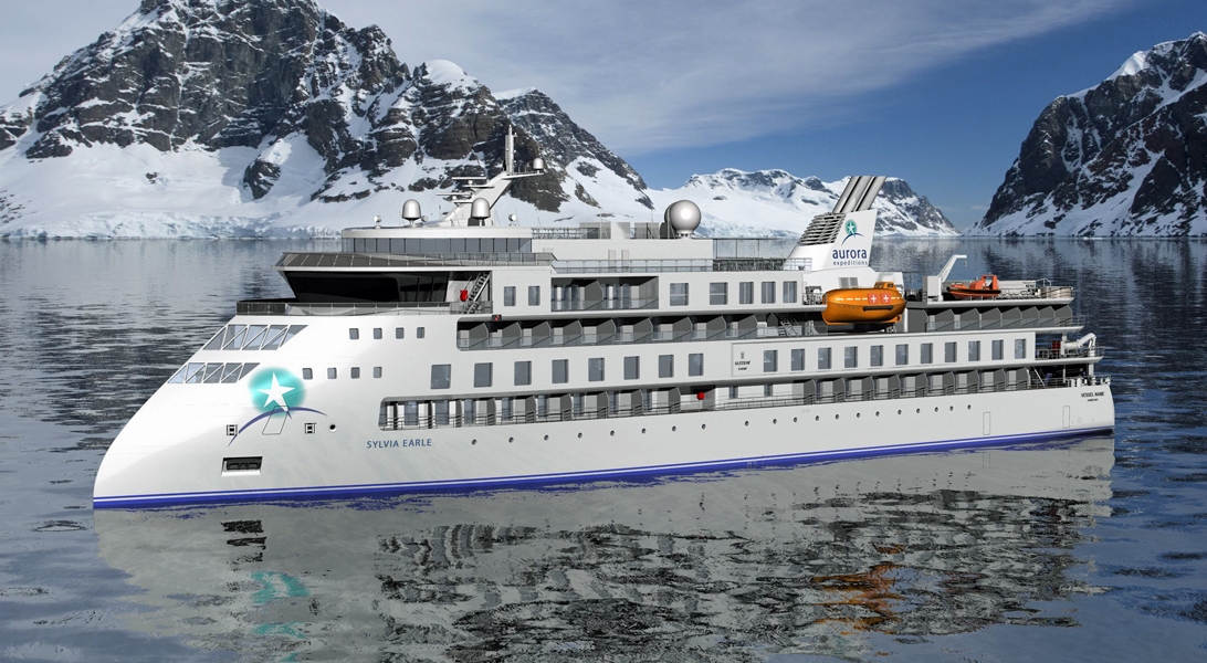
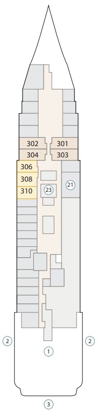

The images shown are for illustration purposes only and may not be an exact representation of what you find on the ship.
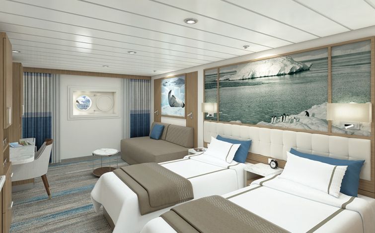
| Grade Code | From | To | |
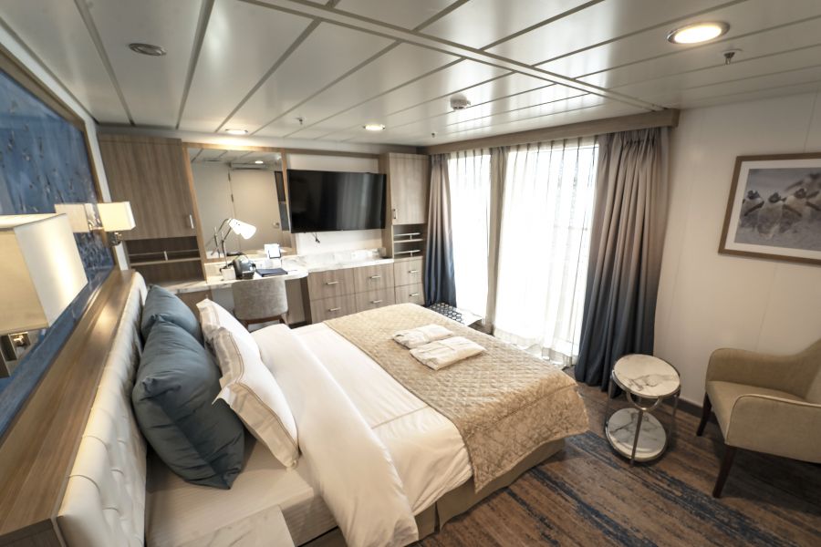
| SASS | Aurora Stateroom Superior | £17,247 | £17,247 |
Located on Deck 7, these comfortable Staterooms feature french balconies, floor to ceiling windows, en-suite bathrooms and a comfortable desk area.
Cabin Inclusion
Amenities
| Grade Code | From | To | |
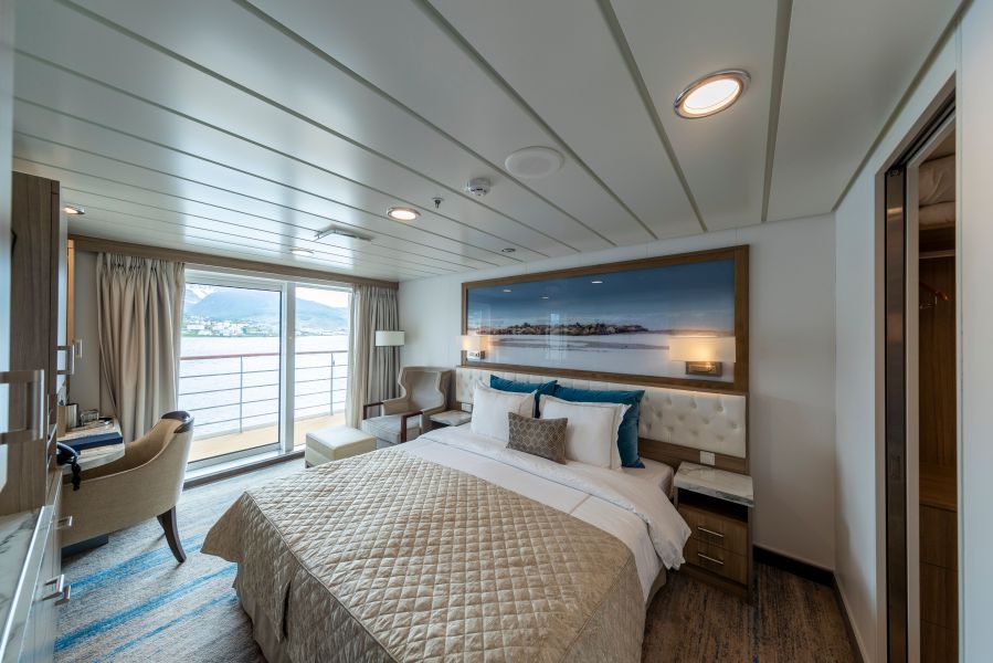
| SBSS | Balcony Stateroom Superior | £21,918 | £21,918 |
With a bit more room to stretch the legs, the Balcony Stateroom Superior cabins are perfect for polar adventurers who travel with plenty of gear. Located on Deck 4 and 6, the Staterooms feature floor to ceiling windows, en-suite bathrooms and a comfortable desk area.
Some of these rooms are equipped with wheelchair accessible bathrooms.
Cabin Inclusion
Some of these rooms are equipped with wheelchair accessible bathrooms.
Amenities
| Grade Code | From | To | |
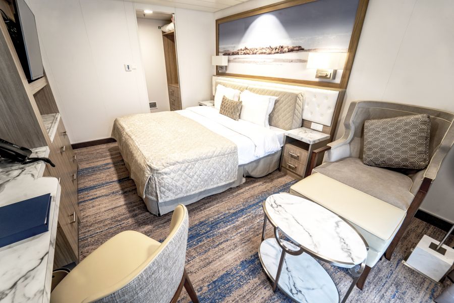
| CSS | Captain's Suite | £29,890 | £29,890 |
The largest of all our rooms, the singular Captain's Suite will take you to the polar regions in ultimate style and comfort. Complete with large lounge area, balcony, walk-in wardrobe and en-suite, you'll need to get in early to secure this suite.
Inclusion
Amenities
| Grade Code | From | To | |
| JSS | Junior Suite | £26,153 | £26,153 |
The four Junior Suites take in some impressive scenery from their vantage points on Deck 7. When you aren't enjoying a landing, you can relax in the suites' separate lounge area, or just watch the world float by from the private balcony.
Cabin Inclusion
*Valid on 1-hour massage or facial treatment only. Further details provided on board.
Amenities
^Mini bar is stocked only once.
The images shown are for illustration purposes only and may not be an exact representation of what you find on the ship.
The images shown are for illustration purposes only and may not be an exact representation of what you find on the ship.
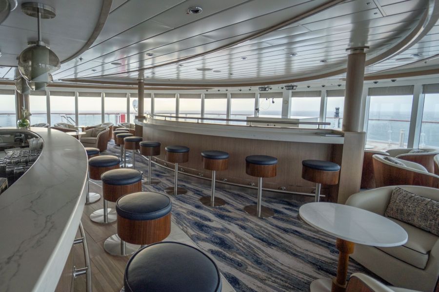
Let's face it – you don't want windowless rooms when travelling around some of the most beautiful locations around the world. This is why the Sylvia Earle is designed with plenty of dedicated observation spaces – ideal for keen bird spotters, wildlife watchers and those wanting to watch the scenery go past.
From the indoor 180-degree lounge and outdoor 360-degree open deck, both on deck 8, to the 270-degree open sundeck on level 7, there are plenty of observation points to share around the ship!
The images shown are for illustration purposes only and may not be an exact representation of what you find on the ship.
The images shown are for illustration purposes only and may not be an exact representation of what you find on the ship.


Our Fusion packages are all ABTA & ATOL protected ensuring that your booking is safe with us
| 14 nights aboard the Sylvia Earle | |||
| Fully-serviced accommodation in your chosen stateroom | |||
| An informative and entertaining lecture program by our team of experts | |||
| Complimentary 3-in-1 polar jacket and the use of gumboots | |||
| Entry fees to historic or tourist sites | |||
| Daily shore excursions, guided walks, Zodiac cruises and some activities | |||
| Daily breakfast, lunch and dinner including house wines, beers and soft drinks and afternoon tea and snacks | |||
| Complimentary use of fitness centre | |||
| Comprehensive pre-departure information kit and destination resource guide | |||
| Captain’s Welcome and Farewell Cocktail Reception including four-course dinner, house cocktails, house beer and wine, non-alcoholic beverages | |||
| Complimentary access to onboard medical doctor or clinic, if required | |||
| An experienced team of destination specialists and activity leaders | |||
| Pre-dinner cocktail hour including cold canapes and bar snacks | |||
| Photographic voyage log (post-voyage) | |||
| Port Taxes and Fees | |||
 | ABTA and ATOL Protection* | ||
Date 30th Aug 2028 |
Nts 14 |
Oceanview £17,247pp |
Balcony £17,746pp |
Suite £26,153pp |
Date 30th Aug 2028 |
Nts 14 |
Oceanview £17,247pp |
Balcony £17,746pp |
Suite £26,153pp |
| Oceanview staterooms from | £17,247pp | ||
| SASS | Aurora Stateroom Superior | £17,247pp | |
| Balcony staterooms from | £17,746pp | ||
| BSCS | Balcony Stateroom C (Forward / Aft) | £17,746pp | |
| BSBS | Balcony Stateroom B (Off Midship) | £18,680pp | |
| BSAS | Balcony Stateroom A (Midship) | £20,050pp | |
| SBSS | Balcony Stateroom Superior | £21,918pp | |
| Suite staterooms from | £26,153pp | ||
| JSS | Junior Suite | £26,153pp | |
| CSS | Captain's Suite | £29,890pp | |
Fusion Holidays when selling travel arrangements is a trading name of Co-op Travel Services Limited, registration 08903986. Fusion Cruises is an Accredited Body Member of Co-op Travel Services Limited ATOL 12904.
Book with Confidence. We are a Member of ABTA which means you have the benefit of ABTA’s assistance and Code of Conduct.
Some of the flights and flight-inclusive holidays on this website are financially protected by the ATOL scheme but ATOL protection does not apply to all holiday and travel services offered on this website. This website will provide you with information on the protection that applies in the case of each holiday and travel service offered before you make your booking. If you do not receive an ATOL Certificate then the booking will not be ATOL protected. If you do receive an ATOL Certificate but all parts of your trip are not listed on it, those parts will not be ATOL protected. Please see our booking conditions for information, or for more information about financial protection and the ATOL Certificate go to: www.caa.co.uk