This site uses cookies as defined in our Cookie Policy, by continuing to use this site you agree to their use.
Continue

Pack your bags for the 2027 World Cruise, an enchanting voyage across the Pacific Ocean. Departing San Diego, we set our course due south to explore the western reaches of Central and South America before the azure waters of the Pacific lure us out to embrace the pure shores of the South Sea Islands. Restless for adventure, we head to New Zealand and Australia, then meander through sultry Indonesia to our westernmost point, Singapore and Thailand. We curve around to examine three pearls of the east, China, South Korea and Japan, before crossing continents once more to the awesome wilds of A... laska and our final port, the mighty Canadian city of Vancouver. Embark on this transformative experience enveloped in the warm hospitality and companionship of our Crystal family.
| Arrive | Depart | ||||||
| 8th08 | JanJan | 202727 | San Diego, California, United States, embark on the Crystal Serenity | 19:00 | |||
San Diego is a vacationer's paradise, with year-round temperatures in the seventies and near-constant sunshine. One of America's most family-friendly cities, San Diego is home to LEGOLAND, the New Children's Museum, and the famous San Diego Zoo. Sunbathers and surfers are guaranteed to find their perfect beach, and foodies find delights in artisanal breweries, local bistros, and gourmet restaurants. From the Broadway excitement of La Jolla Playhouse to the European feel of Little Italy to the nouveau-chic of the Gaslamp Quarter, San Diego has something for everyone. | |||||||
| 9th09 | JanJan | 202727 | At Sea | ||||
| 10th10 | JanJan | 202727 | Cabo San Lucas, Mexico | 13:00 | 21:00 | ||
Cabo San Lucas, a resort city on the southern tip of Mexico’s Baja California peninsula, is known for its beaches, water-based activities and nightlife. Playa El Médano is Cabo’s main beach, with outdoor restaurants and numerous bars. Past the marina is Land's End promontory, site of Playa del Amor (Lover's Beach) and El Arco, a natural archway in the seacliffs. | |||||||
| 11th11 | JanJan | 202727 | Mazatlán, Mexico | 10:00 | 19:00 | ||
| 12th12 | JanJan | 202727 | Puerto Vallarta, Mexico | 09:00 | 18:00 | ||
Puerto Vallarta is a resort town on Mexico’s Pacific coast, in Jalisco state. It is known for its beaches, water sports and nightlife scene. Its cobblestone center is home to the ornate Nuestra Señora de Guadalupe church, boutique shops and a range of restaurants and bars. El Malecón is a beachside promenade with contemporary sculptures, as well as bars, lounges and nightclubs. | |||||||
| 13th13 | JanJan | 202727 | At Sea | ||||
| 14th14 | JanJan | 202727 | At Sea | ||||
| 15th15 | JanJan | 202727 | Acajutla, El Salvador | 08:00 | 17:00 | ||
| 16th16 | JanJan | 202727 | Playa Flamingo, Costa Rica | 11:00 | 19:00 | ||
| 17th17 | JanJan | 202727 | Puntarenas, Costa Rica | 07:00 | 18:00 | ||
This town is not on the Nicoya Peninsula, but rather on Costa Rica's mainland. It is best known as a cruise-ship port and launching pad for ferries heading southeast to the coast of the Nicoya Peninsula and for cruises sailing out on the Gulf of Nicoya. Puntarenas is also a major fishing port with a lively fish market. The town’s reputation suffers from the unimpressive parts you see from your car as you roll through town on the way to the ferry dock. But the town has a lot of character off the main drag, thanks to its illustrious past as an affluent port town and principal vacation spot for San José's wealthy, who arrived by train in the last century. Once the port was moved and roads opened to other beaches, Puntarenas's economy crashed, but it's making a comeback. Sitting on a narrow spit of sand—punta de arenas literally means "point of sand"—that protrudes into the Gulf of Nicoya, the town boasts a beautifully groomed, wide Blue Flag beach with views of the Nicoya Peninsula and spectacular sunsets, along with a public swimming pool, the San Lucas Beach Club, and a marine-life museum. Ticos arrive by bus and car to enjoy the beach and stroll the Paseo de los Turistas, a beachfront promenade lined with tree-shaded concrete benches and seafood restaurants. Crowds of locals, called porteños, cruise by on bicycles, the town’s most popular form of transport. | |||||||
| 18th18 | JanJan | 202727 | At Sea | ||||
| 19th19 | JanJan | 202727 | Manta, Ecuador | 10:00 | 17:00 | ||
| 20th20 | JanJan | 202727 | Guayaquil, Ecuador | 08:00 | 23:00 | ||
The second major jumping off point for the Galapagos Islands after Quito, this is a little city with a big heart. A sea port first and foremost, the city’s personality has been founded on that, and all the better it is for it too. Almost Caribbean in feeling, the clement climate coupled with the intermingling rhythms floating from the windows and abundance of fresh seafood make this a very tropical destination. Once not even considered by the travel books as a potential destination in its own right, the city has undergone something of a resurgence in the past few years. Proud Guayaquileños will not hestitate to point out the Malecón or the exciting new riverfront promenade, once a no-go area after dark, now happily (and hippily) lined with museums, restaurants, shops, and ongoing entertainment. The new airport and urban transportation network are also lauded to the happy tourists who find themselves here. As the largest and most populous city in Ecuador as well as being the commercial centre, it would only be natural that the city would have some kind of modern architecture, but it is the colourful favelas, or to use their real name guasmos, that cling to the side of the hillside like limpets that really catch your eye. A blend of old and new, the first inhabitants can be traced back to 1948 when the government cleared the area for affordable housing, these shanty towns are witness to the social and political particularities that Guayaquil has faced in the past. | |||||||
| 21st21 | JanJan | 202727 | At Sea | ||||
| 22nd22 | JanJan | 202727 | Salaverry, Peru | 07:00 | 16:00 | ||
Located about nine hours north of Lima, Trujillo was founded in 1534 by the Spanish conquistador Pizarro. The attractive, colonial city retains much of its original charm with elegant casonas, or mansions, lining the streets. Nearby is Chan Chan, the ancient capital of the Chimú, a local Indian tribe who came under the rule of the Incas. The area has several other Chimú sites, some dating back about 1500 years. The region is also famous as the home of the Peruvian Paso horses, as well as excellent beaches offering world-class surfing and other water sports. | |||||||
| 23rd23 | JanJan | 202727 | Callao, Peru | 08:00 | |||
When people discuss great South American cities, Lima is often overlooked. But Peru's capital can hold its own against its neighbors. It has an oceanfront setting, colonial-era splendor, sophisticated dining, and nonstop nightlife.It's true that the city—clogged with traffic and choked with fumes—doesn't make a good first impression, especially since the airport is in an industrial neighborhood. But wander around the regal edifices surrounding the Plaza de Armas, among the gnarled olive trees of San Isidro's Parque El Olivar, or along the winding lanes in the coastal community of Barranco, and you'll find yourself charmed.In 1535 Francisco Pizarro found the perfect place for the capital of Spain's colonial empire. On a natural port, the so-called Ciudad de los Reyes (City of Kings) allowed Spain to ship home all the gold the conquistador plundered from the Inca. Lima served as the capital of Spain's South American empire for 300 years, and it's safe to say that no other colonial city enjoyed such power and prestige during this period.When Peru declared its independence from Spain in 1821, the declaration was read in the square that Pizarro had so carefully designed. Many of the colonial-era buildings around the Plaza de Armas are standing today. Walk a few blocks in any direction for churches and elegant houses that reveal just how wealthy this city once was. But the poor state of most buildings attests to the fact that the country's wealthy families have moved to neighborhoods to the south over the past century.The walls that surrounded the city were demolished in 1870, making way for unprecedented growth. A former hacienda became the graceful residential neighborhood of San Isidro. In the early 1920s the construction of tree-lined Avenida Arequipa heralded the development of neighborhoods such as bustling Miraflores and bohemian Barranco.Almost a third of the country's population of 29 million lives in the metropolitan area, many of them in relatively poor conos: newer neighborhoods on the outskirts of the city. Most residents of those neighborhoods moved there from mountain villages during the political violence and poverty that marked the 1980s and ’90s, when crime increased dramatically. During the past decade the country has enjoyed peace and steady economic growth, which have been accompanied by many improvements and refurbishment in the city. Residents who used to steer clear of the historic center now stroll along its streets. And many travelers who once would have avoided the city altogether now plan to spend a day here and end up staying two or three. | |||||||
| 24th24 | JanJan | 202727 | At Sea | ||||
| 25th25 | JanJan | 202727 | At Sea | ||||
| 26th26 | JanJan | 202727 | At Sea | ||||
| 27th27 | JanJan | 202727 | At Sea | ||||
| 28th28 | JanJan | 202727 | Hangaroa, Easter Island, Chile | 12:00 | |||
Discovered (by the Western world) on Easter Sunday, 1722, Easter Island is a UNESCO World Heritage Site and one of the most isolated places on the face of the Earth, some 2,300 miles from the Chilean mainland. Although more Polynesian than South American in character, the 64-square mile island was annexed by Chile in 1888, and is now famous as the world’s largest ‘open air museum’ on account of the Moai, or human-like stone statues, that can be found on the island. The Moai remain very much a mystery, which archaeologists are still trying to unlock by interpreting an ancient language of the Rapa Nui, which is the key to understanding this culture, and is written on the so called ‘rongo rongo tablets’. The island owes its origin to three volcanoes which erupted some three million years ago: Poike, Rano Kau and Maunga Terevaka. It is not known when or how the island was first populated, but the most credible theory suggests that the Rapa Nui people came from other Pacific islands in the 4th century AD. In addition to the cultural and archaeological interest, there are the beautiful beaches, transparent waters, and coral reefs that might be expected of a Pacific Island. | |||||||
| 29th29 | JanJan | 202727 | Hangaroa, Easter Island, Chile | 17:00 | |||
Discovered (by the Western world) on Easter Sunday, 1722, Easter Island is a UNESCO World Heritage Site and one of the most isolated places on the face of the Earth, some 2,300 miles from the Chilean mainland. Although more Polynesian than South American in character, the 64-square mile island was annexed by Chile in 1888, and is now famous as the world’s largest ‘open air museum’ on account of the Moai, or human-like stone statues, that can be found on the island. The Moai remain very much a mystery, which archaeologists are still trying to unlock by interpreting an ancient language of the Rapa Nui, which is the key to understanding this culture, and is written on the so called ‘rongo rongo tablets’. The island owes its origin to three volcanoes which erupted some three million years ago: Poike, Rano Kau and Maunga Terevaka. It is not known when or how the island was first populated, but the most credible theory suggests that the Rapa Nui people came from other Pacific islands in the 4th century AD. In addition to the cultural and archaeological interest, there are the beautiful beaches, transparent waters, and coral reefs that might be expected of a Pacific Island. | |||||||
| 30th30 | JanJan | 202727 | At Sea | ||||
| 31st31 | JanJan | 202727 | At Sea | ||||
| 1st01 | FebFeb | 202727 | Adamstown, Pitcairn | 09:00 | 18:00 | ||
| 2nd02 | FebFeb | 202727 | At Sea | ||||
| 3rd03 | FebFeb | 202727 | At Sea | ||||
| 4th04 | FebFeb | 202727 | Rangiroa, French Polynesia | 09:00 | 17:00 | ||
| 5th05 | FebFeb | 202727 | Fakarava, French Polynesia | 08:00 | 14:00 | ||
| 6th06 | FebFeb | 202727 | Huahine, French Polynesia | 09:00 | 17:00 | ||
| Huahine is an island located among the Society Islands, in French Polynesia, an overseas territory of France in the South Pacific Ocean. It is part of the Leeward Islands group | |||||||
| 7th07 | FebFeb | 202727 | Papeete, Tahiti, French Polynesia | 08:00 | |||
Papeete will be your gateway to the tropical paradise of French Polynesia, where islands fringed with gorgeous beaches and turquoise ocean await to soothe the soul. This spirited city is the capital of French Polynesia, and serves as a superb base for onward exploration of Tahiti – an island of breathtaking landscapes and oceanic vistas. Wonderful lagoons of crisp, clear water beg to be snorkelled, stunning black beaches and blowholes pay tribute to the island's volcanic heritage, and lush green mountains beckon you inland on adventures, as you explore extraordinary Tahiti. Visit to relax inside picturesque stilted huts, which stand out over shimmering water, as you settle into the intoxicating rhythm of life, in this Polynesian paradise. | |||||||
| 8th08 | FebFeb | 202727 | Papeete, Tahiti, French Polynesia | ||||
Papeete will be your gateway to the tropical paradise of French Polynesia, where islands fringed with gorgeous beaches and turquoise ocean await to soothe the soul. This spirited city is the capital of French Polynesia, and serves as a superb base for onward exploration of Tahiti – an island of breathtaking landscapes and oceanic vistas. Wonderful lagoons of crisp, clear water beg to be snorkelled, stunning black beaches and blowholes pay tribute to the island's volcanic heritage, and lush green mountains beckon you inland on adventures, as you explore extraordinary Tahiti. Visit to relax inside picturesque stilted huts, which stand out over shimmering water, as you settle into the intoxicating rhythm of life, in this Polynesian paradise. | |||||||
| 9th09 | FebFeb | 202727 | Moorea, French Polynesia | 07:00 | 17:00 | ||
Mo’orea is one of the Society Islands of the French Polynesia. Located in the South Pacific, it is considered a magical island thanks to its majestic volcanic mountains, set against warm lagoon waters and green meadows. It is an island that attracts visitors of all abilities wanting to explore both above and below the ocean waters. | |||||||
| 10th10 | FebFeb | 202727 | Raiatea, French Polynesia | 08:00 | 23:00 | ||
| 11th11 | FebFeb | 202727 | Bora-Bora, French Polynesia | 08:00 | |||
Simply saying the name Bora Bora is usually enough to induce gasps of jealousy, as images of milky blue water, sparkling white beaches and casually leaning palm trees immediately spring to mind. The imagination doesn't lie, either, and if you visit, you’ll soon realise this island is every bit as gorgeous as you ever imagined. Thatched wooden huts stand out over shallow, sparkling seawater, with vivid fish swirling just below. Soak up the sun, scuba dive, or simply revel in the opulent luxury of one of the island's many magnificent resorts. If blissful inactivity doesn't appeal, then get active, and hike the greenery of the sharp Mount Pahia. | |||||||
| 12th12 | FebFeb | 202727 | Bora-Bora, French Polynesia | 16:00 | |||
Simply saying the name Bora Bora is usually enough to induce gasps of jealousy, as images of milky blue water, sparkling white beaches and casually leaning palm trees immediately spring to mind. The imagination doesn't lie, either, and if you visit, you’ll soon realise this island is every bit as gorgeous as you ever imagined. Thatched wooden huts stand out over shallow, sparkling seawater, with vivid fish swirling just below. Soak up the sun, scuba dive, or simply revel in the opulent luxury of one of the island's many magnificent resorts. If blissful inactivity doesn't appeal, then get active, and hike the greenery of the sharp Mount Pahia. | |||||||
| 13th13 | FebFeb | 202727 | At Sea | ||||
| 14th14 | FebFeb | 202727 | At Sea | ||||
| 15th15 | FebFeb | 202727 | Pago Pago, American Samoa | 08:00 | 18:00 | ||
American Samoa is a tropical paradise, located in the Pacific Ocean and home to some of the world's most unique flora and fauna. Pago Pago is the main harbour and village of Tutuila island. It is considered the capital of the territory and is the entry point for visitors exploring the picturesque volcanic islands. | |||||||
| 17th17 | FebFeb | 202727 | At Sea | ||||
| 17th17 | FebFeb | 202727 | Apia, Samoa | 08:00 | 18:00 | ||
Samoa is a group of ten islands located in the South Pacific. The tropical climate and volcanic landscape create a picturesque location for visitors to explore, together with the experience of Fa'a Samoa, the three thousand year old way of life on Samoa. | |||||||
| 18th18 | FebFeb | 202727 | At Sea | ||||
| 19th19 | FebFeb | 202727 | Suva, Fiji | 08:00 | 18:00 | ||
Fiji is a collection of tropical islands in the South Pacific and is well known for soft coral diving, white sandy beaches, and idyllic and peaceful surroundings. Because of its paradisiac surroundings, Fiji is a popular location for weddings and honeymoons. Suva is the capital of the Fiji archipelago, located on the southeastern coast of the island of Viti Levu and is the second most populated city of Fiji. | |||||||
| 20th20 | FebFeb | 202727 | Lautoka, Fiji | 07:00 | 18:00 | ||
North of Nadi through sugarcane plantations and past the Sabeto Mountains is Lautoka, nicknamed the Sugar City for the local agriculture and its big processing mill. With a population of around 50,000, it's the only city besides Suva and, like the capital, has a pleasant waterfront. It's the sailing point for Blue Lagoon and Beachcomber Cruises but is otherwise unremarkable for tourists, itself having few hotels and fewer good restaurants. Locals recommend the city as a less-expensive place to shop for clothing, but note that it can take as long as 45 minutes to drive here. Legend has it that Lautoka acquired its name when two chiefs engaged in combat and one hit the other with a spear. He proclaimed "lau toka" (spear hit) and thus the future town was named. | |||||||
| 21st21 | FebFeb | 202727 | At Sea | ||||
| 22nd22 | FebFeb | 202727 | Champagne Beach, Espiritu Santo Island, Solomon Islands | 08:00 | 16:00 | ||
Champagne Beach is found in Hog Harbor on Espiritu Santo Island in Vanuatu. The island got its European name in the early 17th century when Pedro de Quiroz believed he had reached the famous unknown southern land or the “Tierra Australis Incognita.” He called Vanuatu’s largest island, “La Austrialia del Espiritu Santo.” Huge fish poison trees and Alexandrian laurel give cooling shade to the picture-perfect beach and crystal-clear water. The name “Champagne Beach” comes from effervescent bubbles of volcanic origin that are occasionally found in the waters of this stunning spot. | |||||||
| 23rd23 | FebFeb | 202727 | Port Vila, Vanuatu | 08:00 | 18:00 | ||
Vanuatu is an island nation located in the southern Pacific Ocean. The archipelago, which is of volcanic origin, is approximately 1,090 miles (about 1,750 kilometres) east of northern Australia, approximately 310 miles (about 500 kilometres) northeast of New Caledonia, west of Fiji and southeast of the Solomon Islands, near New Guinea. Located on Mélé Bay along the southwest coast of Éfaté, Port Vila is the capital and largest city of Vanuatu, as well as its commercial and economic centre. Although Port Vila's British and French influences are apparent, its multinational population includes ni-Vanuatu, British, French, Chinese, and Vietnamese citizens. An active commercial port, the city is home to hospitals, hotels, casinos, markets and shopping districts, a sports stadium, cultural centre, teacher-training institution, campus of the University of the South Pacific, and several meat- and fish-processing plants. The municipality of Port Vila is divided into four wards, Malapoa-Tagabe, Anabrou-Melcofe-Tassiriki, Centre and South. The area occupied by Port Vila has been inhabited by Melanesian people for thousands of years. In 2004, an archaeological expedition unearthed a burial site with 25 tombs, skeletons and pieces of ceramic pottery dating from 1300 B.C. The Vanuatu Islands first had contact with Europeans in 1606 with the arrival of Portuguese explorer Pedro Fernandes de Queirós. Europeans did not return until 1768, when Louis Antoine de Bougainville rediscovered the islands. In 1774, Captain Cook called the islands the 'New Hebrides', a name that would last until their independence in 1980. In 1825, sandalwood was discovered on the island of Erromango, prompting a rush of immigrants that included Catholic and Protestant missionaries from European and North America, as well as settlers looking for land to farm cotton, coffee, cocoa, bananas, and coconuts. British subjects from Australia made up the majority of settlers, but the establishment of the Caledonian Company of the New Hebrides in 1882 attracted more French subjects. The land around Port Vila was converted into the municipality of Franceville in 1889. By the start of the 20th century, the French outnumbered the British, and the two nations agreed to govern the islands jointly by way of the British-French Condominium. During World War II, Port Vila was an American and Australian airbase. The New Hebrides National Party was established in the early-1970s. Renamed Vanua'aku Pati in 1974, the party pushed for independence. In 1980, amidst the brief Coconut War, the Republic of Vanuatu was created. The economies of Port Vila and Vanuatu are supported by the agriculture, offshore financial services and cattle industries. However, the abundant tropical beauty of Vanuatu has made Port Vila a popular tourist destination for outdoor and nature enthusiasts alike. Renowned for its tropical climate and exquisite, white-sand beaches and world-class fishing, the archipelago is a region of spectacular geographic diversity that includes spectacular volcanoes, mountains and valleys, along with idyllic jungles, rainforests, botanical gardens, mineral springs, and waterfalls. What's more, Port Vila offers easy access to exploring the city, Vanuatu and the offshore islands that comprise this wonderful South Pacific island chain. Port Vila consists of a diverse blend of Melanesian, Eastern and Western cultures that presents a unique opportunity to discover the people, traditions and history of Vanuatu. Cultural village tours are a fantastic way to meet the locals and experience indigenous lifestyles and customs through storytelling, music, dance, kava-tasting, and a traditional Melanesian feast. The evolution of Port Vila and Vanuatu can be explored during visits to the Vanuatu Cultural Centre and Museum features a collection of historical artefacts from the Vanuatu Island. Additional historic landmarks include Independence Park, the French and British residencies, Supreme Court, Georges Pompidou Building, World War I and II memorials, Tanna Coffee-Roasting Factory, and more. Vanuatu's verdant canyons, jungle-covered mountain peaks, volcanoes, waterfalls, botanical gardens, mineral springs, white-sand beaches, and rainforests invite a wide array of picturesque, memorable and exciting sightseeing venues for outdoor enthusiasts. Land-based excursions include bird-watching, bicycling and motor-biking, eco-tours, hiking through jungle and rainforest nature trails, horseback-riding at the nearby Sea Horse Ranch or Club Hippique Adventure Park, helicopter or seaplane flight-seeing, dune-bugging the beaches and jungles, 'zorbing' down the hillsides, abseiling down a cascading waterfall, volcano trekking and sandboarding, zip-lining through the jungle canopy, and golfing at the stunningly beautiful Port Vila Golf and Country Club, the only 18-hole championship course in Vanuatu and home to the PGA-sanctioned Vanuatu Open. Picturesque and fun-filled water-based excursions include swimming, boating and sailing along the exquisite coast of Port Vila and Vanuatu, deep-sea fishing for enormous dolphin, marlin, wahoo, dorado, tuna, swordfish, and sailfish, jet-skiing and high-speed jet-boating, stand-up paddle-boarding, surfing, kite-surfing, and parasailing. The archipelago also offers some of the world's finest snorkelling and diving at venues such as the Hideaway Islands Marine Reserves, JoJo Beach Club, Havannah Beach and Boat Club, and Iririki Island.Due to its compact size, Port Vila can be easily explored in just a single day. | |||||||
| 24th24 | FebFeb | 202727 | Mystery Island (Inyeug), Vanuatu | 08:00 | 17:00 | ||
| 25th25 | FebFeb | 202727 | Lifou Island, New Caledonia | 08:00 | 18:00 | ||
Lifou is a commune of France in the Loyalty Islands of New Caledonia. Lifou is made up of two main islands - Lifou Island and Tiga Island- in additional to a number of uninhabited islets. Lifou Isand is the largest atoll in the world. The island is actually made of fossilized coral - known as a makatea. Lifou island does not have any surface water and it relies on a freshwater reservoir accessed by caves. Lifou Island is best known for its vast atoll (the largest in the world). This ring-shaped coral reef affords some of the best snorkelling in the world. Popular activities on this island include scenic walks, relaxing days on the beach, swimming and snorkelling. There are no organized tours being offered during this call to Lifou Island, guests may explore on their own. | |||||||
| 26th26 | FebFeb | 202727 | Nouméa, New Caledonia | 08:00 | 18:00 | ||
With its elegant urban infrastructure in a stunning natural setting, Noumea is a truly unique island and part of the New Caledonia archipelago. Noumea started as a penal colony, but has since evolved to a lovely metropolis and today has almost two thirds of New Caledonia’s population. While much of the archipelago of New Caledonia has a large percentage of Kanak people – the indigenous inhabitants who live in tribal areas across the country – Noumea is predominantly European with a strong French influence. The city’s center and Place de Cocotiers, the main park, are located close to the harbor and several churches date back to the late 19th century. Other attractions include a world-class aquarium at Anse Vata, several long beaches to the south, and a noteworthy collection of Kanak and South Pacific objects at the Museum of New Caledonia. The architectural gem of the city is the Tjibaou Cultural Center, the structure of which resembles sails, or the roofs of Kanak houses hidden behind mangroves. | |||||||
| 27th27 | FebFeb | 202727 | At Sea | ||||
| 28th28 | FebFeb | 202727 | At Sea | ||||
| 1st01 | MarMar | 202727 | Bay of Islands, New Zealand | 08:00 | 18:00 | ||
The Tasman Sea on the west and the Pacific Ocean on the east meet at thetop of North Island at Cape Reinga. No matter what route you take, you'll passfarms and forests, marvellous beaches, and great open spaces. The East Coast,up to the Bay of Islands, is Northland's most densely populated, often withrefugees from bigger cities—looking for a more relaxed life—clustered aroundbreathtaking beaches. The first decision on the drive north comes at the footof the Brynderwyn Hills. Turning left will take you up the West Coast throughareas once covered with forests and now used for either agricultural orhorticulture. Driving over "the Brynderwyns," as they are known,takes you to Whangarei, the only city in Northland. If you're in the mood for adiversion, you can slip to the beautiful coastline and take in Waipu Cove, anarea settled by Scots, and Laings Beach, where million-dollar homes sit next tosmall Kiwi beach houses.An hour's drive farther north is the Bay of Islands, known all over theworld for its beauty. There you will find lush forests, splendid beaches, andshimmering harbors. The Treaty of Waitangi was signed here in 1840 betweenMāoriand the British Crown, establishing the basis for the modern New Zealandstate. Every year on February 6, the extremely beautiful Waitangi Treaty Ground(the name means weeping waters) is the sight of a celebration of the treaty andprotests by Māori unhappy with it. Continuing north on the East Coast, theagricultural backbone of the region is even more evident and a series ofwinding loop roads off the main highway will take you to beaches that are bothbeautiful and isolated where you can swim, dive, picnic, or just laze. .The West Coast is even less populated, and the coastline is rugged andwindswept. In the Waipoua Forest, you will find some of New Zealand's oldestand largest kauri trees; the winding road will also take you past mangroveswamps. Crowning the region is the spiritually significant Cape Reinga, theheadland at the top of the vast stretch of 90 Mile Beach, where it's believedMāori souls depart after death. Today Māori make up roughly a quarter of thearea's population (compared with the national average of about 15%). The legendaryMāori navigator Kupe was said to have landed on the shores of Hokianga Harbour,where the first arrivals made their home. Many different wi (tribes) livedthroughout Northland, including Ngapuhi (the largest), Te Roroa, Ngati Wai,Ngati Kuri, Te Aupouri, Ngaitakoto, Ngati Kahu, and Te Rarawa. Many Māoriherecan trace their ancestry to the earliest inhabitants | |||||||
| 2nd02 | MarMar | 202727 | Auckland, New Zealand | 07:00 | |||
| 3rd03 | MarMar | 202727 | Auckland, New Zealand | 19:00 | |||
| 4th04 | MarMar | 202727 | Tauranga, New Zealand | 07:00 | 16:00 | ||
The population center of the Bay of Plenty, Tauranga is one of New Zealand's fastest-growing cities. Along with its neighbor, Whakatane, this seaside city claims to be one of the country's sunniest towns. Unlike most local towns, Tauranga doesn't grind to a halt in the off-season, because it has one of the busiest ports in the country, and the excellent waves at the neighboring beach resort of Mount Maunganui—just across Tauranga's harbor bridge—always draw surfers and holiday folk. | |||||||
| 5th05 | MarMar | 202727 | Napier, New Zealand | 10:00 | 19:00 | ||
The earthquake that struck Napier at 10:46 am on February 3, 1931, was—at 7.8 on the Richter scale—the largest quake ever recorded in New Zealand. The coastline was wrenched upward several feet. Almost all the town's brick buildings collapsed; many people were killed on the footpaths as they rushed outside. The quake triggered fires throughout town, and with water mains shattered, little could be done to stop the blazes that devoured the remaining wooden structures. Only a few buildings survived (the Public Service Building with its neoclassical pillars is one), and the death toll was well over 100.The surviving townspeople set up tents and cookhouses in Nelson Park, and then tackled the city's reconstruction at a remarkable pace. In the rush to rebuild, Napier went mad for art deco, the bold, geometric style that had burst on the global design scene in 1925. Now a walk through the art deco district, concentrated between Emerson, Herschell, Dalton, and Browning streets, is a stylistic immersion. The decorative elements are often above the ground floors, so keep your eyes up. | |||||||
| 6th06 | MarMar | 202727 | Wellington, New Zealand | 09:00 | 20:00 | ||
New Zealand's capital is, arguably, the country's most cosmopolitan metropolis. It's world-class Te Papa Tongarewa-Museum of New Zealand is a don't-miss attraction, and the burgeoning film industry led, of course, by the Lord of the Rings extravaganzas has injected new life into the local arts scene. Attractive and compact enough to be explored easily on foot, Wellington is a booming destination. Modern high-rise buildings gaze over Port Nicholson, surely one of the finest natural anchorages in the world. Known to local Māori as The Great Harbor of Tara, its two massive arms form the jaws of the fish of Maui from Māori legend. Sometimes referred to as the windy city, Wellington has been the seat of New Zealand's government since 1865. | |||||||
| 7th07 | MarMar | 202727 | Christchurch, New Zealand | 08:00 | 18:00 | ||
Christchurch is one of New Zealand’s most English cities. The Anglisation of the area is quickly evident throughout. The name Christchurch, is named after one of the most famous Oxford Colleges. Traditional English styled punts can be seen drifting lazily along the Avon River, and customary striped blazers are still worn by students at Christ’s College. | |||||||
| 8th08 | MarMar | 202727 | Dunedin, New Zealand | 07:00 | 17:00 | ||
Clinging to the walls of the natural amphitheater at the west end of Otago Harbour, the South Island's second-largest city is enriched with inspiring nearby seascapes and wildlife. Because Dunedin is a university town, floods of students give the city a vitality far greater than its population of 122,000 might suggest. Its manageable size makes it easy to explore on foot—with the possible exception of Baldwin Street, the world's steepest residential street and home to the annual "gutbuster" race, in which people run up it, and the "Jaffa" race, in which people roll the namesake spherical chocolate candy down it.Dunedin, the Gaelic name for Edinburgh, was founded in 1848 by settlers of the Free Church of Scotland, a breakaway group from the Presbyterian Church. The city's Scottish roots are still visible; you'll find New Zealand's first and only (legal) whisky distillery, a statue of Scottish poet Robert Burns, and more kilts, sporrans, and gillies than you can shake a stick at! The Scottish settlers and local Māori came together in relative peace, but this wasn't true of the European whalers who were here three decades before, as places with names such as Murdering Beach illustrate.Dunedin has always had a reputation for the eccentric. Wearing no shoes and a big beard here marks a man as bohemian rather than destitute, and the residents wouldn't have it any other way. The University of Otago was the country's first university and has been drawing writers ever since its founding in 1871, most notably Janet Frame and the poet James K. Baxter. Dunedin also has a musical heritage, which blossomed into the "Dunedin Sound" of the 1970s and '80s. | |||||||
| 9th09 | MarMar | 202727 | At Sea | ||||
| 10th10 | MarMar | 202727 | At Sea | ||||
| 11th11 | MarMar | 202727 | At Sea | ||||
| 12th12 | MarMar | 202727 | Melbourne, Victoria, Australia | 10:00 | |||
Consistently rated among the "world's most livable cities" in quality-of-life surveys, Melbourne is built on a coastal plain at the top of the giant horseshoe of Port Phillip Bay. The city center is an orderly grid of streets where the state parliament, banks, multinational corporations, and splendid Victorian buildings that sprang up in the wake of the gold rush now stand. This is Melbourne's heart, which you can explore at a leisurely pace in a couple of days.In Southbank, one of the newer precincts south of the city center, the Southgate development of bars, restaurants, and shops has refocused Melbourne's vision on the Yarra River. Once a blighted stretch of factories and run-down warehouses, the southern bank of the river is now a vibrant, exciting part of the city, and the river itself is finally taking its rightful place in Melbourne's psyche.Just a hop away, Federation Square—with its host of galleries—has become a civic landmark for Melburnians. Stroll along the Esplanade in the suburb of St. Kilda, amble past the elegant houses of East Melbourne, enjoy the shops and cafés in Fitzroy or Carlton, rub shoulders with locals at the Victoria Market, nip into the Windsor for afternoon tea, or rent a canoe at Studley Park to paddle along one of the prettiest stretches of the Yarra—and you may discover Melbourne's soul as well as its heart. | |||||||
| 13th13 | MarMar | 202727 | Melbourne, Victoria, Australia | 20:00 | |||
Consistently rated among the "world's most livable cities" in quality-of-life surveys, Melbourne is built on a coastal plain at the top of the giant horseshoe of Port Phillip Bay. The city center is an orderly grid of streets where the state parliament, banks, multinational corporations, and splendid Victorian buildings that sprang up in the wake of the gold rush now stand. This is Melbourne's heart, which you can explore at a leisurely pace in a couple of days.In Southbank, one of the newer precincts south of the city center, the Southgate development of bars, restaurants, and shops has refocused Melbourne's vision on the Yarra River. Once a blighted stretch of factories and run-down warehouses, the southern bank of the river is now a vibrant, exciting part of the city, and the river itself is finally taking its rightful place in Melbourne's psyche.Just a hop away, Federation Square—with its host of galleries—has become a civic landmark for Melburnians. Stroll along the Esplanade in the suburb of St. Kilda, amble past the elegant houses of East Melbourne, enjoy the shops and cafés in Fitzroy or Carlton, rub shoulders with locals at the Victoria Market, nip into the Windsor for afternoon tea, or rent a canoe at Studley Park to paddle along one of the prettiest stretches of the Yarra—and you may discover Melbourne's soul as well as its heart. | |||||||
| 14th14 | MarMar | 202727 | At Sea | ||||
| 15th15 | MarMar | 202727 | Sydney, New South Wales, Australia | 08:00 | 23:00 | ||
Sydney, capital of New South Wales and one of Australia's largest cities, is best known for its harbourfront Sydney Opera House, with a distinctive sail-like design. Massive Darling Harbour and the smaller Circular Quay port are hubs of waterside life, with the arched Harbour Bridge and esteemed Royal Botanic Garden nearby. Sydney Tower’s outdoor platform, the Skywalk, offers 360-degree views of the city and suburbs. | |||||||
| 16th16 | MarMar | 202727 | Newcastle, New South Wales, Australia | 08:00 | 19:00 | ||
| 17th17 | MarMar | 202727 | At Sea | ||||
| 18th18 | MarMar | 202727 | Brisbane, Queensland, Australia | 07:00 | 19:00 | ||
Founded in 1824 on the banks of the wide, meandering Brisbane River, the former penal colony of Brisbane was for many years regarded as just a big country town. Many beautiful timber Queenslander homes, built in the 1800s, still dot the riverbanks and inner suburbs, and in spring the city's numerous parks erupt in a riot of colorful jacaranda, poinciana, and bougainvillea blossoms. Today the Queensland capital is one of Australia's most up-and-coming cities: glittering high-rises mark its polished business center, slick fashion boutiques and restaurants abound, and numerous outdoor attractions beckon. In summer, temperatures here are broilingly hot and days are often humid, a reminder that this city is part of a subtropical region. Wear SPF 30-plus sunscreen and a broad-brimmed hat outdoors, even on overcast days.Brisbane's inner suburbs, a 5- to 10-minute drive or 15- to 20-minute walk from the city center, have a mix of intriguing eateries and quiet accommodations. Fortitude Valley combines Chinatown with a cosmopolitan mix of clubs, cafés, and boutiques. Spring Hill has several high-quality hotels, and Paddington, New Farm, Petrie Terrace, West End, and Woolloongabba are full of an eclectic mix of restaurants and bars. Brisbane is also a convenient base for trips to the Sunshine and Gold coasts, the mountainous hinterlands, and the Moreton Bay islands. | |||||||
| 19th19 | MarMar | 202727 | At Sea | ||||
| 20th20 | MarMar | 202727 | Airlie Beach, Australia | 07:00 | 17:00 | ||
| Airlie Beach, nestled in Queensland’s tropical Whitsunday Region, is a vibrant gateway to the Great Barrier Reef and the idyllic Whitsunday Islands. Renowned for its stunning waterfront, the town offers a relaxed yet lively atmosphere, with a picturesque lagoon perfect for swimming and sunbathing. Adventure seekers can enjoy sailing, snorkeling, scuba diving, and skydiving, while the surrounding rainforest and hiking trails provide scenic escapes for nature lovers. The town’s bustling streets are lined with cafés, restaurants, and lively nightlife, ensuring entertainment for all tastes. Airlie Beach is also a launch point for unforgettable island tours, including trips to the world-famous Whitehaven Beach. With its combination of natural beauty, adventure opportunities, and welcoming local culture, Airlie Beach is a must-visit destination for travelers seeking both relaxation and excitement in tropical paradise. | |||||||
| 21st21 | MarMar | 202727 | Cairns, Queensland, Australia | 10:00 | |||
Tourism is the lifeblood of Cairns (pronounced Caans). The city makes a good base for exploring the wild top half of Queensland, and tens of thousands of international travelers use it as a jumping-off point for activities such as scuba diving and snorkeling trips to the Barrier Reef, as well as boating, fishing, parasailing, scenic flights, and rain-forest treks.It's a tough environment, with intense heat and fierce wildlife. Along with wallabies and grey kangaroos in the savannah and tree kangaroos in the rain forest, you'll find stealthy saltwater crocodiles, venomous snakes, and jellyfish so deadly they put the region’s stunning beaches off- limits to swimmers for nearly half the year. Yet despite this formidable setting, Cairns and tropical North Queensland are far from intimidating places. The people are warm and friendly, the sights spectacular, and—at the right time of year—the beachside lounging is world-class. | |||||||
| 22nd22 | MarMar | 202727 | Cairns, Queensland, Australia | 18:00 | |||
Tourism is the lifeblood of Cairns (pronounced Caans). The city makes a good base for exploring the wild top half of Queensland, and tens of thousands of international travelers use it as a jumping-off point for activities such as scuba diving and snorkeling trips to the Barrier Reef, as well as boating, fishing, parasailing, scenic flights, and rain-forest treks.It's a tough environment, with intense heat and fierce wildlife. Along with wallabies and grey kangaroos in the savannah and tree kangaroos in the rain forest, you'll find stealthy saltwater crocodiles, venomous snakes, and jellyfish so deadly they put the region’s stunning beaches off- limits to swimmers for nearly half the year. Yet despite this formidable setting, Cairns and tropical North Queensland are far from intimidating places. The people are warm and friendly, the sights spectacular, and—at the right time of year—the beachside lounging is world-class. | |||||||
| 23rd23 | MarMar | 202727 | At Sea | ||||
| 24th24 | MarMar | 202727 | Alotau, Papua New Guinea | 07:00 | 16:00 | ||
Alotau is the provincial capital of the Milne Bay Province located in the southeast bay of Papua New Guinea. The town and surrounding area has been an important staging ground during World War II and we will see remains and memorials dating back or referring to the war. On a tour of the town, visitors will appreciate lovely vistas of the bay and experience the markets, which are frequented not only by locals, but also by islanders selling their products or looking for produce to take back into Milne Bay. Alotau is an important port facility for the islands and attracts many vendors of handicrafts from different islands. | |||||||
| 25th25 | MarMar | 202727 | Port Moresby, Papua New Guinea | 10:00 | 19:00 | ||
| 26th26 | MarMar | 202727 | At Sea | ||||
| 27th27 | MarMar | 202727 | At Sea | ||||
| 28th28 | MarMar | 202727 | Darwin, Northern Territory, Australia | 08:00 | 18:00 | ||
Darwin is Australia's most colorful, and exotic, capital city. Surrounded on three sides by the turquoise waters of the Timor Sea, the streets are lined with tropical flowers and trees. Warm and dry in winter, hot and steamy in summer, it's a relaxed and casual place, as well as a beguiling blend of tropical frontier outpost and Outback hardiness. Thanks to its close proximity to Southeast Asia and its multicultural population it also seems more like Asia than the rest of Australia. Darwin is a city that has always had to fight for its survival. The seductiveness of contemporary Darwin lifestyles belies a history of failed attempts that date from 1824 when Europeans attempted to establish an enclave in this harsh, unyielding climate. The original 1869 settlement, called Palmerston, was built on a parcel of mangrove wetlands and scrub forest that had changed little in 15 million years. It was not until 1911, after it had already weathered the disastrous cyclones of 1878, 1882, and 1897, that the town was named after the scientist who had visited Australia's shores aboard the Beagle in 1839. During World War II it was bombed more than 60 times, as the harbor full of warships was a prime target for the Japanese war planes. Then, on the night of Christmas Eve 1974, the city was almost completely destroyed by Cyclone Tracy, Australia’s greatest natural disaster. It's a tribute to those who stayed and to those who have come to live here after Tracy that the rebuilt city now thrives as an administrative and commercial center for northern Australia. Old Darwin has been replaced by something of an edifice complex—such buildings as Parliament House and the Supreme Court all seem very grand for such a small city, especially one that prides itself on its casual, outdoor-centric lifestyle. Today Darwin is the best place from which to explore Australia's Top End, with its wonders of Kakadu and the Kimberley region. | |||||||
| 29th29 | MarMar | 202727 | At Sea | ||||
| 30th30 | MarMar | 202727 | Komodo Island, Indonesia | 09:00 | 18:00 | ||
Pink Beach earned its name for the way the beach can appear to have a rosy hue in certain lights. The color comes from small flecks of red coral mixed in with the fine white reef sand. With a few trees along the beach for shade, this stretch of coast makes a fine place to relax or enjoy a snorkel or dive in the crystal clear waters. It is possible to spot a striped clown fish nestled among the protective tentacles of its sea anemone host, or to see a grouper lazily swimming by a flamboyant soft coral. The reef here is now protected by law and the maturing corals are a joy to behold. | |||||||
| 31st31 | MarMar | 202727 | Bali, Indonesia | 12:00 | |||
| 1st01 | AprApr | 202727 | Bali, Indonesia | 21:00 | |||
| 2nd02 | AprApr | 202727 | At Sea | ||||
| 3rd03 | AprApr | 202727 | Semarang, Indonesia | 07:00 | 19:00 | ||
Semarang is one of the oldest cities in Indonesia, situated on Java's north coast between the shore of the Java Sea and a small ridge of mountains. Ceded to the Dutch West India Company in 1677 by King Amangkurat I in payment of his debts, it became their headquarters and the seat of the Dutch governor of the northeast provinces. Semarang's usefulness as a port waned due to the gradual silting up of the harbor; by the 19th century, Surabaya had eclipsed Semarang as Java's premier port. With a population of over one million, a third of whom are thought to be of Chinese extraction, Semarang is the largest city in Central Java and its administrative capital. The city consists of two parts: the coastal lowland where most of the commercial activities are found; and the hilly residential area. Although more a business center than a city for tourists, Semarang serves as a popular gateway to the mountainous interior of Central Java and to fabled Borobudur. | |||||||
| 4th04 | AprApr | 202727 | At Sea | ||||
| 5th05 | AprApr | 202727 | Singapore, Singapore | 12:00 | |||
The main island of Singapore is shaped like a flattened diamond, 42 km (26 miles) east to west and 23 km (14 miles) north to south. Near the northern peak is the causeway leading to West Malaysia—Kuala Lumpur is less than four hours away by car. It is at the southern foot where you will find most of the city-state’s action, with its gleaming office towers, working docks, and futuristic "supertrees," which are solar-powered and serve as vertical gardens. Offshore are Sentosa and over 60 smaller islands, most uninhabited, that serve as bases for oil refining or as playgrounds and beach escapes from the city. To the east is Changi International Airport, connected to the city by metro, bus, and a tree-lined parkway. Of the island's total land area, more than half is built up, with the balance made up of parkland, farmland, plantations, swamp areas, and rain forest. Well-paved roads connect all parts of the island, and Singapore city has an excellent, and constantly expanding, public transportation system. The heart of Singapore's history and its modern wealth are in and around the Central Business District. The area includes the skyscrapers in the Central Business District, the 19th-century Raffles Hotel, the convention centers of Marina Square, on up to the top of Ft. Canning. Although most of old Singapore has been knocked down to make way for the modern city, most colonial landmarks have been preserved in the CBD, including early-19th-century buildings designed by the Irish architect George Coleman. | |||||||
| 6th06 | AprApr | 202727 | Singapore, Singapore | 19:00 | |||
The main island of Singapore is shaped like a flattened diamond, 42 km (26 miles) east to west and 23 km (14 miles) north to south. Near the northern peak is the causeway leading to West Malaysia—Kuala Lumpur is less than four hours away by car. It is at the southern foot where you will find most of the city-state’s action, with its gleaming office towers, working docks, and futuristic "supertrees," which are solar-powered and serve as vertical gardens. Offshore are Sentosa and over 60 smaller islands, most uninhabited, that serve as bases for oil refining or as playgrounds and beach escapes from the city. To the east is Changi International Airport, connected to the city by metro, bus, and a tree-lined parkway. Of the island's total land area, more than half is built up, with the balance made up of parkland, farmland, plantations, swamp areas, and rain forest. Well-paved roads connect all parts of the island, and Singapore city has an excellent, and constantly expanding, public transportation system. The heart of Singapore's history and its modern wealth are in and around the Central Business District. The area includes the skyscrapers in the Central Business District, the 19th-century Raffles Hotel, the convention centers of Marina Square, on up to the top of Ft. Canning. Although most of old Singapore has been knocked down to make way for the modern city, most colonial landmarks have been preserved in the CBD, including early-19th-century buildings designed by the Irish architect George Coleman. | |||||||
| 7th07 | AprApr | 202727 | At Sea | ||||
| 8th08 | AprApr | 202727 | Ko Samui, Thailand | 09:00 | 17:00 | ||
Koh Samui is the most popular tourist destination on the Western Gulf coast, which isn't surprising, considering the island's gorgeous beaches, perfect weather, and sparkling blue, almost turquoise, water. Koh Samui has seen rapid development since the 1990s, and you'll encounter hotels in all price ranges.Koh Samui is half the size of Phuket, so you could easily drive around it in a day. But Koh Samui is best appreciated by those who take a slower, more casual approach. Most people come for the sun and sea, so they head straight to their hotel and rarely venture beyond its beach. But it's worth exploring beyond your lodging. Every beach has its own character, and you might find the perfect one for you. One beach many visitors find to their liking is Chawaeng. On Koh Samui's east coast, this stretch of glistening white sand is divided into two main sections—Chawaeng Yai (yai means "big") and Chawaeng Noi (noi means "little"). You'll find the greatest variety of hotels, restaurants, and bars here. Despite the crowds, Chawaeng is no Pattaya or Patong—the mood is very laid-back. A rocky headland separates Chawaeng Lamai Beach, whose clear water and long stretch of sand were the first place on the island to attract developers. More budget accommodations are available here than in Chawaeng, and there are some happening nightclubs.On the west coast of Koh Samui, Na Thon is the island's primary port and the spot where ferries arrive from the mainland. It's home to the island's governmental offices, including the Tourism Authority of Thailand, and there are banks, foreign-exchange booths, travel agents, shops, restaurants, and cafés by the ferry pier. A few places rent rooms, but there's really no reason to stay here—nicer accommodations can be found a short songthaew ride away.To the north and east of Na Thon lie a few beaches worthy of exploration. Laem Yai, 5 km (3 miles) north, has great seafood. East of here, a small headland separates two low-key communities on the northern shore, Mae Nam and Bophut Beach. Mae Nam is also the departure point for boats bound for Koh Phangan and Koh Tao . Just south of the Samui's northeastern tip you'll find sandy Choengmon Beach, a good area for swimming that's not overdeveloped. | |||||||
| 9th09 | AprApr | 202727 | Laem Chabang, Thailand | 08:00 | |||
There are two Bangkoks, the ancient soul of Thailand with its long and fascinating history and the frantic, modern metropolis that embraces the latest trends both Eastern and Western. The two blend together remarkably well—even the most jarring juxtapositions of old and new somehow make sense. Bangkok is not only the biggest city in Thailand, but also the most mesmerizing, with some of the country's most beautiful temples and shrines. The city's energy is palpable, especially at night, when traffic opens up a bit, its famous markets get going, and everything seems lit up—from its proudest monuments to its seediest streets. When Ayutthaya was besieged and pillaged by the Burmese in 1766, Thonburi became Thailand's capital. The Thais call Bangkok Krung Thep (City of Angels), and in 1782 King Rama I moved his capital here, just across the Chao Praya River. Laem Chabang is approximately 130 km (81 mi) from Bangkok. | |||||||
| 10th10 | AprApr | 202727 | Laem Chabang, Thailand | 19:00 | |||
There are two Bangkoks, the ancient soul of Thailand with its long and fascinating history and the frantic, modern metropolis that embraces the latest trends both Eastern and Western. The two blend together remarkably well—even the most jarring juxtapositions of old and new somehow make sense. Bangkok is not only the biggest city in Thailand, but also the most mesmerizing, with some of the country's most beautiful temples and shrines. The city's energy is palpable, especially at night, when traffic opens up a bit, its famous markets get going, and everything seems lit up—from its proudest monuments to its seediest streets. When Ayutthaya was besieged and pillaged by the Burmese in 1766, Thonburi became Thailand's capital. The Thais call Bangkok Krung Thep (City of Angels), and in 1782 King Rama I moved his capital here, just across the Chao Praya River. Laem Chabang is approximately 130 km (81 mi) from Bangkok. | |||||||
| 11th11 | AprApr | 202727 | Ko Kut, Thailand | 08:00 | 18:00 | ||
| 12th12 | AprApr | 202727 | Phú Quốc, Vietnam | 08:00 | 18:00 | ||
| 13th13 | AprApr | 202727 | At Sea | ||||
| 14th14 | AprApr | 202727 | Ho Chi Minh City, Vietnam | 08:00 | |||
Romantically referred to by the French as the Pearl of the Orient, Ho Chi Minh City today is a super-charged city of sensory overload. Motorbikes zoom day and night along the wide boulevards, through the narrow back alleys and past vendors pushing handcarts hawking goods of all descriptions. Still called Saigon by most residents, this is Vietnam's largest city and the engine driving the country's current economic resurgence, but despite its frenetic pace, it's a friendlier place than Hanoi and locals will tell you the food—simple, tasty, and incorporating many fresh herbs—is infinitely better than in the capital.This is a city full of surprises. The madness of the city's traffic—witness the oddball things that are transported on the back of motorcycles—is countered by tranquil pagodas, peaceful parks, quirky coffee shops, and whole neighborhoods hidden down tiny alleyways, although some of these quiet spots can be difficult to track down. Life in Ho Chi Minh City is lived in public: on the back of motorcycles, on the sidewalks, and in the parks. Even when its residents are at home, they're still on display. With many living rooms opening onto the street, grandmothers napping, babies being rocked, and food being prepared, are all in full view of passersby.Icons of the past endure in the midst of the city’s headlong rush into capitalism. The Hotel Continental, immortalized in Graham Greene's The Quiet American, continues to stand on the corner of old Indochina's most famous thoroughfare, the rue Catinat, known to American G.I.s during the Vietnam War as Tu Do (Freedom) Street and renamed Dong Khoi (Uprising) Street by the Communists. The city still has its ornate opera house and its old French city hall, the Hôtel de Ville. The broad colonial boulevards leading to the Saigon River and the gracious stucco villas are other remnants of the French colonial presence. Grisly reminders of the more recent past can be seen at the city's war-related museums. Residents, however, prefer to look forward rather than back and are often perplexed by tourists' fascination with a war that ended 40 years ago.The Chinese influence on the country is still very much in evidence in the Cholon district, the city's Chinatown, but the modern office towers and international hotels that mark the skyline symbolize Vietnam's fixation on the future. | |||||||
| 15th15 | AprApr | 202727 | Ho Chi Minh City, Vietnam | 16:00 | |||
Romantically referred to by the French as the Pearl of the Orient, Ho Chi Minh City today is a super-charged city of sensory overload. Motorbikes zoom day and night along the wide boulevards, through the narrow back alleys and past vendors pushing handcarts hawking goods of all descriptions. Still called Saigon by most residents, this is Vietnam's largest city and the engine driving the country's current economic resurgence, but despite its frenetic pace, it's a friendlier place than Hanoi and locals will tell you the food—simple, tasty, and incorporating many fresh herbs—is infinitely better than in the capital.This is a city full of surprises. The madness of the city's traffic—witness the oddball things that are transported on the back of motorcycles—is countered by tranquil pagodas, peaceful parks, quirky coffee shops, and whole neighborhoods hidden down tiny alleyways, although some of these quiet spots can be difficult to track down. Life in Ho Chi Minh City is lived in public: on the back of motorcycles, on the sidewalks, and in the parks. Even when its residents are at home, they're still on display. With many living rooms opening onto the street, grandmothers napping, babies being rocked, and food being prepared, are all in full view of passersby.Icons of the past endure in the midst of the city’s headlong rush into capitalism. The Hotel Continental, immortalized in Graham Greene's The Quiet American, continues to stand on the corner of old Indochina's most famous thoroughfare, the rue Catinat, known to American G.I.s during the Vietnam War as Tu Do (Freedom) Street and renamed Dong Khoi (Uprising) Street by the Communists. The city still has its ornate opera house and its old French city hall, the Hôtel de Ville. The broad colonial boulevards leading to the Saigon River and the gracious stucco villas are other remnants of the French colonial presence. Grisly reminders of the more recent past can be seen at the city's war-related museums. Residents, however, prefer to look forward rather than back and are often perplexed by tourists' fascination with a war that ended 40 years ago.The Chinese influence on the country is still very much in evidence in the Cholon district, the city's Chinatown, but the modern office towers and international hotels that mark the skyline symbolize Vietnam's fixation on the future. | |||||||
| 16th16 | AprApr | 202727 | At Sea | ||||
| 17th17 | AprApr | 202727 | Muara, Brunei Darussalam | 08:00 | 19:00 | ||
The microscopic Sultanate of Brunei lays claim to one of the most dramatic rags-to-riches stories. Thanks to oil, the Sultan of Brunei is one of the richest men in the world, and the Sultanate is often dubbed a Shell-fare-state. Brunei's citizens do not pay income tax; they enjoy free education, medical care and old-age pensions. The government employs a third of the workforce, who are probably the best-paid bureaucrats in the world. Brunei Darussalam, as the country is officially called, is the rump of what was once a sprawling empire that occupied a land area of about twice the size of Luxembourg. On January 1, 1984, after nearly 100 years as a British Protectorate, Brunei became a fully independent sovereign nation. In August of 1967, Hassanal Bolkiah was crowned the 29th Sultan of Brunei. He succeeded his father, Sir Omar Ali Saifuddien III, who started to modernize the capital and is known as the architect of modern Brunei. Bandar Seri Begawan is the capital and the only town of any size in the country. It is a neat, modern city, split into three main areas. The "old" sector, built in the 1950s, is being redeveloped with new buildings around the Omar Ali Saifuddien Mosque; the Seri Complex, a commercial area dates from the 1970s, and Gadong boasts a recently shopping center and numerous restaurants: Bandar or, simply BSB, as the capital is commonly called, still features a sprawling maze of wooden houses built on stilts along the Brunei River. | |||||||
| 18th18 | AprApr | 202727 | Kota Kinabalu, Sabah, Malaysia | 08:00 | 18:00 | ||
The capital of Sabah, Borneo's northernmost state, Kota Kinabalu is wedged between a tropical rainforest and the South China Sea. Many explorers use it as a launching point to venture off and see the surrounding jungle and marine life. Mt. Kinabalu challenges climbers daily, and top diving spots reel in underwater adventurers. The city is made up of a dense grid of concrete buildings built over reclaimed land along the coast. Several waterfront seafood restaurants and a diverse mix of hotels appeal to the travelers passing through, mostly off to explore the region. | |||||||
| 19th19 | AprApr | 202727 | At Sea | ||||
| 20th20 | AprApr | 202727 | Boracay Island, Philippines | 08:00 | 17:00 | ||
| 21st21 | AprApr | 202727 | Manila, Philippines | 08:00 | 18:00 | ||
MANILA, the capital city of the Philippines, was founded in, 1571 by Spanish conquistador Miguel López de Legazpi. It is one of the oldest cities in the country and was the seat of power for most of the colonial rules of the Philippines. It is situated on the eastern shore of Manila Bay and contains a multitude of landmarks, some of which date back to the 16th century. It is home to the baroque 16th-century San Agustin Church as well as Fort Santiago, a storied citadel and military prison. In the 19th century Manila became one of the most modern cities in Asia. Before the Spanish–American War, Manila saw the rise of the Philippine Revolution. Under the American rule following the Spanish-American War, the United States changed the official language from Spanish to English. Towards the end of World War II, during the Battle of Manila, most of the city was flattened by intensive aerial bombardment. Today, tourism is a vital industry in Manila. Major shopping malls and bazaars thrive around Manila. | |||||||
| 22nd22 | AprApr | 202727 | At Sea | ||||
| 23rd23 | AprApr | 202727 | Hong Kong, Hong Kong | 07:00 | |||
The Hong Kong Island skyline, with its ever-growing number of skyscrapers, speaks to ambition and money. Paris, London, even New York were centuries in the making, while Hong Kong's towers, bright lights, and glitzy shopping emporia weren't yet part of the urban scene when many of the young investment bankers who fuel one of the world's leading financial centers were born. Commerce is concentrated in the glittering high-rises of Central, tucked between Victoria Harbor and forested peaks on Hong Kong Island's north shore. While it's easy to think all the bright lights are the sum of today's Hong Kong, you need only walk or board a tram for the short jaunt west into Western to discover a side of Hong Kong that is more traditionally Chinese but no less high-energy. You'll discover the real Hong Kong to the east of Central, too, in Wan Chai, Causeway Bay, and beyond. Amid the residential towers are restaurants, shopping malls, bars, convention centers, a nice smattering of museums, and—depending on fate and the horse you wager on—one of Hong Kong's luckiest or unluckiest spots, the Happy Valley Racecourse. Kowloon sprawls across a generous swath of the Chinese mainland across Victoria Harbour from Central. Tsim Sha Tsui, at the tip of Kowloon peninsula, is packed with glitzy shops, first-rate museums, and eye-popping views of the skyline across the water. Just to the north are the teeming market streets of Mong Kok and in the dense residential neighborhoods beyond, two of Hong Kong's most enchanting spiritual sights, Wong Tai Sin Temple and Chi Lin Nunnery. As you navigate this huge metropolis (easy to do on the excellent transportation network), keep in mind that streets are usually numbered odd on one side, even on the other. There's no baseline for street numbers and no block-based numbering system, but street signs indicate building numbers for any given block. | |||||||
| 24th24 | AprApr | 202727 | Hong Kong, Hong Kong | 14:00 | |||
The Hong Kong Island skyline, with its ever-growing number of skyscrapers, speaks to ambition and money. Paris, London, even New York were centuries in the making, while Hong Kong's towers, bright lights, and glitzy shopping emporia weren't yet part of the urban scene when many of the young investment bankers who fuel one of the world's leading financial centers were born. Commerce is concentrated in the glittering high-rises of Central, tucked between Victoria Harbor and forested peaks on Hong Kong Island's north shore. While it's easy to think all the bright lights are the sum of today's Hong Kong, you need only walk or board a tram for the short jaunt west into Western to discover a side of Hong Kong that is more traditionally Chinese but no less high-energy. You'll discover the real Hong Kong to the east of Central, too, in Wan Chai, Causeway Bay, and beyond. Amid the residential towers are restaurants, shopping malls, bars, convention centers, a nice smattering of museums, and—depending on fate and the horse you wager on—one of Hong Kong's luckiest or unluckiest spots, the Happy Valley Racecourse. Kowloon sprawls across a generous swath of the Chinese mainland across Victoria Harbour from Central. Tsim Sha Tsui, at the tip of Kowloon peninsula, is packed with glitzy shops, first-rate museums, and eye-popping views of the skyline across the water. Just to the north are the teeming market streets of Mong Kok and in the dense residential neighborhoods beyond, two of Hong Kong's most enchanting spiritual sights, Wong Tai Sin Temple and Chi Lin Nunnery. As you navigate this huge metropolis (easy to do on the excellent transportation network), keep in mind that streets are usually numbered odd on one side, even on the other. There's no baseline for street numbers and no block-based numbering system, but street signs indicate building numbers for any given block. | |||||||
| 25th25 | AprApr | 202727 | Xiamen, China | 10:00 | 20:00 | ||
| 26th26 | AprApr | 202727 | At Sea | ||||
| 27th27 | AprApr | 202727 | Shanghai, China | 11:00 | |||
Shanghai is a city of two faces. It is home to some of the world’s tallest skyscrapers, miles of luxury goods shops, and scores of trendy bars and restaurants. But look just beyond the main streets and you’ll find narrow alleyways packed with traditional lane houses, where laundry billows from bamboo poles, and local communities are alive and well.Shanghai has always been China’s most Westernized city. In its heyday, Shanghai had the best nightlife, the greatest architecture, and the strongest business in Asia. Nearly a century later, after extreme tumult and political upheaval, it’s back on top.Shanghai’s charm lies not in a list of must-see sites, but in quiet, tree-lined streets, the Bund’s majestic colonial buildings, sweet boutiques, and a dizzying array of places to eat and drink, from literal hole-in-the-walls to celebrity chef restaurants.Today, Shanghai has nearly 24 million people, the skyscrapers keep getting taller, the metro keeps getting longer, and the historical buildings continue to evade the wrecking ball. For how much longer is anyone’s guess. | |||||||
| 28th28 | AprApr | 202727 | Shanghai, China | ||||
Shanghai is a city of two faces. It is home to some of the world’s tallest skyscrapers, miles of luxury goods shops, and scores of trendy bars and restaurants. But look just beyond the main streets and you’ll find narrow alleyways packed with traditional lane houses, where laundry billows from bamboo poles, and local communities are alive and well.Shanghai has always been China’s most Westernized city. In its heyday, Shanghai had the best nightlife, the greatest architecture, and the strongest business in Asia. Nearly a century later, after extreme tumult and political upheaval, it’s back on top.Shanghai’s charm lies not in a list of must-see sites, but in quiet, tree-lined streets, the Bund’s majestic colonial buildings, sweet boutiques, and a dizzying array of places to eat and drink, from literal hole-in-the-walls to celebrity chef restaurants.Today, Shanghai has nearly 24 million people, the skyscrapers keep getting taller, the metro keeps getting longer, and the historical buildings continue to evade the wrecking ball. For how much longer is anyone’s guess. | |||||||
| 29th29 | AprApr | 202727 | Shanghai, China | 16:00 | |||
Shanghai is a city of two faces. It is home to some of the world’s tallest skyscrapers, miles of luxury goods shops, and scores of trendy bars and restaurants. But look just beyond the main streets and you’ll find narrow alleyways packed with traditional lane houses, where laundry billows from bamboo poles, and local communities are alive and well.Shanghai has always been China’s most Westernized city. In its heyday, Shanghai had the best nightlife, the greatest architecture, and the strongest business in Asia. Nearly a century later, after extreme tumult and political upheaval, it’s back on top.Shanghai’s charm lies not in a list of must-see sites, but in quiet, tree-lined streets, the Bund’s majestic colonial buildings, sweet boutiques, and a dizzying array of places to eat and drink, from literal hole-in-the-walls to celebrity chef restaurants.Today, Shanghai has nearly 24 million people, the skyscrapers keep getting taller, the metro keeps getting longer, and the historical buildings continue to evade the wrecking ball. For how much longer is anyone’s guess. | |||||||
| 30th30 | AprApr | 202727 | At Sea | ||||
| 1st01 | MayMay | 202727 | Busan, South Korea | 07:00 | 17:00 | ||
White-sand city beaches and hot-spring resorts may not be everyone's first image of Korea, but these are what Koreans flock to Busan for all year. And there are plenty of opportunities for rest, relaxation, retail therapy, and even a touch of glamour every October with the Busan International Film Festival. Busan's beaches are the big summertime draw but there is plenty to be seen year round. Quintessential experiences include taking some rest and relaxation at a local spa and exploring the Beomeosa temple complex. | |||||||
| 2nd02 | MayMay | 202727 | Hiroshima, Japan | 10:00 | 20:00 | ||
History buffs will want to write home Hiroshima. Despite being devastated in 1945, this Japanese city is known to all for its commitment peace – its ruin on the 6th August 1945 led to the end of the war and today, the Peace Memorial (a UNESCO World Heritage Site) , is a constant reminder of the destruction that war brings. A walk in the leafy boulevards of Peace Memorial Park brings quiet contemplation. The Flames of Peace – set in the park’s central feature pond – burn brightly and will continue to do so until all the nuclear bombs I the world have been destroyed. There are many other inspiring messages of hope around the city too; the Children’s’ Peace Monument just north of the park is a homage to little Sadako Sasaki, who was just two in 1945. When she developed leukemia in 1956, she believed that if she folded 1,000 paper cranes – a symbol of longevity and happiness in Japan – she would recover. Sadly she died before she finished her task but her classmates finished the rest. It is impossible to ignore the events of 1945 in Hiroshima, but this is far from a depressing place. The great efforts that have been made in rebuilding of the city over the years have given Hiroshima a vibrant, eclectic edge, with the downtown shopping area and street food stalls being well worth a visit. The proximity to Miyajima and its iconic, impressive, Torii gate should not be overlooked either. If you are lucky enough to visit during the unpredictable and short-lived Sakura (cherry blossom) season, then the extraordinary sight of the delicate pink blossom floating across the water to the red gate, means you can consider yourself one of the luckiest people on the planet. | |||||||
| 3rd03 | MayMay | 202727 | Beppu, Kyushu Island, Oita, Japan | 08:30 | 19:00 | ||
| 4th04 | MayMay | 202727 | At Sea | ||||
| 5th05 | MayMay | 202727 | Wakayama, Japan | 07:00 | 20:00 | ||
| 6th06 | MayMay | 202727 | Nagoya, Japan | 09:00 | 18:00 | ||
| 7th07 | MayMay | 202727 | Yokohama, Japan | 07:30 | |||
In 1853, a fleet of four American warships under Commodore Matthew Perry sailed into the bay of Tokyo (then Edo) and presented the reluctant Japanese with the demands of the U.S. government for the opening of diplomatic and commercial relations. The following year Perry returned and first set foot on Japanese soil at Yokohama—then a small fishing village on the mudflats of Tokyo bay. Two years later New York businessman Townsend Harris became America's first diplomatic representative to Japan. In 1858 he was finally able to negotiate a commercial treaty between the two countries; part of the deal designated four locations—one of them Yokohama—as treaty ports. In 1859 the shogunate created a special settlement in Yokohama for the growing community of merchants, traders, missionaries, and other assorted adventurers drawn to this exotic new land of opportunity. The foreigners (predominantly Chinese and British, plus a few French, Americans, and Dutch) were confined here to a guarded compound about 5 square km (2 square miles)—placed, in effect, in isolation—but not for long. Within a few short years the shogunal government collapsed, and Japan began to modernize. Western ideas were welcomed, as were Western goods, and the little treaty port became Japan's principal gateway to the outside world. In 1872 Japan's first railway was built, linking Yokohama and Tokyo. In 1889 Yokohama became a city; by then the population had grown to some 120,000. As the city prospered, so did the international community and by the early 1900s Yokohama was the busiest and most modern center of international trade in all of East Asia. Then Yokohama came tumbling down. On September 1, 1923, the Great Kanto Earthquake devastated the city. The ensuing fires destroyed some 60,000 homes and took more than 40,000 lives. During the six years it took to rebuild the city, many foreign businesses took up quarters elsewhere, primarily in Kobe and Osaka, and did not return. Over the next 20 years Yokohama continued to grow as an industrial center—until May 29, 1945, when in a span of four hours, some 500 American B-29 bombers leveled nearly half the city and left more than half a million people homeless. When the war ended, what remained became—in effect—the center of the Allied occupation. General Douglas MacArthur set up headquarters here, briefly, before moving to Tokyo; the entire port facility and about a quarter of the city remained in the hands of the U.S. military throughout the 1950s. By the 1970s Yokohama was once more rising from the debris; in 1978 it surpassed Osaka as the nation's second-largest city, and the population is now inching up to the 3.5 million mark. Boosted by Japan's postwar economic miracle, Yokohama has extended its urban sprawl north to Tokyo and south to Kamakura—in the process creating a whole new subcenter around the Shinkansen Station at Shin-Yokohama. The development of air travel and the competition from other ports have changed the city's role in Japan's economy. The great liners that once docked at Yokohama's piers are now but a memory, kept alive by a museum ship and the occasional visit of a luxury vessel on a Pacific cruise. Modern Large as Yokohama is, the central area is very negotiable. As with any other port city, much of what it has to offer centers on the waterfront—in this case, on the west side of Tokyo Bay. The downtown area is called Kannai (literally, "within the checkpoint"); this is where the international community was originally confined by the shogunate. Though the center of interest has expanded to include the waterfront and Ishikawa-cho, to the south, Kannai remains the heart of town. Think of that heart as two adjacent areas. One is the old district of Kannai, bounded by Basha-michi on the northwest and Nippon-odori on the southeast, the Keihin Tohoku Line tracks on the southwest, and the waterfront on the northeast. This area contains the business offices of modern Yokohama. The other area extends southeast from Nippon-odori to the Moto-machi shopping street and the International Cemetery, bordered by Yamashita Koen and the waterfront to the northeast; in the center is Chinatown, with Ishikawa-cho Station to the southwest. This is the most interesting part of town for tourists. Whether you're coming from Tokyo, Nagoya, or Kamakura, make Ishikawa-cho Station your starting point. Take the South Exit from the station and head in the direction of the waterfront. | |||||||
| 8th08 | MayMay | 202727 | Yokohama, Japan | 19:00 | |||
In 1853, a fleet of four American warships under Commodore Matthew Perry sailed into the bay of Tokyo (then Edo) and presented the reluctant Japanese with the demands of the U.S. government for the opening of diplomatic and commercial relations. The following year Perry returned and first set foot on Japanese soil at Yokohama—then a small fishing village on the mudflats of Tokyo bay. Two years later New York businessman Townsend Harris became America's first diplomatic representative to Japan. In 1858 he was finally able to negotiate a commercial treaty between the two countries; part of the deal designated four locations—one of them Yokohama—as treaty ports. In 1859 the shogunate created a special settlement in Yokohama for the growing community of merchants, traders, missionaries, and other assorted adventurers drawn to this exotic new land of opportunity. The foreigners (predominantly Chinese and British, plus a few French, Americans, and Dutch) were confined here to a guarded compound about 5 square km (2 square miles)—placed, in effect, in isolation—but not for long. Within a few short years the shogunal government collapsed, and Japan began to modernize. Western ideas were welcomed, as were Western goods, and the little treaty port became Japan's principal gateway to the outside world. In 1872 Japan's first railway was built, linking Yokohama and Tokyo. In 1889 Yokohama became a city; by then the population had grown to some 120,000. As the city prospered, so did the international community and by the early 1900s Yokohama was the busiest and most modern center of international trade in all of East Asia. Then Yokohama came tumbling down. On September 1, 1923, the Great Kanto Earthquake devastated the city. The ensuing fires destroyed some 60,000 homes and took more than 40,000 lives. During the six years it took to rebuild the city, many foreign businesses took up quarters elsewhere, primarily in Kobe and Osaka, and did not return. Over the next 20 years Yokohama continued to grow as an industrial center—until May 29, 1945, when in a span of four hours, some 500 American B-29 bombers leveled nearly half the city and left more than half a million people homeless. When the war ended, what remained became—in effect—the center of the Allied occupation. General Douglas MacArthur set up headquarters here, briefly, before moving to Tokyo; the entire port facility and about a quarter of the city remained in the hands of the U.S. military throughout the 1950s. By the 1970s Yokohama was once more rising from the debris; in 1978 it surpassed Osaka as the nation's second-largest city, and the population is now inching up to the 3.5 million mark. Boosted by Japan's postwar economic miracle, Yokohama has extended its urban sprawl north to Tokyo and south to Kamakura—in the process creating a whole new subcenter around the Shinkansen Station at Shin-Yokohama. The development of air travel and the competition from other ports have changed the city's role in Japan's economy. The great liners that once docked at Yokohama's piers are now but a memory, kept alive by a museum ship and the occasional visit of a luxury vessel on a Pacific cruise. Modern Large as Yokohama is, the central area is very negotiable. As with any other port city, much of what it has to offer centers on the waterfront—in this case, on the west side of Tokyo Bay. The downtown area is called Kannai (literally, "within the checkpoint"); this is where the international community was originally confined by the shogunate. Though the center of interest has expanded to include the waterfront and Ishikawa-cho, to the south, Kannai remains the heart of town. Think of that heart as two adjacent areas. One is the old district of Kannai, bounded by Basha-michi on the northwest and Nippon-odori on the southeast, the Keihin Tohoku Line tracks on the southwest, and the waterfront on the northeast. This area contains the business offices of modern Yokohama. The other area extends southeast from Nippon-odori to the Moto-machi shopping street and the International Cemetery, bordered by Yamashita Koen and the waterfront to the northeast; in the center is Chinatown, with Ishikawa-cho Station to the southwest. This is the most interesting part of town for tourists. Whether you're coming from Tokyo, Nagoya, or Kamakura, make Ishikawa-cho Station your starting point. Take the South Exit from the station and head in the direction of the waterfront. | |||||||
| 9th09 | MayMay | 202727 | Hitachinaka, Japan | 09:00 | 19:00 | ||
| 10th10 | MayMay | 202727 | Sendai, Japan | 07:00 | 16:00 | ||
| 11th11 | MayMay | 202727 | Hakodate, Japan | 10:00 | 21:00 | ||
Facing out on two bays, Hakodate is a 19th-century port town, with clapboard buildings on sloping streets, a dockside tourist zone, streetcars, and fresh fish on every menu. In the downtown historic quarter, a mountain rises 1,100 feet above the city on the southern point of the narrow peninsula. Russians, Americans, Chinese, and Europeans have all left their mark; this was one of the first three Japanese ports the Meiji government opened up to international trade in 1859. The main sights around the foot of Mt. Hakodate can be done in a day, but the city is best appreciated with an overnight stay for the illumination in the historic area, the night views from either the mountain or the fort tower, and the fish market at dawn. City transport is easy to navigate and English information is readily available. Evening departure trains from Tokyo arrive here at dawn—perfect for fish-market breakfasts. | |||||||
| 12th12 | MayMay | 202727 | Aomori, Japan | 07:00 | 16:00 | ||
Aomori's main event is its Nebuta Matsuri Festival,held August 2 to 7. People come to see illuminated floats of gigantic samurai figures paraded through the streets at night. Aomori's festival is one of Japan's largest, and is said to celebrate the euphoria of post-battle victory, and is thus encouraged to be noisier and livelier than you may have been exposed to in other Japanese festivals. Dancers, called heneto, run alongside the floats, dancing crazily, and you're encouraged to join in. Throughout the year you can enjoy delicious seafood from Aomori Bay, including Oma no Maguro (tuna of Oma), as well as delicious fruits and vegetables (particularly garlic). And come every summer, the town cuts loose to throw the decidedly wild Nebuta Matsuri festival, a frenzied, utterly unaccountable period when normal gets thrown to the wind. | |||||||
| 13th13 | MayMay | 202727 | Kushiro, Japan | 08:00 | 17:00 | ||
Kushiro, known as the "town of mist", is situated in the south eastern part of Hokkaido. With about 200,000 inhabitants, it is the largest city in the region and the base for deep-sea fishing. The marine products industry of Kushiro has flourished since the early 20 th century and many streets of this port town retain features of this era. Thanks to its strategic location on Hokkaido's Eastern Pacific seaboard and the area's only ice free port, Kushiro is experiencing steady growth as an important economic, social and cultural centre. A literary atmosphere can be attributed to the poet and novelist Takuboku Ishikawa, who lived here in the early 20th century. To the north of Kushiro lies one of its most renowned attractions, the Kushiro Shitsugen, Japan's largest marshland. Stretching out over the majority of the Kushiro Plain, it accounts for 60 percent of Japan's wetland and was designated to become the country's 28th National Park in 1987. As the marsh is considered one of the greatest treasure houses of flora and fauna in Japan, its protection, preservation and wise use are promoted by a national agreement. Equally famous is the marshland as the habitat of the Tancho (Japanese Crane). At one time, it could be seen in many places in Japan, but their numbers dwindled in the Meiji Era due to over hunting and environmental changes. In the late 19 th century, the cranes were thought to be almost extinct. Then several dozens cranes were discovered in the depths of the Kushiro Shitsugen, and after establishing special crane reserves, the birds rehabilitation has succeeded. | |||||||
| 14th14 | MayMay | 202727 | At Sea | ||||
| 15th15 | MayMay | 202727 | At Sea | ||||
| 16th16 | MayMay | 202727 | At Sea | ||||
| 17th17 | MayMay | 202727 | At Sea | ||||
| 18th18 | MayMay | 202727 | At Sea | ||||
| 19th19 | MayMay | 202727 | Kodiak, Alaska, United States | 08:00 | 17:00 | ||
Today, commercial fishing is king in Kodiak. Despite its small population—about 6,475 people scattered among the several islands in the Kodiak group—the city is among the busiest fishing ports in the United States. The harbor is also an important supply point for small communities on the Aleutian Islands and the Alaska Peninsula.Visitors to the island tend to follow one of two agendas: either immediately fly out to a remote lodge for fishing, kayaking, or bear viewing; or stay in town and access whatever pursuits they can reach from the limited road system. If the former is too pricey an option, consider combining the two: drive the road system to see what can be seen inexpensively, then add a fly-out or charter-boat excursion to a remote lodge or wilderness access point.Floatplane and boat charters are available from Kodiak to many remote attractions, chief among them the Kodiak National Wildlife Refuge , which covers four islands in the Gulf of Alaska: Kodiak, Afognak, Ban, and Uganik. | |||||||
| 20th20 | MayMay | 202727 | Seward, Alaska, United States | 07:00 | 18:00 | ||
It is hard to believe that a place as beautiful as Seward exists. Surrounded on all sides by Kenai Fjords National Park, Chugach National Forest, and Resurrection Bay, Seward offers all the quaint realities of a small railroad town with the bonus of jaw-dropping scenery. This little town of about 2,750 citizens was founded in 1903, when survey crews arrived at the ice-free port and began planning a railroad to the Interior. Since its inception, Seward has relied heavily on tourism and commercial fishing. It is also the launching point for excursions into Kenai Fjords National Park, where it is quite common to see marine life and calving glaciers. | |||||||
| 21st21 | MayMay | 202727 | At Sea | ||||
| 22nd22 | MayMay | 202727 | Skagway, Alaska, United States | 09:00 | 20:00 | ||
Located at the northern terminus of the Inside Passage, Skagway is a one-hour ferry ride from Haines. By road, however, the distance is 359 miles, as you have to take the Haines Highway up to Haines Junction, Yukon, then take the Alaska Highway 100 miles south to Whitehorse, and then drive a final 100 miles south on the Klondike Highway to Skagway. North-country folk call this sightseeing route the Golden Horseshoe or Golden Circle tour, because it passes a lot of gold-rush country in addition to spectacular lake, forest, and mountain scenery.The town is an amazingly preserved artifact from North America's biggest, most-storied gold rush. Most of the downtown district forms part of the Klondike Gold Rush National Historical Park, a unit of the National Park System dedicated to commemorating and interpreting the frenzied stampede of 1897 that extended to Dawson City in Canada's Yukon.Nearly all the historic sights are within a few blocks of the cruise-ship and ferry dock, allowing visitors to meander through the town's attractions at whatever pace they choose. Whether you're disembarking from a cruise ship, a ferry, or a dusty automobile fresh from the Golden Circle, you'll quickly discover that tourism is the lifeblood of this town. Unless you're visiting in winter or hiking into the backcountry on the Chilkoot Trail, you aren't likely to find a quiet Alaska experience around Skagway. | |||||||
| 23rd23 | MayMay | 202727 | Icy Strait Point, United States | 08:00 | 18:00 | ||
Since Icy Strait Point opened in 2004, Hoonah has attracted more visitors, particularly those who arrive by cruise ship. The port is centered around the restored salmon cannery, which now houses a museum, local arts and crafts shops, restaurants, and a mid-1930s cannery line display. Outside is the world’s largest and highest zip line at 5,330 feet long, featuring a 1,300-foot vertical drop—a thrilling ride with fantastic views of the surrounding mountains and ocean. If you're looking for more relaxing mountaintop views, book a gondola ride that will whisk you up into the mountains for some leisurely hiking and stellar sightseeing. Icy Strait Point houses several restaurants where visitors can dine on freshly caught seafood while taking in the waterfront views. A range of excursions are available at Icy Strait Point catering primarily to cruise ship passengers, from Alaska Native dance performances to bear viewing and whale watching. | |||||||
| 24th24 | MayMay | 202727 | Sitka, Alaska, United States | 08:00 | 18:00 | ||
It's hard not to like Sitka, with its eclectic blend of Alaska Native, Russian, and American history and its dramatic and beautiful open-ocean setting. This is one of the best Inside Passage towns to explore on foot, with St. Michael's Cathedral, Sheldon Jackson Museum, Castle Hill, Sitka National Historical Park, and the Alaska Raptor Center topping the must-see list.Sitka was home to the Kiksádi clan of the Tlingit people for centuries prior to the 18th-century arrival of the Russians under the direction of territorial governor Alexander Baranof, who believed the region was ideal for the fur trade. The governor also coveted the Sitka site for its beauty, mild climate, and economic potential; in the island's massive timber forests he saw raw materials for shipbuilding. Its location offered trading routes as far west as Asia and as far south as California and Hawaii. In 1799 Baranof built St. Michael Archangel—a wooden fort and trading post 6 miles north of the present town.Strong disagreements arose shortly after the settlement. The Tlingits attacked the settlers and burned their buildings in 1802. Baranof, however, was away in Kodiak at the time. He returned in 1804 with a formidable force—including shipboard cannons—and attacked the Tlingits at their fort near Indian River, site of the present-day 105-acre Sitka National Historical Park, forcing many of them north to Chichagof Island.By 1821 the Tlingits had reached an accord with the Russians, who were happy to benefit from the tribe's hunting skills. Under Baranof and succeeding managers, the Russian-American Company and the town prospered, becoming known as the Paris of the Pacific. The community built a major shipbuilding and repair facility, sawmills, and forges, and even initiated an ice industry, shipping blocks of ice from nearby Swan Lake to the booming San Francisco market. The settlement that was the site of the 1802 conflict is now called Old Sitka. It is a state park and listed as a National Historic Landmark.The town declined after its 1867 transfer from Russia to the United States, but it became prosperous again during World War II, when it served as a base for the U.S. effort to drive the Japanese from the Aleutian Islands. Today its most important industries are fishing, government, and tourism. | |||||||
| 25th25 | MayMay | 202727 | Wrangell, Alaska, United States | 07:00 | 16:00 | ||
A small, unassuming timber and fishing community, Wrangel sits on the northern tip of Wrangel Island, near the mouth of the fast-flowing Stikine River—North America's largest undammed river. The Stikine plays a large role in the life of many Wrangel residents, including those who grew up homesteading on the islands that pepper the area. Trips on the river with local guides are highly recommended as they provide, basically, an insider's guide to the Stikine and a very Alaskan way of life. Like much of Southeast, Wrangel has suffered in recent years from a declining resource-based economy. But locals are working to build tourism in the town. Bearfest, which started in 2010, celebrates Wrangel's proximity to Anan Creek, where you can get a close-up view of both brown and black bears. Wrangel has flown three different national flags in its time. Russia established Redoubt St. Dionysius here in 1834. Five years later Great Britain's Hudson's Bay Company leased the southern Alaska coastline, renaming the settlement Ft. Stikine. It was rechristened Wrangel when the Americans took over in 1867; the name came from Baron Ferdinand Petrovich von Wrangel, governor of the Russian-American Company. The rough-around-the-edges town is off the track of the larger cruise ships, so it does not get the same seasonal traffic that Ketchikan and Juneau do. Hence, it is nearly devoid of the souvenir shops that dominate so many other nearby downtown areas. But the gift shops and art galleries that are here do sell locally created work, and the town is very welcoming to visitors; independent travelers would do well to add a stop in Wrangel during their Southeast wanderings. | |||||||
| 26th26 | MayMay | 202727 | At Sea | ||||
| 27th27 | MayMay | 202727 | Vancouver, British Columbia, Canada, disembark the Crystal Serenity | 06:00 | |||
Vancouver is a delicious juxtaposition of urban sophistication and on-your-doorstep wilderness adventure. The mountains and seascape make the city an outdoor playground for hiking, skiing, kayaking, cycling, and sailing—and so much more—while the cuisine and arts scenes are equally diverse, reflecting the makeup of Vancouver's ethnic (predominantly Asian) mosaic. Vancouver is consistently ranked as one of the world's most livable cities, and it's easy for visitors to see why. It's beautiful, it's outdoorsy, and there's a laidback West Coast vibe. On the one hand, there's easy access to a variety of outdoor activities, a fabulous variety of beaches, and amazing parks. At the same time, the city has a multicultural vitality and cosmopolitan flair. The attraction is as much in the range of food choices—the fresh seafood and local produce are some of North America's best—as it is in the museums, shopping, and nightlife.Vancouver's landscaping also adds to the city's walking appeal. In spring, flowerbeds spill over with tulips and daffodils while sea breezes scatter scented cherry blossoms throughout Downtown; in summer office workers take to the beaches, parks, and urban courtyards for picnic lunches and laptop meetings. More than 8 million visitors each year come to Vancouver, Canada's third-largest metropolitan area. Because of its peninsula location, traffic flow is a contentious issue. Thankfully, Vancouver is wonderfully walkable, especially in the downtown core. The North Shore is a scoot across the harbor, and the rapid-transit system to Richmond and the airport means that staying in the more affordable ’burbs doesn't have to be synonymous with sacrificing convenience. The mild climate, exquisite natural scenery, and relaxed outdoor lifestyle keep attracting residents, and the number of visitors is increasing for the same reasons. People often get their first glimpse of Vancouver when catching an Alaskan cruise, and many return at some point to spend more time here. | |||||||
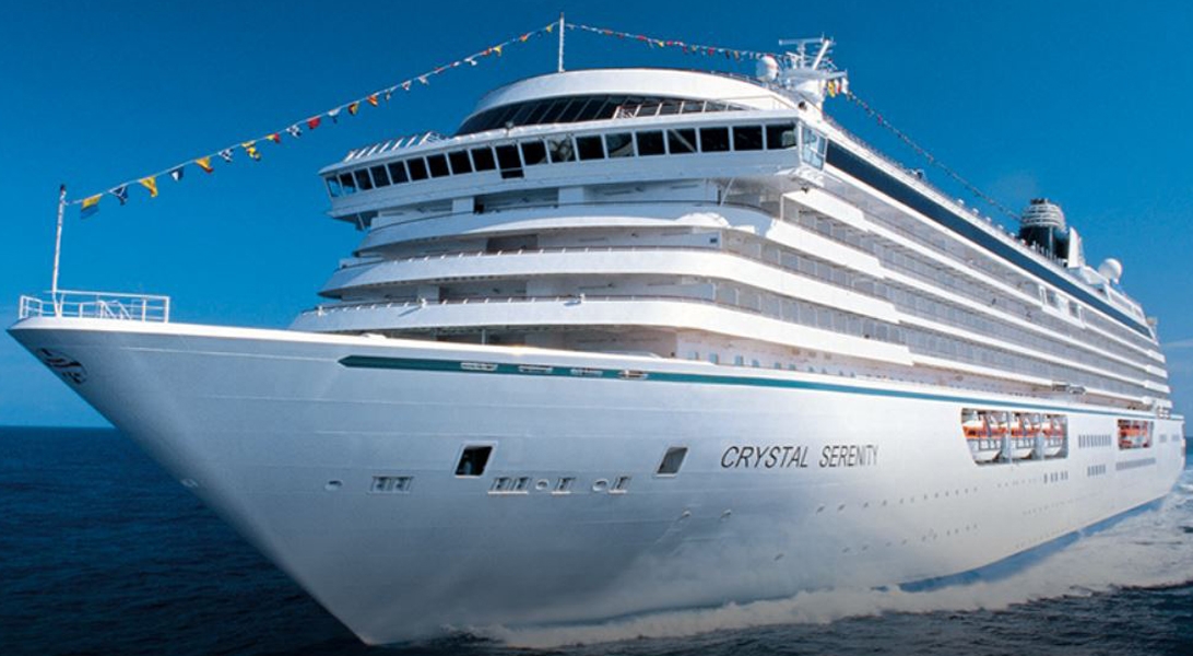
The images shown are for illustration purposes only and may not be an exact representation of what you find on the ship.
The images shown are for illustration purposes only and may not be an exact representation of what you find on the ship.

A nod to the mythic bars and bistros of Paris. Celebrate the classics in this spacious and airy café that serves light bites from dawn to dusk.
The Bistro is a delightful daytime relaxing cafe that offers delicious light meals, with panoramic views of the sparkling sea.
The images shown are for illustration purposes only and may not be an exact representation of what you find on the ship.

The ship's sleek cinema for recent-released movies, live sport events, guest lectures and religious services.

An ideal refreshment stop any time of the day, and the perfect place to meet friends for a pre-dinner cocktail. Enjoy a variety of musical styles as the day turns into night.

An elegant space to indulge in the finest cigars and cognacs.

Signature piano bar with an intimate ambience. The perfect setting for a cocktail before and after dinner.

Featuring large sky lights, floor-to-ceiling windows and a fabulous 270-degree forward view, this venue is perfect for afternoon tea, social gatherings and dancing.
The images shown are for illustration purposes only and may not be an exact representation of what you find on the ship.
The images shown are for illustration purposes only and may not be an exact representation of what you find on the ship.
Our Fusion packages are all ABTA & ATOL protected ensuring that your booking is safe with us
| 139 nights aboard the Crystal Serenity | |||
| Gratuities included | |||
| Complimentary drinks including wines, champagne, spirits throughout the ship | |||
| Award winning Broadway style entertainment | |||
| Complimentary speciality dining (one visit per restaurant) | |||
| Choice of shore excursions in every port | |||
| Butler Service | |||
| Enrichment programs & lectures | |||
| Complimentary shuttle buses in selected ports | |||
| Complimentary Wi-fi throughout the ship | |||
| Port Taxes and Fees | |||
 | ABTA and ATOL Protection* | ||
Date 8th Jan 2027 |
Nts 139 |
Oceanview £60,600pp |
Balcony £68,400pp |
Suite £152,000pp |
Date 8th Jan 2027 |
Nts 139 |
Oceanview £60,600pp |
Balcony £68,400pp |
Suite £152,000pp |
| Oceanview staterooms from | £60,600pp | ||
| CSWM | Double Guest Room with Ocean View | £60,600pp | |
| Balcony staterooms from | £68,400pp | ||
| CSVF | Double Guest Room with Veranda (Forward/Back) | £68,400pp | |
| CSVM | Double Guest Room with Veranda (Midship) | £70,300pp | |
| SSVF | Aquamarine Veranda Suite (Forward/Back) | £77,100pp | |
| SSVM | Aquamarine Veranda Suite (Midship) | £82,200pp | |
| GSVF | Sapphire Veranda Suite (Forward/Back) | £97,700pp | |
| GSVM | Sapphire Veranda Suite (Midship) | £101,000pp | |
| Suite staterooms from | £152,000pp | ||
| RYVF | Junior Crystal Penthouse Suite | £152,000pp | |
Fusion Holidays when selling travel arrangements is a trading name of Co-op Travel Services Limited, registration 08903986. Fusion Cruises is an Accredited Body Member of Co-op Travel Services Limited ATOL 12904.
Book with Confidence. We are a Member of ABTA which means you have the benefit of ABTA’s assistance and Code of Conduct.
Some of the flights and flight-inclusive holidays on this website are financially protected by the ATOL scheme but ATOL protection does not apply to all holiday and travel services offered on this website. This website will provide you with information on the protection that applies in the case of each holiday and travel service offered before you make your booking. If you do not receive an ATOL Certificate then the booking will not be ATOL protected. If you do receive an ATOL Certificate but all parts of your trip are not listed on it, those parts will not be ATOL protected. Please see our booking conditions for information, or for more information about financial protection and the ATOL Certificate go to: www.caa.co.uk
