| | | | | Arrive | Depart |
| 8th08 | SepSep | 202424 | 1 night accommodation before your cruise | | |
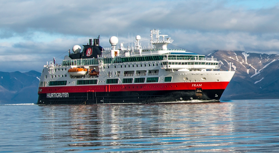
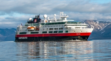
| 9th09 | SepSep | 202424 | Cambridge Bay, Nunavut, Canada, embark on the MS Fram | | 18:00 |
| 10th10 | SepSep | 202424 | Gjoa Haven, Nunavut, Canada | 14:00 | 19:00 |
| 11th11 | SepSep | 202424 | At Sea | | |
| 12th12 | SepSep | 202424 | Fort Ross, Nunavut, Canada | 17:00 | 12:00 |
| 13th13 | SepSep | 202424 | At Sea | | |
| 14th14 | SepSep | 202424 | Beechey Island, Nunavut, Canada | 07:00 | 12:00 |
| Beechey Island is a small island off the southwest coast of Devon Island, separated by a narrow waterway called the Barrow Strait. Captain William Edward Parry was the first European to visit the island in 1819. His lieutenant, Frederick William Beechey, named the island after his father, the artist William Beechey (1753–1839). Beechey Island played a significant role in the history of Arctic Exploration. During the winter of 1845-46, Sir John Franklin and his men camped on the island as part of their ill-fated quest to find the Northwest Passage. Mummified remains of three of Franklin’s crew were discovered, giving a better understanding of what happened before the disappearance of the expedition. In 1850 Edward Belcher used the island as a base while surveying the area. Later, in 1903, Norwegian explorer Roald Amundsen stopped at the island at the beginning of his successful voyage in search for the Northwest Passage. Subsequently, Beechey Island has been declared a "Territorial Historic Site" since 1975 by the Northwest Territories government |
| 14th14 | SepSep | 202424 | Radstock Bay, Devon Island, Canada | 15:00 | 19:00 |
| Devon Island is Canada’s sixth largest island and was first seen by Europeans in the early 17th century. The Thule culture had already settled there many centuries before, and left behind qarmat homes, made of rocks, whale bones, rock and sod walls, and skins for roofs that tell a story of over 800 years of human habitation. Other striking finds in this area are the many fossils of corals, crinoids and nautiloids that can be seen. Just across Lancaster Sound is Prince Leopold Island, a Canadian Important Bird Area, a federally listed migratory bird sanctuary, and a Key Migratory Bird Terrestrial Habitat site with large numbers of Thick-billed Murres, Northern Fulmars and Black-legged Kittiwakes that breed there. |
| 15th15 | SepSep | 202424 | Dundas Harbour, Devon Island, Nunavut, Canada | 08:00 | 12:00 |
| Dundas Harbour is located in the southeast of Devon Island, Canada’s 6th largest island. It is a forlorn but starkly beautiful spot. The island was first sighted by Europeans in 1616 by the English explorers Robert Bylot and William Baffin. But it did not appear on maps until after explorer William Edward Parry’s exploration in the 1820’s. Parry named it after Devon, England. In the local Inuktitut language, the place is called Talluruti, which translates as “a woman’s chin with tattoos on it.” This refers to the deep crevasses and streaks on Devon Island, which from a distance resemble traditional facial tattoos. On land there are remains of a Thule settlement dating back to 1000 A.D., including tent rings, middens and a gravesite. There are also much more recent remains a Royal Canadian Mounted Police outpost. The first post was established in 1924 to monitor and control illegal activities, such as foreign whaling, in the eastern entrance to the Northwest Passage. But conditions were so isolated and severe that the post was abandoned in 1933. It was reopened in 1945, but again closed, this time permanently, in 1951. Today, Devon Island is the largest uninhabited island in the world. |
| 16th16 | SepSep | 202424 | Pond Inlet, Nunavut, Canada | 14:00 | 19:00 |
| Located in northern Baffin Island, Pond Inlet is a small, predo¬minantly Inuit community, with a population of roughly 1,500 inhabitants. In 1818, the British explorer John Ross named a bay in the vicinity after the English astronomer John Pond. Today Pond Inlet is considered one of Canada's "jewels of the North" thanks to several picturesque glaciers and mountain ranges nearby. Many archaeological sites of ancient Dorset and Thule peoples can be found near Pond Inlet. The Inuit hunted caribou, ringed and harp seals, fish, polar bears, walrus, narwhals, geese, ptarmigans and Arctic hares, long before European and American whalers came here to harvest bowhead whales. Pond Inlet is also known as a major center of Inuit art, especially the printmaking and stone carving that are featured in the town’s art galleries. |
| 17th17 | SepSep | 202424 | At Sea | | |
| 18th18 | SepSep | 202424 | At Sea | | |
| 19th19 | SepSep | 202424 | Ilulissat (Jakobshavn), Greenland | 08:00 | 17:30 |
| Known as the birthplace of icebergs, the Ilulissat Icefjord produces nearly 20 million tons of ice each day. In fact, the word Ilulissat means “icebergs” in the Kalaallisut language. The town of Ilulissat is known for its long periods of calm and settled weather, but the climate tends to be cold due to its proximity to the fjord. Approximately 4,500 people live in Ilulissat, the third-largest town in Greenland after Nuuk and Sisimiut. Some people here estimate that there are nearly as many sled dogs as human beings living in the town that also boasts a local history museum located in the former home of Greenlandic folk hero and famed polar explorer Knud Rasmussen. |
| 20th20 | SepSep | 202424 | Sisimiut (Holsteinsborg), Greenland | 08:00 | 16:00 |
| Located just north of the Arctic Circle, Sisimiut is the northernmost town in Greenland where the port remains free of ice in the winter. Yet it is also the southernmost town where there is enough snow and ice to drive a dogsled in winter and spring. In Sisimiut, travelling by sled has been the primary means of winter transportation for centuries. In fact, the area has been inhabited for approximately 4,500 years. Modern Sisimiut is the largest business center in the north of Greenland, and is one of the fastest growing Greenlandic cities. Commercial fishing is the lead economy in the town‘s thriving industrial base. |
| 21st21 | SepSep | 202424 | Nuuk (Godthaab), Greenland | 08:00 | 16:00 |
| Nuuk, meaning “the cape”, was Greenland’s first town (1728). Started as a fort and later mission and trading post some 240 kilometers south of the Arctic Circle, it is the current capital. Almost 30% of Greenland’s population lives in the town. Not only does Nuuk have great natural beauty in its vicinity, but there are Inuit ruins, Hans Egede’s home, the parliament, and the Church of our Saviour as well. The Greenlandic National Museum has an outstanding collection of Greenlandic traditional dresses, as well as the famous Qilakitsoq mummies. The Katuaq Cultural Center’s building was inspired by the undulating Northern Lights and can house 10% of Nuuk’s inhabitants. |
| 22nd22 | SepSep | 202424 | Kvanefjord, Greenland | 07:00 | 12:00 |
| 23rd23 | SepSep | 202424 | At Sea | | |
| 24th24 | SepSep | 202424 | Red Bay, Newfoundland and Labrador, Canada | 14:00 | 18:00 |
| 25th25 | SepSep | 202424 | Corner Brook, Newfoundland and Labrador, Canada | 08:00 | 18:00 |
| Newfoundland's fourth-largest city, Corner Brook is the hub of the island's west coast. Hills fringe three sides of the city, which has dramatic views of the harbor and the Bay of Islands. The town is also home to a large paper mill and a branch of Memorial University. Captain James Cook, the British explorer, charted the coast in the 1760s, and a memorial to him overlooks the bay.The town enjoys more clearly defined seasons than most of the rest of the island, and in summer it has many pretty gardens. The nearby Humber River is the best-known salmon river in the province, and there are many kilometers of well-maintained walking trails in the community. |
| 26th26 | SepSep | 202424 | At Sea | | |
| 27th27 | SepSep | 202424 | At Sea | | |
| 28th28 | SepSep | 202424 | Isle of Portland, England, disembark the MS Fram | 07:00 | |
| The Isle of Portland is a tied island, 6 kilometres long by 2.7 kilometres wide, in the English Channel. The southern tip, Portland Bill lies 8 kilometres south of the resort of Weymouth, forming the southernmost point of the county of Dorset, England. A barrier beach called Chesil Beach joins it to the mainland. |