| | | | | Arrive | Depart |
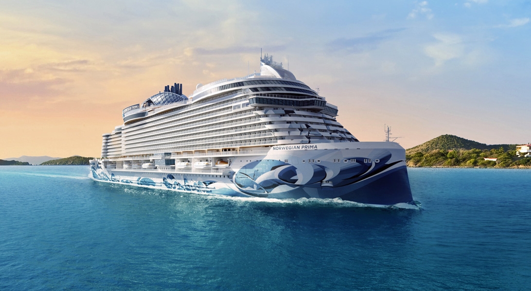
| 31st31 | JanJan | 202525 | Galveston, Texas, United States, embark on the Norwegian Prima | | 16:00 |
Located 50 miles from the better known Houston, the city of Galveston is very different, both in terms of atmosphere and attractions. Her Moody Gardens are probably her biggest attraction, offering families the chance to discover and learn about fauna and flora together whilst having fun. The refurbished Galveston Island Historic Pier is also a great place to spend some time with the family. |
| 1st01 | FebFeb | 202525 | At Sea | | |
| 2nd02 | FebFeb | 202525 | At Sea | | |
| 3rd03 | FebFeb | 202525 | Great Stirrup Cay, Bahamas | 07:00 | 17:00 |
Located 50 miles from Nassau, Great Stirrup Cay is a 250-acre island owned by Norwegian Cruise Line. A range of activities are on offer, including water sports, ping-pong, beach volleyball and a water slide. For lunch, the Jumbey Beach Grill offers barbecues on the beach. Afterwards, head to the Berried Treasure Bazaar to find a little something to bring back home. |
| 4th04 | FebFeb | 202525 | At Sea | | |
| 5th05 | FebFeb | 202525 | At Sea | | |
| 6th06 | FebFeb | 202525 | Philipsburg, Sint Maarten (Dutch part) | 07:00 | 17:30 |
The capital of Dutch St. Maarten stretches about a mile (1½ km) along an isthmus between Great Bay and the Salt Pond and has five parallel streets. Most of the village's dozens of shops and restaurants are on Front Street, narrow and cobblestone, closest to Great Bay. It's generally congested when cruise ships are in port, because of its many duty-free shops and several casinos. Little lanes called steegjes connect Front Street with Back Street, which has fewer shops and considerably less congestion. Along the beach is a ½-mile-long (1-km-long) boardwalk with restaurants and several Wi-Fi hot spots.Wathey Square (pronounced watty) is in the heart of the village. Directly across from the square are the town hall and the courthouse, in a striking white building with cupola. The structure was built in 1793 and has served as the commander's home, a fire station, a jail, and a post office. The streets surrounding the square are lined with hotels, duty-free shops, restaurants, and cafés. The Captain Hodge Pier, just off the square, is a good spot to view Great Bay and the beach that stretches alongside. |
| 7th07 | FebFeb | 202525 | Road Town, Tortola, British Virgin Islands | 08:00 | 17:30 |
| 8th08 | FebFeb | 202525 | Saint Thomas, U.S. Virgin Islands | 07:00 | 14:30 |
If you fly to the 32-square-mile (83-square-km) island of St. Thomas, you land at its western end; if you arrive by cruise ship, you come into one of the world's most beautiful harbors. Either way, one of your first sights is the town of Charlotte Amalie. From the harbor you see an idyllic-looking village that spreads into the lower hills. If you were expecting a quiet hamlet with its inhabitants hanging out under palm trees, you've missed that era by about 300 years. Although other islands in the USVI developed plantation economies, St. Thomas cultivated its harbor, and it became a thriving seaport soon after it was settled by the Danish in the 1600s. The success of the naturally perfect harbor was enhanced by the fact that the Danes—who ruled St. Thomas with only a couple of short interruptions from 1666 to 1917—avoided involvement in some 100 years' worth of European wars. Denmark was the only European country with colonies in the Caribbean to stay neutral during the War of the Spanish Succession in the early 1700s. Thus, products of the Dutch, English, and French islands—sugar, cotton, and indigo—were traded through Charlotte Amalie, along with the regular shipments of slaves. When the Spanish wars ended, trade fell off, but by the end of the 1700s Europe was at war again, Denmark again remained neutral, and St. Thomas continued to prosper. Even into the 1800s, while the economies of St. Croix and St. John foundered with the market for sugarcane, St. Thomas's economy remained vigorous. This prosperity led to the development of shipyards, a well-organized banking system, and a large merchant class. In 1845 Charlotte Amalie had 101 large importing houses owned by the English, French, Germans, Haitians, Spaniards, Americans, Sephardim, and Danes. Charlotte Amalie is still one of the world's most active cruise-ship ports. On almost any day at least one and sometimes as many as eight cruise ships are tied to the docks or anchored outside the harbor. Gently rocking in the shadows of these giant floating hotels are just about every other kind of vessel imaginable: sleek sailing catamarans that will take you on a sunset cruise complete with rum punch and a Jimmy Buffett soundtrack, private megayachts for billionaires, and barnacle-bottom sloops—with laundry draped over the lifelines—that are home to world-cruising gypsies. Huge container ships pull up in Sub Base, west of the harbor, bringing in everything from breakfast cereals to tires. Anchored right along the waterfront are down-island barges that ply the waters between the Greater Antilles and the Leeward Islands, transporting goods such as refrigerators, VCRs, and disposable diapers. The waterfront road through Charlotte Amalie was once part of the harbor. Before it was filled in to build the highway, the beach came right up to the back door of the warehouses that now line the thoroughfare. Two hundred years ago those warehouses were filled with indigo, tobacco, and cotton. Today the stone buildings house silk, crystal, and diamonds. Exotic fragrances are still traded, but by island beauty queens in air-conditioned perfume palaces instead of through open market stalls. The pirates of old used St. Thomas as a base from which to raid merchant ships of every nation, though they were particularly fond of the gold- and silver-laden treasure ships heading to Spain. Pirates are still around, but today's versions use St. Thomas as a drop-off for their contraband: illegal immigrants and drugs. To explore outside Charlotte Amalie, rent a car or hire a taxi. Your rental car should come with a good map; if not, pick up the pocket-size "St. Thomas–St. John Road Map" at a tourist information center. Roads are marked with route numbers, but they're confusing and seem to switch numbers suddenly. Roads are also identified by signs bearing the St. Thomas–St. John Hotel and Tourism Association's mascot, Tommy the Starfish. More than 100 of these color-coded signs line the island's main routes. Orange signs trace the route from the airport to Red Hook, green signs identify the road from town to Magens Bay, Tommy's face on a yellow background points from Mafolie to Crown Bay through the north side, red signs lead from Smith Bay to Four Corners via Skyline Drive, and blue signs mark the route from the cruise-ship dock at Havensight to Red Hook. These color-coded routes are not marked on most visitor maps, however. Allow yourself a day to explore, especially if you want to stop to take pictures or to enjoy a light bite or refreshing swim. Most gas stations are on the island's more populated eastern end, so fill up before heading to the north side. And remember to drive on the left! |
| 9th09 | FebFeb | 202525 | Puerto Plata, Dominican Republic | 10:00 | 19:00 |
San Felipe de Puerto Plata is the capital of the Puerto Plata province on the Dominican Republic’s Atlantic north coast. The city is best known for its beaches. Playa Dorada’s lengthy beachfront is backed by resorts and an 18-hole golf course. The city’s old colonial-era center is dominated by the 16th-century Fortaleza San Felipe, a Spanish fortress that now houses historical and military artifacts. |
| 10th10 | FebFeb | 202525 | At Sea | | |
| 11th11 | FebFeb | 202525 | Georgetown, Grand Cayman, Cayman Islands | 07:00 | 15:30 |
Begin exploring the capital by strolling along the waterfront Harbour Drive to Elmslie Memorial United Church, named after the first Presbyterian missionary to serve in Cayman. Its vaulted ceiling, wooden arches, and sedate nave reflect the religious nature of island residents. In front of the court building, in the center of town, names of influential Caymanians are inscribed on the Wall of History, which commemorates the islands' quincentennial in 2003. Across the street is the Cayman Islands Legislative Assembly Building, next door to the 1919 Peace Memorial Building. In the middle of the financial district is the General Post Office, built in 1939. Let the kids pet the big blue iguana statues. |
| 12th12 | FebFeb | 202525 | Cozumel, Mexico | 10:00 | 18:00 |
It's not another Cancún yet, but Cozumel's days as a rustic divers' hangout are history. Whether arriving by plane or at the island's gleaming ferry terminal, visitors soon realize there's nothing deserted about this island. That has its advantages. It's rare to find such stunning natural beauty, glass-clear aquamarine seas, and vast marine life combined with top-flight visitor services and accommodations, and as a result Cozumel's devotees are legion. Divers sharing stories of lionfish and sharks sit table-to-table with families tanned from a day at the beach club, while Mexican couples spin and step to salsa music in the central plaza. But the elephant in Cozumel's big and bountiful room are the throngs of cruise-ship passengers who take over the countless crafts and jewelry stores along the seaward boulevard downtown any day there are ships in port—which is to say, just about every day. But take just a few steps off the beaten path and this little island offers big rewards. Deserted, windswept beaches, wild and vibrant natural parks, and 600 miles of coral reef are still yours for the discovering. Just 19 km (12 miles) off the coast, Cozumel is 53 km (33 miles) long and 15 km (9 miles) wide, making it the country's third-largest island. Plaza Central, or just "la plaza," is the heart of San Miguel, directly across from the docks. Residents congregate here in the evening, especially on weekends, when free concerts begin at 8 pm. Heading inland (east) takes you away from the tourist zone and toward residential areas of town. Most of the island's restaurants, hotels, stores, and dive shops are concentrated downtown and along the two hotel zones that fan out along the leeward coast to the north and south of San Miguel. The most concentrated commercial district is between Calle 10 Norte and Calle 11 Sur to beyond Avenida Pedro Joaquin Coldwell. Cozumel's solitude-seeking windward side also has a few restaurants and one hotel. Unless you want to stick around your hotel or downtown San Miguel for your whole stay, you'll do well to rent a car or a scooter. Most worthwhile sites, such as the island's Mayan ruins and pristine windward beaches, are only readily accessible with wheels. Taxi fares are astronomical, and after just a few trips a rental car is clearly a better deal. |
| 13th13 | FebFeb | 202525 | At Sea | | |
| 14th14 | FebFeb | 202525 | Galveston, Texas, United States, disembark the Norwegian Prima | 08:00 | |
Located 50 miles from the better known Houston, the city of Galveston is very different, both in terms of atmosphere and attractions. Her Moody Gardens are probably her biggest attraction, offering families the chance to discover and learn about fauna and flora together whilst having fun. The refurbished Galveston Island Historic Pier is also a great place to spend some time with the family. |

