This site uses cookies as defined in our Cookie Policy, by continuing to use this site you agree to their use.
Continue

| Arrive | Depart | ||||||
| 11th11 | MarMar | 202828 | Ushuaia, Argentina, embark on the Seabourn Venture | 17:00 | |||
At 55 degrees latitude south, Ushuaia (pronounced oo-swy-ah) is closer to the South Pole than to Argentina's northern border with Bolivia. It is the capital and tourism base for Tierra del Fuego, the island at the southernmost tip of Argentina.Although its stark physical beauty is striking, Tierra del Fuego's historical allure is based more on its mythical past than on rugged reality. The island was inhabited for 6,000 years by Yámana, Haush, Selk'nam, and Alakaluf Indians. But in 1902 Argentina, eager to populate Patagonia to bolster its territorial claims, moved to initiate an Ushuaian penal colony, establishing the permanent settlement of its most southern territories and, by implication, everything in between.When the prison closed in 1947, Ushuaia had a population of about 3,000, made up mainly of former inmates and prison staff. Today the Indians of Darwin's "missing link" theory are long gone—wiped out by diseases brought by settlers and by indifference to their plight—and the 60,000 residents of Ushuaia are hitching their star to tourism.The city rightly (if perhaps too loudly) promotes itself as the southernmost city in the world (Puerto Williams, a few miles south on the Chilean side of the Beagle Channel, is a small town). You can make your way to the tourism office to get your clichéd, but oh-so-necessary, "Southernmost City in the World" passport stamp. Ushuaia feels like a frontier boomtown, at heart still a rugged, weather-beaten fishing village, but exhibiting the frayed edges of a city that quadrupled in size in the '70s and '80s and just keeps growing. Unpaved portions of Ruta 3, the last stretch of the Pan-American Highway, which connects Alaska to Tierra del Fuego, are finally being paved. The summer months (December through March) draw more than 120,000 visitors, and dozens of cruise ships. The city is trying to extend those visits with events like March's Marathon at the End of the World and by increasing the gamut of winter activities buoyed by the excellent snow conditions.A terrific trail winds through the town up to the Martial Glacier, where a ski lift can help cut down a steep kilometer of your journey. The chaotic and contradictory urban landscape includes a handful of luxury hotels amid the concrete of public housing projects. Scores of "sled houses" (wooden shacks) sit precariously on upright piers, ready for speedy displacement to a different site. But there are also many small, picturesque homes with tiny, carefully tended gardens. Many of the newer homes are built in a Swiss-chalet style, reinforcing the idea that this is a town into which tourism has breathed new life. At the same time, the weather-worn pastel colors that dominate the town's landscape remind you that Ushuaia was once just a tiny fishing village, snuggled at the end of the Earth.As you stand on the banks of the Canal Beagle (Beagle Channel) near Ushuaia, the spirit of the farthest corner of the world takes hold. What stands out is the light: at sundown the landscape is cast in a subdued, sensual tone; everything feels closer, softer, and more human in dimension despite the vastness of the setting. The snowcapped mountains reflect the setting sun back onto a stream rolling into the channel, as nearby peaks echo their image—on a windless day—in the still waters.Above the city rise the last mountains of the Andean Cordillera, and just south and west of Ushuaia they finally vanish into the often-stormy sea. Snow whitens the peaks well into summer. Nature is the principal attraction here, with trekking, fishing, horseback riding, wildlife spotting, and sailing among the most rewarding activities, especially in the Parque Nacional Tierra del Fuego (Tierra del Fuego National Park). | |||||||
| 11th11 | MarMar | 202828 | Buenos Aires, Argentina | ||||
Glamorous and gritty, Buenos Aires is two cities in one. What makes Argentina's capital so fascinating is its dual heritage—part European, part Latin American. Plaza de Mayo resembles a grand square in Madrid, and the ornate Teatro Colón would not be out of place in Vienna. But you’ll know you’re in South America by the leather shoes for sale on cobbled streets and impromptu parades of triumphant soccer fans. Limited-production wines, juicy steaks, and ice cream in countless flavors are among the old-world imports the city has perfected. | |||||||
| 12th12 | MarMar | 202828 | Ushuaia, Argentina | ||||
At 55 degrees latitude south, Ushuaia (pronounced oo-swy-ah) is closer to the South Pole than to Argentina's northern border with Bolivia. It is the capital and tourism base for Tierra del Fuego, the island at the southernmost tip of Argentina.Although its stark physical beauty is striking, Tierra del Fuego's historical allure is based more on its mythical past than on rugged reality. The island was inhabited for 6,000 years by Yámana, Haush, Selk'nam, and Alakaluf Indians. But in 1902 Argentina, eager to populate Patagonia to bolster its territorial claims, moved to initiate an Ushuaian penal colony, establishing the permanent settlement of its most southern territories and, by implication, everything in between.When the prison closed in 1947, Ushuaia had a population of about 3,000, made up mainly of former inmates and prison staff. Today the Indians of Darwin's "missing link" theory are long gone—wiped out by diseases brought by settlers and by indifference to their plight—and the 60,000 residents of Ushuaia are hitching their star to tourism.The city rightly (if perhaps too loudly) promotes itself as the southernmost city in the world (Puerto Williams, a few miles south on the Chilean side of the Beagle Channel, is a small town). You can make your way to the tourism office to get your clichéd, but oh-so-necessary, "Southernmost City in the World" passport stamp. Ushuaia feels like a frontier boomtown, at heart still a rugged, weather-beaten fishing village, but exhibiting the frayed edges of a city that quadrupled in size in the '70s and '80s and just keeps growing. Unpaved portions of Ruta 3, the last stretch of the Pan-American Highway, which connects Alaska to Tierra del Fuego, are finally being paved. The summer months (December through March) draw more than 120,000 visitors, and dozens of cruise ships. The city is trying to extend those visits with events like March's Marathon at the End of the World and by increasing the gamut of winter activities buoyed by the excellent snow conditions.A terrific trail winds through the town up to the Martial Glacier, where a ski lift can help cut down a steep kilometer of your journey. The chaotic and contradictory urban landscape includes a handful of luxury hotels amid the concrete of public housing projects. Scores of "sled houses" (wooden shacks) sit precariously on upright piers, ready for speedy displacement to a different site. But there are also many small, picturesque homes with tiny, carefully tended gardens. Many of the newer homes are built in a Swiss-chalet style, reinforcing the idea that this is a town into which tourism has breathed new life. At the same time, the weather-worn pastel colors that dominate the town's landscape remind you that Ushuaia was once just a tiny fishing village, snuggled at the end of the Earth.As you stand on the banks of the Canal Beagle (Beagle Channel) near Ushuaia, the spirit of the farthest corner of the world takes hold. What stands out is the light: at sundown the landscape is cast in a subdued, sensual tone; everything feels closer, softer, and more human in dimension despite the vastness of the setting. The snowcapped mountains reflect the setting sun back onto a stream rolling into the channel, as nearby peaks echo their image—on a windless day—in the still waters.Above the city rise the last mountains of the Andean Cordillera, and just south and west of Ushuaia they finally vanish into the often-stormy sea. Snow whitens the peaks well into summer. Nature is the principal attraction here, with trekking, fishing, horseback riding, wildlife spotting, and sailing among the most rewarding activities, especially in the Parque Nacional Tierra del Fuego (Tierra del Fuego National Park). | |||||||
| 13th13 | MarMar | 202828 | At Sea | ||||
| 14th14 | MarMar | 202828 | Antarctic Experience, Antarctica | 07:00 | 17:00 | ||
| 15th15 | MarMar | 202828 | Antarctic Experience, Antarctica | 17:00 | |||
| 16th16 | MarMar | 202828 | Antarctic Experience, Antarctica | 17:00 | |||
| 17th17 | MarMar | 202828 | Antarctic Experience, Antarctica | 17:00 | |||
| 18th18 | MarMar | 202828 | Antarctic Experience, Antarctica | 17:00 | |||
| 19th19 | MarMar | 202828 | At Sea | ||||
| 20th20 | MarMar | 202828 | Ushuaia, Argentina | 19:00 | |||
At 55 degrees latitude south, Ushuaia (pronounced oo-swy-ah) is closer to the South Pole than to Argentina's northern border with Bolivia. It is the capital and tourism base for Tierra del Fuego, the island at the southernmost tip of Argentina.Although its stark physical beauty is striking, Tierra del Fuego's historical allure is based more on its mythical past than on rugged reality. The island was inhabited for 6,000 years by Yámana, Haush, Selk'nam, and Alakaluf Indians. But in 1902 Argentina, eager to populate Patagonia to bolster its territorial claims, moved to initiate an Ushuaian penal colony, establishing the permanent settlement of its most southern territories and, by implication, everything in between.When the prison closed in 1947, Ushuaia had a population of about 3,000, made up mainly of former inmates and prison staff. Today the Indians of Darwin's "missing link" theory are long gone—wiped out by diseases brought by settlers and by indifference to their plight—and the 60,000 residents of Ushuaia are hitching their star to tourism.The city rightly (if perhaps too loudly) promotes itself as the southernmost city in the world (Puerto Williams, a few miles south on the Chilean side of the Beagle Channel, is a small town). You can make your way to the tourism office to get your clichéd, but oh-so-necessary, "Southernmost City in the World" passport stamp. Ushuaia feels like a frontier boomtown, at heart still a rugged, weather-beaten fishing village, but exhibiting the frayed edges of a city that quadrupled in size in the '70s and '80s and just keeps growing. Unpaved portions of Ruta 3, the last stretch of the Pan-American Highway, which connects Alaska to Tierra del Fuego, are finally being paved. The summer months (December through March) draw more than 120,000 visitors, and dozens of cruise ships. The city is trying to extend those visits with events like March's Marathon at the End of the World and by increasing the gamut of winter activities buoyed by the excellent snow conditions.A terrific trail winds through the town up to the Martial Glacier, where a ski lift can help cut down a steep kilometer of your journey. The chaotic and contradictory urban landscape includes a handful of luxury hotels amid the concrete of public housing projects. Scores of "sled houses" (wooden shacks) sit precariously on upright piers, ready for speedy displacement to a different site. But there are also many small, picturesque homes with tiny, carefully tended gardens. Many of the newer homes are built in a Swiss-chalet style, reinforcing the idea that this is a town into which tourism has breathed new life. At the same time, the weather-worn pastel colors that dominate the town's landscape remind you that Ushuaia was once just a tiny fishing village, snuggled at the end of the Earth.As you stand on the banks of the Canal Beagle (Beagle Channel) near Ushuaia, the spirit of the farthest corner of the world takes hold. What stands out is the light: at sundown the landscape is cast in a subdued, sensual tone; everything feels closer, softer, and more human in dimension despite the vastness of the setting. The snowcapped mountains reflect the setting sun back onto a stream rolling into the channel, as nearby peaks echo their image—on a windless day—in the still waters.Above the city rise the last mountains of the Andean Cordillera, and just south and west of Ushuaia they finally vanish into the often-stormy sea. Snow whitens the peaks well into summer. Nature is the principal attraction here, with trekking, fishing, horseback riding, wildlife spotting, and sailing among the most rewarding activities, especially in the Parque Nacional Tierra del Fuego (Tierra del Fuego National Park). | |||||||
| 21st21 | MarMar | 202828 | Ushuaia, Argentina | 20:00 | |||
At 55 degrees latitude south, Ushuaia (pronounced oo-swy-ah) is closer to the South Pole than to Argentina's northern border with Bolivia. It is the capital and tourism base for Tierra del Fuego, the island at the southernmost tip of Argentina.Although its stark physical beauty is striking, Tierra del Fuego's historical allure is based more on its mythical past than on rugged reality. The island was inhabited for 6,000 years by Yámana, Haush, Selk'nam, and Alakaluf Indians. But in 1902 Argentina, eager to populate Patagonia to bolster its territorial claims, moved to initiate an Ushuaian penal colony, establishing the permanent settlement of its most southern territories and, by implication, everything in between.When the prison closed in 1947, Ushuaia had a population of about 3,000, made up mainly of former inmates and prison staff. Today the Indians of Darwin's "missing link" theory are long gone—wiped out by diseases brought by settlers and by indifference to their plight—and the 60,000 residents of Ushuaia are hitching their star to tourism.The city rightly (if perhaps too loudly) promotes itself as the southernmost city in the world (Puerto Williams, a few miles south on the Chilean side of the Beagle Channel, is a small town). You can make your way to the tourism office to get your clichéd, but oh-so-necessary, "Southernmost City in the World" passport stamp. Ushuaia feels like a frontier boomtown, at heart still a rugged, weather-beaten fishing village, but exhibiting the frayed edges of a city that quadrupled in size in the '70s and '80s and just keeps growing. Unpaved portions of Ruta 3, the last stretch of the Pan-American Highway, which connects Alaska to Tierra del Fuego, are finally being paved. The summer months (December through March) draw more than 120,000 visitors, and dozens of cruise ships. The city is trying to extend those visits with events like March's Marathon at the End of the World and by increasing the gamut of winter activities buoyed by the excellent snow conditions.A terrific trail winds through the town up to the Martial Glacier, where a ski lift can help cut down a steep kilometer of your journey. The chaotic and contradictory urban landscape includes a handful of luxury hotels amid the concrete of public housing projects. Scores of "sled houses" (wooden shacks) sit precariously on upright piers, ready for speedy displacement to a different site. But there are also many small, picturesque homes with tiny, carefully tended gardens. Many of the newer homes are built in a Swiss-chalet style, reinforcing the idea that this is a town into which tourism has breathed new life. At the same time, the weather-worn pastel colors that dominate the town's landscape remind you that Ushuaia was once just a tiny fishing village, snuggled at the end of the Earth.As you stand on the banks of the Canal Beagle (Beagle Channel) near Ushuaia, the spirit of the farthest corner of the world takes hold. What stands out is the light: at sundown the landscape is cast in a subdued, sensual tone; everything feels closer, softer, and more human in dimension despite the vastness of the setting. The snowcapped mountains reflect the setting sun back onto a stream rolling into the channel, as nearby peaks echo their image—on a windless day—in the still waters.Above the city rise the last mountains of the Andean Cordillera, and just south and west of Ushuaia they finally vanish into the often-stormy sea. Snow whitens the peaks well into summer. Nature is the principal attraction here, with trekking, fishing, horseback riding, wildlife spotting, and sailing among the most rewarding activities, especially in the Parque Nacional Tierra del Fuego (Tierra del Fuego National Park). | |||||||
| 22nd22 | MarMar | 202828 | At Sea | ||||
| 23rd23 | MarMar | 202828 | Falkland Islands, Falkland Islands (Malvinas) | 07:00 | 17:00 | ||
| 24th24 | MarMar | 202828 | Port Stanley, Falkland Islands (Malvinas) | 08:00 | 20:00 | ||
Tiny Stanley, capital of the Falklands, seems in many ways like a British village fallen out of the sky. Many homes are painted in bright colours, adding visual appeal to this distant outpost. Not far offshore, the wreck of the Lady Elizabeth, is one of the many vessels remaining as a silent testimonial to the region's frequent harsh weather conditions.The islands, also known by their Spanish name of Islas Malvinas, are home to arguably more tuxedo-clad inhabitants of the penguin variety than human residents. Various species, such as Gentoo, Magellanic and the more elusive King penguins, either live here permanently or use the Falklands as a stopover on their migration route. Darwin found the islands' flora and fauna fascinating - no doubt you will, too. | |||||||
| 25th25 | MarMar | 202828 | At Sea | ||||
| 26th26 | MarMar | 202828 | At Sea | ||||
| 27th27 | MarMar | 202828 | South Georgia Experience, South Georgia and the South Sandwich Islands | 07:00 | 17:00 | ||
| 28th28 | MarMar | 202828 | South Georgia Experience, South Georgia and the South Sandwich Islands | 17:00 | |||
| 29th29 | MarMar | 202828 | South Georgia Experience, South Georgia and the South Sandwich Islands | 17:00 | |||
| 30th30 | MarMar | 202828 | At Sea | ||||
| 31st31 | MarMar | 202828 | At Sea | ||||
| 1st01 | AprApr | 202828 | At Sea | ||||
| 2nd02 | AprApr | 202828 | At Sea | ||||
| 3rd03 | AprApr | 202828 | Inaccessible Island, Ascencion and Tristan da Cunha | 07:00 | 11:30 | ||
| 3rd03 | AprApr | 202828 | Tristan da Cunha, Saint Helena, Ascension and Tristan da Cunha | 13:00 | 18:00 | ||
For the adventurous and fit Jacobs Ladder could be of interest: the ladder actually is an inclined plane with 699 steps (and 600ft). For connoisseurs a visit to the St Helena Distillery is a must: names like White Lion Rum, Midnight Mist coffee liqueur and Juniper flavoured gin entice to see how they are made –and perhaps taste them. | |||||||
| 4th04 | AprApr | 202828 | Nightingale Islands, Saint Helena, Ascension and Tristan da Cunha | 07:00 | 12:00 | ||
Nightingale Island is an active volcano and one of three islands in the extremes of the South Atlantic Ocean known as the Nightingale Islands falling within the Tristan da Cunha group. The three islands are administered by the United Kingdom and are visited for scientific research purposes and little else. This means the magnificent wildlife with an estimated one million seabirds, in addition to unusual flora, is all unspoiled by people. Nightingale Island is also a protected wildlife reserve and World Heritage Site. Nightingale has two peaks on its north end and the rest of the island is ringed by cliffs and sea caves, and is fringed with kelp beds. The sea caves have been said to hide pirate treasure with a fortune in Spanish doubloons and pieces-of-eight hidden here for safekeeping. However, no recovery of this booty has ever been documented. | |||||||
| 5th05 | AprApr | 202828 | At Sea | ||||
| 6th06 | AprApr | 202828 | At Sea | ||||
| 7th07 | AprApr | 202828 | At Sea | ||||
| 8th08 | AprApr | 202828 | Jamestown, Saint Helena, Ascension and Tristan da Cunha | 09:00 | 23:00 | ||
In the South Atlantic Ocean, St Helena is a tropical island that has a variation of influences from all over the world. Explore the island with its many activities, local delicacies and rich culture. | |||||||
| 9th09 | AprApr | 202828 | At Sea | ||||
| 10th10 | AprApr | 202828 | At Sea | ||||
| 11th11 | AprApr | 202828 | Bird Island, South Africa | 07:00 | 11:00 | ||
| 12th12 | AprApr | 202828 | At Sea | ||||
| 13th13 | AprApr | 202828 | At Sea | ||||
| 14th14 | AprApr | 202828 | At Sea | ||||
| 15th15 | AprApr | 202828 | At Sea | ||||
| 16th16 | AprApr | 202828 | Mindelo, São Vicente Island, Cape Verde | 07:00 | 17:00 | ||
Your next stop will be Cape Verde’s cultural capital, Mindelo. Get along with the locals listening to the real morna in the bars of the old town and sipping the local drink, a sugarcane spirit. This island is also known by its British and Portuguese colonial architecture and pastel-coloured houses, the municipal market and the facades of the old Governor’s Palace. | |||||||
| 17th17 | AprApr | 202828 | At Sea | ||||
| 18th18 | AprApr | 202828 | At Sea | ||||
| 19th19 | AprApr | 202828 | Tenerife, Spain | 08:00 | |||
| 20th20 | AprApr | 202828 | Tenerife, Spain | 12:00 | |||
| 21st21 | AprApr | 202828 | Funchal, Madeira, Portugal | 08:00 | 17:00 | ||
Formed by a volcanic eruption, Madeira lies in the Gulf Stream, about 500 miles due west of Casablanca. Discovered by Portuguese explorer João Gonçalves Zarco in 1419, this beautiful island became part of Portugal’s vast empire and was named for the dense forest which cloaked it - 'Madeira' means 'wood' in Portuguese. Sugar plantations first brought wealth here, and when King Charles II of England granted an exclusive franchise to sell wine to England and its colonies, many British emigrants were drawn to the capital, Funchal. Today’s travellers come to Madeira for the varied and luxuriant scenery, from mountain slopes covered with vines to picturesque villages and a profusion of wild flowers. The natural beauty of the island has earned it many pseudonyms such as ‘The Floating Garden of the Atlantic’, 'The Island of Eternal Springtime' and ‘God’s Botanical Gardens’ and our selection of excursions aim to show you why. | |||||||
| 22nd22 | AprApr | 202828 | At Sea | ||||
| 23rd23 | AprApr | 202828 | Lisbon, Portugal | 07:00 | 17:00 | ||
Set on seven hills on the banks of the River Tagus, Lisbon has been the capital of Portugal since the 13th century. It is a city famous for its majestic architecture, old wooden trams, Moorish features and more than twenty centuries of history. Following disastrous earthquakes in the 18th century, Lisbon was rebuilt by the Marques de Pombal who created an elegant city with wide boulevards and a great riverfront and square, Praça do Comércio. Today there are distinct modern and ancient sections, combining great shopping with culture and sightseeing in the Old Town, built on the city's terraced hillsides. The distance between the ship and your tour vehicle may vary. This distance is not included in the excursion grades. | |||||||
| 24th24 | AprApr | 202828 | At Sea | ||||
| 25th25 | AprApr | 202828 | At Sea | ||||
| 26th26 | AprApr | 202828 | Cherbourg, France | 07:00 | 17:00 | ||
Originally a little fishing village, Cherbourg has developed into a historic port designed by Vauban. This was also a strategic naval port during the Napoleonic wars; there is a marina with over 1000 moorings. “Cap de la Hague” is to the West and the “Pointe de Barfleur” to the East. This port, which belongs to Normandy, is a region that has provided inspiration for countless artists and writers, and is the land of apple orchards and rolling farmland dotted with villages of half-timbered houses. Boasting a wealth of abbeys and châteaux, as well as a superb coastline, it offers something for everyone. Cherbourg was also the first stop of RMS Titanic after it left Southampton, England. On 19 June 1864, the naval engagement between USS Kearsarge and CSS Alabama took place off Cherbourg. The Battle of Cherbourg, fought in June 1944 following the Normandy Invasion, ended with the capture of Cherbourg on June 30. | |||||||
| 27th27 | AprApr | 202828 | Plymouth, England | 07:00 | 17:00 | ||
Best known as the port from which Sir Francis Drake and the port which the Pilgrim Fathers set sail from, Plymouth is awash with history. Walk down its cobbled streets, step back in time and discover the historical landmarks and sites. | |||||||
| 28th28 | AprApr | 202828 | Lundy Island, England | 12:00 | 20:00 | ||
| 29th29 | AprApr | 202828 | Skomer Island, Wales | 07:00 | 15:00 | ||
The cliffs of small Skomer Island off the southwest coast of Wales are accessible only by boat. Skomer has a large population of breeding seabirds that include Manx Shearwaters, Razorbills, Great Cormorants, Black-legged Kittiwakes, Atlantic Puffins, European Storm Petrels, Common Shags, Eurasian Oystercatchers and gulls, as well as birds of prey including Short-eared Owls, Common Kestrels and Peregrine Falcons. The island’s slopes are covered with bluebells and a variety of wildflowers. Grey seals and harbour porpoises can sometimes be seen in the surrounding waters. | |||||||
| 30th30 | AprApr | 202828 | Bantry, Ireland | 07:00 | 20:00 | ||
| 1st01 | MayMay | 202828 | Schull, Ireland | 07:00 | 17:00 | ||
| 2nd02 | MayMay | 202828 | Cape Clear Island, Ireland | 07:00 | 17:00 | ||
| 3rd03 | MayMay | 202828 | Kinsale, Ireland | 07:00 | 17:00 | ||
| 4th04 | MayMay | 202828 | Calf of Man, Isle of Man | 12:00 | 20:00 | ||
| 5th05 | MayMay | 202828 | Belfast, Northern Ireland | 07:00 | 22:00 | ||
Before English and Scottish settlers arrived in the 1600s, Belfast was a tiny village called Béal Feirste ("sandbank ford") belonging to Ulster's ancient O'Neill clan. With the advent of the Plantation period (when settlers arrived in the 1600s), Sir Arthur Chichester, from Devon in southwestern England, received the city from the English Crown, and his son was made Earl of Donegall. Huguenots fleeing persecution from France settled near here, bringing their valuable linen-work skills. In the 18th century, Belfast underwent a phenomenal expansion—its population doubled every 10 years, despite an ever-present sectarian divide. Although the Anglican gentry despised the Presbyterian artisans—who, in turn, distrusted the native Catholics—Belfast's growth continued at a dizzying speed. The city was a great Victorian success story, an industrial boomtown whose prosperity was built on trade, especially linen and shipbuilding. Famously (or infamously), the Titanic was built here, giving Belfast, for a time, the nickname "Titanic Town." Having laid the foundation stone of the city's university in 1845, Queen Victoria returned to Belfast in 1849 (she is recalled in the names of buildings, streets, bars, monuments, and other places around the city), and in the same year, the university opened under the name Queen's College. Nearly 40 years later, in 1888, Victoria granted Belfast its city charter. Today its population is nearly 300,000, tourist numbers have increased, and this dramatically transformed city is enjoying an unparalleled renaissance.This is all a welcome change from the period when news about Belfast meant reports about "the Troubles." Since the 1994 ceasefire, Northern Ireland's capital city has benefited from major hotel investment, gentrified quaysides (or strands), a sophisticated new performing arts center, and major initiatives to boost tourism. Although the 1996 bombing of offices at Canary Wharf in London disrupted the 1994 peace agreement, the ceasefire was officially reestablished on July 20, 1997, and this embattled city began its quest for a newfound identity.Since 2008, the city has restored all its major public buildings such as museums, churches, theaters, City Hall, Ulster Hall—and even the glorious Crown Bar—spending millions of pounds on its built heritage. A gaol that at the height of the Troubles held some of the most notorious murderers involved in paramilitary violence is now a major visitor attraction.Belfast's city center is made up of three roughly contiguous areas that are easy to navigate on foot. From the south end to the north, it's about an hour's leisurely walk. | |||||||
| 6th06 | MayMay | 202828 | Calf of Man, Isle of Man | 07:00 | 12:00 | ||
| 6th06 | MayMay | 202828 | Douglas, Isle of Man | 14:00 | 20:00 | ||
The Isle of Man, situated in the Irish Sea off the west coast of England, is a mountainous, cliff-fringed island and one of Britain’s most beautiful spots. Measuring just 30 miles by 13 miles, the Isle of Man remains semi-autonomous. With its own postage stamps, laws, currency, and the Court of Tynwald (the world’s oldest democratic parliament), the Isle of Man is rich with history and lore.Inhabited from Neolithic times, the island became a refuge for Irish missionaries after the 5th Century. Norsemen took the island during the 9th Century and sold it to Scotland in 1266. However, since the 14th Century, it has been held by England. Manx, the indigenous Celtic language, is still spoken by a small minority. The Isle of Man has no income tax, which has encouraged many Britains to regard the island as a refuge. Otherwise, it is populated by Gaelic farmers, fishermen, and the famous tailless manx cats. The varied landscape features austere moorlands and wooded glens, interspersed by fine castles, narrow-gauge railways, and scores of standing stones with Celtic crosses. The hilly terrain rises to a height of 2,036 feet at Mount Snaefell, which dominates the center of the island. | |||||||
| 7th07 | MayMay | 202828 | Brodick, Isle of Arran, Scotland | 07:00 | 18:00 | ||
| 8th08 | MayMay | 202828 | Rathlin Island, Northern Ireland | 07:00 | 17:00 | ||
| 9th09 | MayMay | 202828 | Isle of Iona, Scotland | 07:00 | 12:00 | ||
With a population of 120 residents, Iona is Located off the Southwest of Mull. The island is 3 miles long and 1.5 miles wide but draws in thousands of visitors each year due to its natural beauty and historical interest. Saint Columba and his fellow monks landed here in 563. This beautiful stretch of coastline brings out the true beauty of Iona facing onto the Gulf Stream that gives the island its mild climate. Located to the south of the road lies Sìthean Mòr (Large fairy hill) and alternatively known as the Hill of Angels, this is said to have been the setting for many rituals and traditions dating far back in history. This wonderful highlight, Iona Abbey was founded by Saint Columba in 563 and is said to have survived many Viking attacks. Although little remains of the monastic buildings of this period, the magnificent Abbey is the main attraction. | |||||||
| 9th09 | MayMay | 202828 | Staffa Island, Scotland | 13:00 | 19:00 | ||
| 10th10 | MayMay | 202828 | Tobermory, Isle of Mull, Scotland | 07:00 | 14:00 | ||
You'll always receive a welcome to remember, as the colourful cafes, houses and shops that line Tobermory's picturesque harbour salute your arrival. Located on the craggy Scottish Inner Hebrides, Tobermory serves as the capital of the Isle of Mull. There's a high chance you'll recognise the town’s colourfully-daubed buildings, as their charming exteriors have featured in countless TV shows - most notably in the children’s favourite, Balamory. There's always a new story to discover here – not least the legend that suggests there's a sunken Spanish galleon, brimming with lost gold, sitting just below the waves that roll around the harbour. Learn a little more of the area’s history at the Mull Museum, or head out to enjoy some of the fabulous wildlife watching opportunities on offer on a boat tour. You can spot majestic birds like white tail and golden eagles circling in the skies, or turn your attention to the waves, where friendly dolphins and Minke whales are regular visitors. Treat yourself to a sample of one of the island's finest exports before leaving, as you drop in at the Tobermory Distillery for some whiskey tasting. Established in 1798, it’s one of Scotland's oldest distilleries. | |||||||
| 10th10 | MayMay | 202828 | Isle of Eigg, Scotland | 15:00 | 19:00 | ||
| 11th11 | MayMay | 202828 | St. Kilda Archipelago, Scotland | 07:00 | 17:00 | ||
St Kilda is a remarkable uninhabited archipelago some 40 nautical miles beyond the Outer Hebrides. The stunning cliffs and sea stacks are home to the most important seabird breeding colony in northwest Europe. St Kilda is one of the few places in the world to have received dual World Heritage status from UNESCO in recognition of its Natural Heritage and cultural significance. Village Bay on the island of Hirta once supported a population of over 200, but the last islanders left in the 1930s. Recent restoration work on the village by the National Trust for Scotland offers a marvellous link with the past. One of the caretakers acts as shopkeeper and postmaster for any visitors who might like to send a postcard home from St. Kilda. | |||||||
| 12th12 | MayMay | 202828 | Stornoway, Isle of Lewis, Scotland | 07:00 | 17:00 | ||
Tour description Stornoway, Scotland The Isle of Lewis and Harris is the northernmost and largest of the Outer Hebrides-the Western Isles in common parlance. The island's only major town, Stornoway, is on a nearly landlocked harbor on the east coast of Lewis. It's the port capital for the Outer Hebrides and the island's cultural center, such that it is. Stornoway has an increasing number of good restaurants. Lewis has some fine historic attractions, including the Calanais Standing Stones-a truly magical place. The Uists are known for their rare, plentiful wildlife. Stornoway. Besides being the island's main entry point for ferries, Stornoway is also Lewis's main arts center. You'll find some good restaurants in town if you want to have lunch off the ship. The town can be explored by bicycle if you are so inclined. Local rental shops can give you advice on where to ride, including a route to Tolsta that takes in five stunning beaches before reaching the edge of moorland. An Lanntair Arts Centre. The fabulous An Lanntair Arts Centre has exhibitions of contemporary and traditional art, as well as a cinema, a gift shop, and a restaurant serving international and Scottish fare. There are frequent traditional musical and theatrical events in the impressive auditorium. Kenneth St.. Black House. In the small community of Arnol, the Black House is a well-preserved example of an increasingly rare type of traditional Hebridean home. Once common throughout the islands-even into the 1950s-these dwellings were built without mortar and thatched on a timber framework without eaves. Other characteristic features include an open central peat hearth and the absence of a chimney-hence the soot and the designation black. On display inside are many of the house's original furnishings. To reach Arnol from Port of Ness, head south on the A857 and pick up the A858 at Barvas. Off A858, 21 mi southwest of Port of Ness. Admission charged. Calanais Standing Stones. These impressive stones are actually part of a cluster of several different archaeological sites in this area. Probably positioned in several stages between 3000 BC and 1500 BC, the grouping consists of an avenue of 19 monoliths extending northward from a circle of 13 stones, with other rows leading south, east, and west. Ruins of a cairn sit within the circle on the east side. Researchers believe they may have been used for astronomical observations, but you can create your own explanations. The visitor center has an exhibit on the stones, a gift shop, and a tearoom. On an unmarked road off A858. Admission charged. Dun Carloway. One of the best-preserved Iron Age brochs (circular stone towers) in Scotland, Dun Carloway dominates the scattered community of Carloway. The mysterious tower was probably built around 2,000 years ago as protection against seaborne raiders. The Dun Broch Centre explains more about the broch and its setting. Off A857. Gearrannan. Up a side road north from Carloway, Gearrannan is an old black-house village that has been brought back to life with a museum screening excellent short films on peat cutting and weaving. For a unique experience, groups can rent the restored houses. Leverburgh. At Leverburgh you can take the ferry to North Uist. Nearby Northton has several attractions; St. Clement's Church at Rodel is particularly worth a visit. MacGillivray Centre. Located in a round building overlooking the bay, the MacGillivray Centre gives insight into the life and work of William MacGillivray (1796-1852), a noted naturalist with strong links to Harris. MacGillivray authored the five-volume History of British Birds. This is a great location for a picnic (there are tables for just such a purpose). A walk to a ruined church starts at the parking lot. A859, Northton. Seallam! Visitor Centre and Co Leis Thu? Genealogical Research Centre. The center is where you can trace your Western Isles ancestry. Photographs and interpretive signs describe the history of Harris and its people. The owners organize guided walks and cultural evenings weekly between May and September. Off A859, Northton. Admission charged. St. Clement's Church. At the southernmost point of Harris is the community of Rodel, where you can find St. Clement's Church, a cruciform church standing on a hillock. This is the most impressive pre-Reformation church in the Outer Hebrides; it was built around 1500 and contains the magnificently sculptured tomb (1528) of the church's builder, Alasdair Crotach, MacLeod chief of Dunvegan Castle. Rodel is 3 mi south of Leverburgh and 21 mi south of Tarbert. A859, Rodel. Port of Ness. The stark, windswept community of Port of Ness, 30 mi north of Stornoway, cradles a small harbor squeezed in among the rocks. Butt of Lewis Lighthouse. At the northernmost point of Lewis stands the Butt of Lewis Lighthouse, designed by David and Thomas Stevenson (of the prominent engineering family whose best-known member was not an engineer at all, but the novelist Robert Louis Stevenson). The structure was first lighted in 1862. The adjacent cliffs provide a good vantage point for viewing seabirds, whales, and porpoises. The lighthouse is northwest of Port of Ness along the B8014. Shopping Harris tweed is available at many outlets on the islands, including some of the weavers' homes; keep an eye out for signs directing you to weavers' workshops. Harris Tweed Artisans Cooperative. The Harris Tweed Artisans Cooperative sells stylish and quirky hand-crafted tweed clothing, hats, accessories, all made by artists belonging to the cooperative. 40 Point St., Stornoway. Borgh Pottery. At Borgh Pottery, open from Monday to Saturday 9:30 to 6, you can buy attractive hand-thrown studio pottery made on the premises, including lamps, vases, mugs, and dishes. Fivepenny House, A857, Borve. | |||||||
| 13th13 | MayMay | 202828 | Kirkwall, Orkney Islands, Scotland | 07:00 | 22:00 | ||
In bustling Kirkwall, the main town on Orkney, there's plenty to see in the narrow, winding streets extending from the harbor. The cathedral and some museums are highlights. | |||||||
| 14th14 | MayMay | 202828 | Copinsay Island, Scotland | 07:00 | 15:00 | ||
| 15th15 | MayMay | 202828 | Leith, Scotland | 08:45 | |||
| 16th16 | MayMay | 202828 | Leith, Scotland | 17:00 | |||
| 17th17 | MayMay | 202828 | Invergordon, Scotland | 10:00 | 18:00 | ||
The port of Invergordon is your gateway to the Great Glen, an area of Scotland that includes Loch Ness and the city of Inverness. Inverness, the capital of the Highlands, has the flavor of a Lowland town, its winds blowing in a sea-salt air from the Moray Firth. The Great Glen is also home to one of the world's most famous monster myths: in 1933, during a quiet news week, the editor of a local paper decided to run a story about a strange sighting of something splashing about in Loch Ness. But there's more to look for here besides Nessie, including inland lochs, craggy and steep-sided mountains, rugged promontories, deep inlets, brilliant purple and emerald moorland, and forests filled with astonishingly varied wildlife, including mountain hares, red deer, golden eagles, and ospreys. | |||||||
| 18th18 | MayMay | 202828 | Kirkwall, Orkney Islands, Scotland | 07:00 | 22:00 | ||
In bustling Kirkwall, the main town on Orkney, there's plenty to see in the narrow, winding streets extending from the harbor. The cathedral and some museums are highlights. | |||||||
| 19th19 | MayMay | 202828 | Dunrossness and Fair Isle, Scotland | 07:00 | 18:00 | ||
| 20th20 | MayMay | 202828 | Lerwick, Shetland Islands, Scotland | 18:00 | |||
Founded by Dutch fishermen in the 17th century, Lerwick today is a busy town and administrative center. Handsome stone buildings—known as lodberries—line the harbor; they provided loading bays for goods, some of them illegal. The town's twisting flagstone lanes and harbor once heaved with activity, and Lerwick is still an active port today. This is also where most visitors to Shetland dock, spilling out of cruise ships, allowing passengers to walk around the town. | |||||||
| 20th20 | MayMay | 202828 | Mousa Island, Scotland | 07:00 | 12:00 | ||
| 20th20 | MayMay | 202828 | Isle of Noss, Scotland | 13:00 | 17:00 | ||
Exploring the sandstone cliff faces of the Isle of Noss will reveal ledges loaded with gannets, puffins, guillemots, shags, kittiwakes, Razorbills, fulmars and Great Skuas. The island was recognized as a National Nature Reserve in 1955, and has one of Europe’s largest and most diverse seabird colonies. Sheep have grazed the inland hillsides of Noss since the late 1800s and early 1900s when around twenty people lived on the island to manage the sheep farm. Along with the sheep, shaggy Shetland ponies graze the windblown slopes of Noss. | |||||||
| 21st21 | MayMay | 202828 | Lerwick, Shetland Islands, Scotland | 16:00 | |||
Founded by Dutch fishermen in the 17th century, Lerwick today is a busy town and administrative center. Handsome stone buildings—known as lodberries—line the harbor; they provided loading bays for goods, some of them illegal. The town's twisting flagstone lanes and harbor once heaved with activity, and Lerwick is still an active port today. This is also where most visitors to Shetland dock, spilling out of cruise ships, allowing passengers to walk around the town. | |||||||
| 22nd22 | MayMay | 202828 | Tórshavn, Faroe Islands | 23:00 | |||
| 22nd22 | MayMay | 202828 | Tvoroyri, Faroe Islands | 09:00 | 18:00 | ||
| 23rd23 | MayMay | 202828 | Tórshavn, Faroe Islands | ||||
| 24th24 | MayMay | 202828 | Tórshavn, Faroe Islands | 04:00 | |||
| 24th24 | MayMay | 202828 | Klaksvik, Faroe Islands | 08:00 | 18:00 | ||
| 25th25 | MayMay | 202828 | At Sea | ||||
| 26th26 | MayMay | 202828 | Seydisfjørdur, Iceland | 08:00 | 17:00 | ||
Seyðisfjörður, a beautiful 19th-century Norwegian village on the east coast of Iceland, is regarded by many as one of Iceland's most picturesque towns, not only due to its impressive environment, but also because nowhere in Iceland has a community of old wooden buildings been preserved so well as here. Poet Matthías Johannessen called Seyðisfjörður a 'pearl enclosed in a shell'. The community owes its origins to foreign merchants, mainly Danes, who started trading in the fjord in the mid-19th century. But the crucial factor in the evolution of the village was the establishment of the Icelandic herring fishery by Norwegians in 1870-1900. The Norwegians built up a number of herring-fishing facilities, and in a matter of years the little community grew into a boom town. Today, about 800 people live in Seyðisfjörður. The local economy has long been based on the fisheries, while light industry also flourishes. Tourism is playing a growing role, as the picturesque town in its spectacular surroundings attracts more and more visitors. The car/passenger ferry Norrøna, which plies between continental Europe and Iceland every summer, docks at Seyðisfjörður every Thursday. Seyðisfjörður has been a cosmopolitan community from its foundation, and the ferry service has contributed to ensuring that it remains so. | |||||||
| 27th27 | MayMay | 202828 | Siglufjørdur - høfn, Iceland | 09:00 | 19:00 | ||
| 28th28 | MayMay | 202828 | Patreksfjørdur, Iceland | 08:00 | 15:00 | ||
| 28th28 | MayMay | 202828 | Dynjandi Waterfalls, Iceland | 18:00 | 21:00 | ||
Iceland is well-known for its spectacular waterfalls. The iconic Dynjandi waterfall, located in the Westfjords region, is regarded as one of Iceland’s most impressive and majestic waterfalls. At the top, the cascading water is roughly 100 feet wide and tumbles down about 330 feet into the fjord. Its name Dynjandi means, “the thundering one” and its vast size, enormous sound, and sheer force is overwhelming. It has also been nicknamed, ‘The Bridal Veil’ because of the way the water sprays and spreads over the rocks. | |||||||
| 29th29 | MayMay | 202828 | Grundarfjørdur, Iceland | 08:00 | 17:00 | ||
| 30th30 | MayMay | 202828 | Reykjavík, Iceland, disembark the Seabourn Venture | 07:00 | |||
Sprawling Reykjavík, the nation's nerve center and government seat, is home to half the island's population. On a bay overlooked by proud Mt. Esja (pronounced eh-shyuh), with its ever-changing hues, Reykjavík presents a colorful sight, its concrete houses painted in light colors and topped by vibrant red, blue, and green roofs. In contrast to the almost treeless countryside, Reykjavík has many tall, native birches, rowans, and willows, as well as imported aspen, pines, and spruces.Reykjavík's name comes from the Icelandic words for smoke, reykur, and bay, vík. In AD 874, Norseman Ingólfur Arnarson saw Iceland rising out of the misty sea and came ashore at a bay eerily shrouded with plumes of steam from nearby hot springs. Today most of the houses in Reykjavík are heated by near-boiling water from the hot springs. Natural heating avoids air pollution; there's no smoke around. You may notice, however, that the hot water brings a slight sulfur smell to the bathroom.Prices are easily on a par with other major European cities. A practical option is to purchase a Reykjavík City Card at the Tourist Information Center or at the Reykjavík Youth Hostel. This card permits unlimited bus usage and admission to any of the city's seven pools, the Family Park and Zoo, and city museums. The cards are valid for one (ISK 3,300), two (ISK 4,400), or three days (ISK 4,900), and they pay for themselves after three or four uses a day. Even lacking the City Card, paying admission (ISK 500, or ISK 250 for seniors and people with disabilities) to one of the city art museums (Hafnarhús, Kjarvalsstaðir, or Ásmundarsafn) gets you free same-day admission to the other two. | |||||||

The images shown are for illustration purposes only and may not be an exact representation of what you find on the ship.
The images shown are for illustration purposes only and may not be an exact representation of what you find on the ship.
The images shown are for illustration purposes only and may not be an exact representation of what you find on the ship.
The images shown are for illustration purposes only and may not be an exact representation of what you find on the ship.
The images shown are for illustration purposes only and may not be an exact representation of what you find on the ship.
Our Fusion packages are all ABTA & ATOL protected ensuring that your booking is safe with us
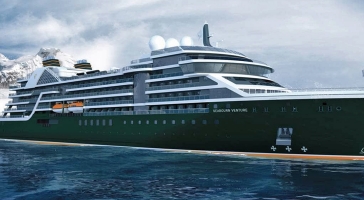
| 80 nights aboard the Seabourn Venture | |||
| All dining venues are complimentary | |||
| Open Bars throughout the Ship | |||
| Tipping is neither required nor expected | |||
| All Suite Accommodations | |||
| Intimate small size ships | |||
| Open-seating gourmet dining in The Restaurant | |||
| Port Taxes and Fees | |||
 | ABTA and ATOL Protection* | ||
Date 11th Mar 2028 |
Nts 80 |
Balcony £49,298pp |
Suite £64,498pp |
Date 11th Mar 2028 |
Nts 80 |
Balcony £49,298pp |
Suite £64,498pp |
| Balcony staterooms from | £49,298pp | ||
| V1 | Veranda Suite (Deck 5 - Fwd) | £49,298pp | |
| V2 | Veranda Suite (Deck 6/7 - Fwd) | £52,503pp | |
| V3 | Veranda Suite (Deck 5/6 - Mid) | £57,313pp | |
| V4 | Veranda Suite (Deck 7/8 - Mid) | £60,518pp | |
| Suite staterooms from | £64,498pp | ||
| PH | Penthouse Suite | £64,498pp | |
Fusion Cruises when selling travel arrangements is a trading name of Co-op Travel Services Ltd. Fusion Cruises is an Accredited Body Member of Co-operative Travel Consortium. (ABTA:P6652, ATOL:12904).
Book with Confidence. We are a Member of ABTA which means you have the benefit of ABTA’s assistance and Code of Conduct.
Some of the flights and flight-inclusive holidays on this website are financially protected by the ATOL scheme but ATOL protection does not apply to all holiday and travel services offered on this website. This website will provide you with information on the protection that applies in the case of each holiday and travel service offered before you make your booking. If you do not receive an ATOL Certificate then the booking will not be ATOL protected. If you do receive an ATOL Certificate but all parts of your trip are not listed on it, those parts will not be ATOL protected. Please see our booking conditions for information, or for more information about financial protection and the ATOL Certificate go to: www.caa.co.uk