This site uses cookies as defined in our Cookie Policy, by continuing to use this site you agree to their use.
Continue

| Arrive | Depart | ||||||
| 25th25 | AugAug | 202424 | Fremantle, Western Australia, Australia, embark on the Silver Cloud | 07:30 | 18:00 | ||
| The port city of Fremantle is a jewel in Western Australia's crown, largely because of its colonial architectural heritage and hippy vibe. Freo (as the locals call it) is a city of largely friendly, interesting, and sometimes eccentric residents supportive of busking, street art, and alfresco dining. Like all great port cities, Freo is cosmopolitan, with mariners from all parts of the world strolling the streets—including thousands of U.S. Navy personnel on rest and recreation throughout the year. It's also a good jumping-off point for a day trip to Rottnest Island, where lovely beaches, rocky coves, and unique wallaby-like inhabitants called quokkas set the scene.Modern Fremantle is a far cry from the barren, sandy plain that greeted the first wave of English settlers back in 1829 at the newly constituted Swan River Colony. Most were city dwellers, and after five months at sea in sailing ships they landed on salt-marsh flats that sorely tested their fortitude. Living in tents with packing cases for chairs, they found no edible crops, and the nearest freshwater was a distant 51 km (32 miles)—and a tortuous trip up the waters of the Swan. As a result they soon moved the settlement upriver to the vicinity of present-day Perth.Fremantle remained the principal port, and many attractive limestone buildings were built to service the port traders. Australia's 1987 defense of the America's Cup—held in waters off Fremantle—triggered a major restoration of the colonial streetscapes. In the leafy suburbs nearly every other house is a restored 19th-century gem. Coming in at number seven on Lonely Planet’s list of best places to live, Fremantle has finally begun to shake off the shadow of neighbouring big brother Perth. With just 20 kilometres separating the two cities, Perth, with its happy hippie vibe has long been the big pull for visitors to the region. But Fremantle’s colourful past and bright future gives Perth as good as it gets. The coastal city has undergone a complete revamp since the America’s Cup thrust Fremantle into the spotlight in 1987. Over AUS$1.3 billion has been poured into revamping the city, and the fruits of the city’s labour are ripe for picking. Investment in the arts has brought Fremantle to the fore of thriving urban culture, while generous grants for small businesses has led to groovy live-music rooms, hipster bars, boutique hotels, left-field bookshops, craft-beer breweries, Indian Ocean seafood shacks amid the buskers and beaches. If that doesn’t not sound like your glass of beer, we guarantee a stroll along the wooden riverside walkway will change your mind. The city also enjoys another, rather different status. Fremantle was one of Australia’s penal cities, vestiges of which can still be found in Fremantle Prison. Almost 10,000 convicts were condemned to life imprisonment here between 1850 and 1868, but the prison remained in use until 1991. Today, the memorable sandstone building is a UNESCO World Heritage Site and at just 15 minutes from port is well worth a visit. Just don’t forget your get out of jail free card. | |||||||
| 26th26 | AugAug | 202424 | Abrolhos Islands, Western Australia, Australia | ||||
| Three island groups make up the Houtman Abrolhos Islands. The Wallabi Easter and Pelsaert groups stretch across 100 kilometers from north to south with a total of 122 islands. Named Houtman after the Dutch captain who first described them in 1619 the Portuguese word “Abrolhos” refers to the reefs and dangers they posed to unsuspecting seafarers –sometimes taken to mean “open your eyes”. The Houtman Abrolhos are known for cray fishing and pearling activities as well as for their bird and marine life. The islands and their surrounding reef communities form one of Western Australia’s unique marine areas of tropical and temperate sea life. | |||||||
| 27th27 | AugAug | 202424 | Abrolhos Islands, Western Australia, Australia | 18:30 | |||
| Three island groups make up the Houtman Abrolhos Islands. The Wallabi Easter and Pelsaert groups stretch across 100 kilometers from north to south with a total of 122 islands. Named Houtman after the Dutch captain who first described them in 1619 the Portuguese word “Abrolhos” refers to the reefs and dangers they posed to unsuspecting seafarers –sometimes taken to mean “open your eyes”. The Houtman Abrolhos are known for cray fishing and pearling activities as well as for their bird and marine life. The islands and their surrounding reef communities form one of Western Australia’s unique marine areas of tropical and temperate sea life. | |||||||
| 28th28 | AugAug | 202424 | Cape Peron, Rockingham, Western Australia, Australia | 10:00 | 17:30 | ||
| 29th29 | AugAug | 202424 | North Muiron Island, Australia | 13:00 | 18:00 | ||
| 30th30 | AugAug | 202424 | Montebello Islands, Western Australia, Australia | 06:30 | 12:30 | ||
| 31st31 | AugAug | 202424 | Rowley Shoals, Western Australia, Australia | 09:00 | 17:30 | ||
| Rowley Shoals is regarded as one of the most incredible diving and snorkelling locations in the world. Three coral atolls; Mermaid, Clerke and Imperieuse reefs rise near vertical, from the surrounding crystal-clear waters on the edge of the continental shelf. Spot an array of rare, wonderful and vibrant marine wildlife who live within the corals and make for an exceptional diving and snorkelling exploration. To take full advantage of the location, Le Lapérouse will spend one and a half days at the Rowley Shoals, allowing you to swim and snorkel from Zodiac®. Some 300 kilometers northwest of Broome the Rowley Shoals consists of the three reefs Imperieuse Clerke and Mermaid. The first two reefs form the Rowley Shoals Marine Park and have sandy cays that will still be visible at high tide. Bedwell Island a small sandy cay inside Clerke Reef is home to one of Western Australia’s two colonies of Red-tailed Tropicbirds. Other birds nesting on the island are Wedge-tailed Shearwaters White-bellied Sea-Eagles Eastern Reef-Egrets and terns. The Mermaid Reef Commonwealth Marine Reserve is slightly further northeast and is the closest to land. | |||||||
| 1st01 | SepSep | 202424 | Lacepede Islands, Western Australia, Australia | 06:30 | 17:30 | ||
| The Lacepedes are a group of four islands, perfectly nestled off the Kimberley coast. The islands are imperative to Australia’s rich wildlife as they are key breeding habitats for Green Turtles and are home to a wealth of birds such as Masked Boobies, Australian Pelicans, Lesser Frigatebirds and the largest colony of Brown Bobbies in the world. Join your expedition team for a guided zodiac tour to view the prolific wildlife. Due to the sensitive nature of the environment, landings are prohibited on the Lacepede Islands. | |||||||
| 2nd02 | SepSep | 202424 | Adele Island, Kimberley, Western Australia, Australia | 06:30 | 17:30 | ||
| 3rd03 | SepSep | 202424 | Talbot Bay, Western Australia, Australia | 06:00 | 19:00 | ||
| Talbot Bay is famous for the Horizontal Falls which have been described as “one of the greatest natural wonders of the world“. The region’s tides of close to 36 feet create an amazing spectacle when the water tries to enter or leave Poulton Creek through two very narrow openings located one behind the other in the McLarty Ranges. Water builds up faster on one side than it can flow through the gaps, leaving or entering depending on the tide. This incredible tidal power can be experienced firsthand by boarding a local 900hp fast boat and taking an exhilarating ride through the Horizontal Waterfalls. | |||||||
| 4th04 | SepSep | 202424 | Freshwater Cove, Australia | 05:00 | 12:30 | ||
| Adjacent to Montgomery Reef, but on the mainland, Freshwater Cove –locally known as Wijingarra Butt Butt- will offer an opportunity to see and purchase Aboriginal art. Aboriginal guides will welcome guests with a traditional ochre welcome on the beach. The rock formations that can be seen along the shore represent spiritual ancestors relating to the great Wandjina battle. Caves with rock art are found in the vicinity, but can only be visited with local guides. On the beach, Aboriginal artists have set up a shelter where one can relax, share a cup of tea and damper with them and peruse their paintings. These paintings based on Dreamtime stories and motives are available for purchase from the artists. | |||||||
| 4th04 | SepSep | 202424 | Montgomery Reef, Western Australia, Australia | 14:15 | 19:30 | ||
| Montgomery Reef, which is some 300 square kilometres in size, can show an amazing tidal change of up to 4 metres. When the tide drops, the reef seems to rise out of the water. At low tide a river is exposed that allows access to an amazing semi-submerged world. When the tide continues to ebb, Zodiacs will be used to make the way to the edge of the reef where one is surrounded by cascading waterfalls up to 3 metres high. Continuing up the river one is able to look at the abundance of reef birds and sea creatures including turtles and manta rays. A visit to Montgomery Reef is very much tide-depending, but truly a once in a lifetime experience. | |||||||
| 5th05 | SepSep | 202424 | At Sea | 06:00 | 17:30 | ||
| The Hunter River is home to an immense mangrove system surrounded by soaring red sandstone cliffs. Narrow mangrove channels shelter numerous bird species mudskippers fiddler crabs and the infamous saltwater crocodile the most aggressive crocodile species known to man. Naturalist Island at the mouth of the river has a stunning stretch of sandy beach that makes a perfect landing site for small helicopters that can pick up visitors wishing to explore some of the Kimberley’s vast interior. The highlight inland is the famous Mitchell Falls where four tiers of waterfalls plunge into deep pools that flow out into the mighty Mitchell River. The headwaters of the falls are cool and a dip in the fresh water is a welcome reprieve from the heat of the heartland. | |||||||
| 6th06 | SepSep | 202424 | Ashmore and Cartier Islands, Australia | 09:15 | 17:00 | ||
| Ashmore Reef is a sanctuary for seabirds, shorebirds, marine turtles, dugongs, and many other marine species. Each year around 100,000 seabirds breed on Ashmore Reef including great knots, crested terns and white-tailed tropicbirds. The sanctuary zone provides the highest level of protection for wildlife. Lost in the immensity of Indian Ocean and situated 630 km of Broome, Ashmore Reef Marine Park is an Australian External Territory that covers 583 square km. With its diverse shades of blue, its underwater wonders and feathery friends, this protected area is one of Australia’s most beautiful natural treasures. The three tiny islands and their surrounding waters are home to an oasis of flourishing wildlife. Ashmore Reef is known to be the favourite place of more than 40 bird species. 100,000 seabirds breed there every year, including crested terns, white-tailed tropicbirds and greater frigatebirds. The islands are also a haven for thousands of migratory shorebirds like curlew sandpipers, bar-tailed godwits and great knots – some of them coming from very far places like Siberia! On the ocean side, the colourful reef is home to around 500 species of fish but also marine turtles, dugongs and many playful dolphins. Given the rich and fragile environment, Ashmore Reef has been declared a Sanctuary zone, providing the highest level of protection for the wildlife and minimising disturbance from human activities. Only scientific research is permitted but the visitors can access to the Recreational Use Zone, which includes a small area of the West Island, and thus discover this unique place. | |||||||
| 7th07 | SepSep | 202424 | Swift Bay, Western Australia, Australia | 07:15 | 19:30 | ||
| The Bonaparte Archipelago is a rugged maze of islands that stretch almost 150km along Western Australia’s remote Kimberley coast. Remaining relatively unspoilt and remarkably pristine, Swift Bay is landscaped by heavily fractured sandstone providing an abundance of rock shelters. On the walls of these shelters are examples of both Wandjina and Gwion Gwion style rock art. Join your expedition team ashore for a guided walk to a number of rock art galleries depicting these unique rock art styles. Australia’s jaw dropping Kimberley region shelters some of the oldest collections of rock art. This ancestral art depicting warriors, animals or nature is an authentic testimony to Aboriginal’s culture, rituals and traditions. Tranquil Swift Bay offers you the opportunity to discover astonishing Wandjina art galleries and wake up the adventurer in you. A quick zodiac ride on the turquoise water gives you a chance to admire the coast’s spectacular scenery, while a short walk across the rocky and wild landscape - 250 meters from the landing site, leads you to the historic and artistic caves.In these ancient galleries, two different styles of rock art can be observed: the Gwion Gwion style, represented by long and skinny human-like figures and the much rounder Wandjina style. Both very impressive and special. You’ll need to keep your wits about you if you want to admire the most spectacular of the ancient paintings though, as it is painted on the ceiling and only visible by lying down. However, those with claustrophobia beware! the ceiling is only about a metre above your head. Those who do wiggle in to be the best position will fully appreciate the artwork’s enormous scale and size and surely won’t be left indifferent. | |||||||
| 8th08 | SepSep | 202424 | Koolama Bay, Kimberley, Western Australia, Australia | 06:00 | 18:30 | ||
| Koolama Bay is found at the mouth of the King George River. Named after the ship that had been beached here after a Japanese aerial attack during World War II, Koolama Bay is the starting point for a Zodiac cruise to reach the King George Falls, one of the Kimberley’s most magnificent natural wonders. At 260 feet (80 m), the twin cascades are among the highest in Australia. Koolama Bay and the river weaving through an amazing landscape of near vertical red rock formations will offer a parade of wildlife —saltwater crocodiles and amazing birdlife, including giant raptors and the Brahminy Kite. | |||||||
| 9th09 | SepSep | 202424 | Wyndham, Western Australia, Australia | 06:30 | 18:00 | ||
| Wyndham is a small settlement with the spirit of a Kimberley outback township. It was established in 1886 with the Halls Creek gold rush and sits on the Cambridge Gulf where several rivers converge. Today Wyndham has a population of roughly 900 people and operates largely as a port exporting cattle, servicing the mining industry and hosting a few small ships. For these vessels Wyndham is a gateway to the breathtaking Bungle Bungle mountain range and the nearby Ord River. The Bungle Bungle Mountains in Purnululu National Park are now a World Heritage Site. In excess of 350 million years have shaped geological formations of giant orange and black striped domes rising out of the ground into a landscape unlike any other. Known to the local Aboriginal people for thousands of years, the Bungles were only discovered by the outside world in the mid-1980s. Conversely, cruising the peaceful and tree-lined Ord River is a chance to look for freshwater crocodiles, fruit bats, short-eared rock wallabies and a variety of birds, including Mangrove Herons and Mangrove Gerygones.Please note: All destinations on voyages in the Kimberley region, and the order in which they are visited, are subject to tidal variations and weather conditions. Other destinations may be visited in lieu of the stop described above. Wyndham is a small settlement with the spirit of a Kimberley outback township. It was established in 1886 with the Halls Creek gold rush and sits on the Cambridge Gulf where several rivers converge. Today Wyndham has a population of roughly 900 people and operates largely as a port exporting cattle, servicing the mining industry and hosting a few small ships. For these vessels Wyndham is a gateway to the nearby Ord River. Conversely, cruising the peaceful and tree-lined Ord River is a chance to look for freshwater crocodiles, fruit bats, short-eared rock wallabies and a variety of birds, including Mangrove Herons and Mangrove Gerygones. Please note: All destinations on voyages in the Kimberley region, and the order in which they are visited, are subject to tidal variations and weather conditions. | |||||||
| 10th10 | SepSep | 202424 | Darwin, Northern Territory, Australia | ||||
| Darwin is Australia's most colorful, and exotic, capital city. Surrounded on three sides by the turquoise waters of the Timor Sea, the streets are lined with tropical flowers and trees. Warm and dry in winter, hot and steamy in summer, it's a relaxed and casual place, as well as a beguiling blend of tropical frontier outpost and Outback hardiness. Thanks to its close proximity to Southeast Asia and its multicultural population it also seems more like Asia than the rest of Australia. Darwin is a city that has always had to fight for its survival. The seductiveness of contemporary Darwin lifestyles belies a history of failed attempts that date from 1824 when Europeans attempted to establish an enclave in this harsh, unyielding climate. The original 1869 settlement, called Palmerston, was built on a parcel of mangrove wetlands and scrub forest that had changed little in 15 million years. It was not until 1911, after it had already weathered the disastrous cyclones of 1878, 1882, and 1897, that the town was named after the scientist who had visited Australia's shores aboard the Beagle in 1839. During World War II it was bombed more than 60 times, as the harbor full of warships was a prime target for the Japanese war planes. Then, on the night of Christmas Eve 1974, the city was almost completely destroyed by Cyclone Tracy, Australia’s greatest natural disaster. It's a tribute to those who stayed and to those who have come to live here after Tracy that the rebuilt city now thrives as an administrative and commercial center for northern Australia. Old Darwin has been replaced by something of an edifice complex—such buildings as Parliament House and the Supreme Court all seem very grand for such a small city, especially one that prides itself on its casual, outdoor-centric lifestyle. Today Darwin is the best place from which to explore Australia's Top End, with its wonders of Kakadu and the Kimberley region. Australia's capital of the north is a uniquely tropical city and a historically isolated outpost of this vast diverse country. Reaching up towards the equator a full 2 000 miles from Sydney and Melbourne the city was named in honour of Charles Darwin by the British settlers who established a frontier outpost here. With a unique history beautiful islands nearby and a palette of sizzling Pacific flavours colourful Darwin is an enchanting and exotic Australian destination. Crocodiles patrol the jungled waterways and tropical rainforests around Australia's gateway to the Top End. Explore via airboat to look down on the veiny waterways of the mist-laced Kakadu National Park. The sounds of chattering birdlife and the gentle splash of fountains and waterfalls will fill your ears in George Brown Darwin Botanic Gardens. Soak it all in before kicking back and relaxing with a picnic and a crackling barbecue. The sunshine and famous tropical pink sunsets mean many visitors naturally gravitate to the city's soft sands to relax at spots like pretty Mindil Beach as evening approaches. The adjoining market is filled with souvenirs and crafts stands and is the perfect great place to enjoy some fiery Asian flavours. Stroll the stalls grab some food and crack open an ice-frosted beer as the sunset show begins. It may be remote but Darwin found itself on the front line during the Pacific War as the Japanese air force unloaded their bombs onto the city in 1942. | |||||||
| 11th11 | SepSep | 202424 | Darwin, Northern Territory, Australia | 17:00 | |||
| Darwin is Australia's most colorful, and exotic, capital city. Surrounded on three sides by the turquoise waters of the Timor Sea, the streets are lined with tropical flowers and trees. Warm and dry in winter, hot and steamy in summer, it's a relaxed and casual place, as well as a beguiling blend of tropical frontier outpost and Outback hardiness. Thanks to its close proximity to Southeast Asia and its multicultural population it also seems more like Asia than the rest of Australia. Darwin is a city that has always had to fight for its survival. The seductiveness of contemporary Darwin lifestyles belies a history of failed attempts that date from 1824 when Europeans attempted to establish an enclave in this harsh, unyielding climate. The original 1869 settlement, called Palmerston, was built on a parcel of mangrove wetlands and scrub forest that had changed little in 15 million years. It was not until 1911, after it had already weathered the disastrous cyclones of 1878, 1882, and 1897, that the town was named after the scientist who had visited Australia's shores aboard the Beagle in 1839. During World War II it was bombed more than 60 times, as the harbor full of warships was a prime target for the Japanese war planes. Then, on the night of Christmas Eve 1974, the city was almost completely destroyed by Cyclone Tracy, Australia’s greatest natural disaster. It's a tribute to those who stayed and to those who have come to live here after Tracy that the rebuilt city now thrives as an administrative and commercial center for northern Australia. Old Darwin has been replaced by something of an edifice complex—such buildings as Parliament House and the Supreme Court all seem very grand for such a small city, especially one that prides itself on its casual, outdoor-centric lifestyle. Today Darwin is the best place from which to explore Australia's Top End, with its wonders of Kakadu and the Kimberley region. Australia's capital of the north is a uniquely tropical city and a historically isolated outpost of this vast diverse country. Reaching up towards the equator a full 2 000 miles from Sydney and Melbourne the city was named in honour of Charles Darwin by the British settlers who established a frontier outpost here. With a unique history beautiful islands nearby and a palette of sizzling Pacific flavours colourful Darwin is an enchanting and exotic Australian destination. Crocodiles patrol the jungled waterways and tropical rainforests around Australia's gateway to the Top End. Explore via airboat to look down on the veiny waterways of the mist-laced Kakadu National Park. The sounds of chattering birdlife and the gentle splash of fountains and waterfalls will fill your ears in George Brown Darwin Botanic Gardens. Soak it all in before kicking back and relaxing with a picnic and a crackling barbecue. The sunshine and famous tropical pink sunsets mean many visitors naturally gravitate to the city's soft sands to relax at spots like pretty Mindil Beach as evening approaches. The adjoining market is filled with souvenirs and crafts stands and is the perfect great place to enjoy some fiery Asian flavours. Stroll the stalls grab some food and crack open an ice-frosted beer as the sunset show begins. It may be remote but Darwin found itself on the front line during the Pacific War as the Japanese air force unloaded their bombs onto the city in 1942. | |||||||
| 12th12 | SepSep | 202424 | Victoria Settlement, Garig Gunak Barlu National Park, Northern Territories, Australia | 07:00 | 12:30 | ||
| 13th13 | SepSep | 202424 | Banthula, Elcho Island, Northern Territories, Australia | 07:30 | 17:30 | ||
| Elcho Island, known as Galiwinku by the indigenous Yolngu, is the largest of the Wessel Islands in Northeast Arnhem Land. The main settlement on the island’s southwestern side had started during WWII as a refuge from possible bombings of an air force base on nearby Milingimbi Island, some 70 km away. Banthula is one of the homelands on Elcho Island’s northwestern side facing the Arafura Sea. It was founded in 1979 when the Australian government encouraged the indigenous population to return to lands they had used before contact with the western world and to establish small settlements, the so-called homelands or outstations. Banthula is some 300 meters inland from Refuge Bay’s 7 kilometer long sandy shore. Some 40 Aborigines live in Banthula, almost 2% of Elcho Island’s population. The school closest to the Banthula children is some 12 km away at Gawa –it actually is one of Australia’s most remote schools. The area around Banthula has dry rain forest and an extensive mangrove growth is found around a creek at the northern end of the beach and bay. Green turtles, flatback turtles, hawksbill turtles, and Olive Ridley turtles, as well as dugong and Australian snubfin dolphins have all been recorded in and around Refuge Bay and Bridled Terns have been found nesting. Yams and bananas are among the plants cultivated. | |||||||
| 14th14 | SepSep | 202424 | Yirrkala, Northern Territory, Australia | 07:30 | 12:30 | ||
| Follow the red sand paths along the shoreline surrounded by gum trees to arrive to the dwellings inhabited by the indigenous communities of Yirrkala. In there, you can discover their unique art and culture at the Buku-Larrnggay Mulka art centre, where you can admire a wide selection of local artwork. Don’t miss the chance of hearing musicians playing the yidaki – a traditional wooden didgeridoo –, or to attend a demonstration of ritual dancing. If you’re lucky, you might even be invited to some of the propitiatory ceremonies practiced by this community. Yirrkala is an aboriginal community in northeastern Arnhem Land and has a population of roughly 800 residents. The Yolngu have been in the area for more than 40 000 years but they only congregated here in larger numbers when the township was founded after a Methodist mission was started in 1935. This small coastal settlement became famous in the 1960s as the Yolngu opposed the opening of a bauxite mine on their land writing (and sending) the Yirrkala Bark Petition to the Australian House of Representatives. Yirrkala is also one of the best-known locations of Aboriginal art -not only in the Northern Territories- and has the community controlled Buku-Larrnggay Mulka Art Centre and Museum. Just 10 kilometers south of Yirrkala is Wurrwurrwuy an interesting arrangement of stones listed on the Australian National Heritage List. The stones have been set up in the mid-19th century and depict praus canoes sea cucumber boiling spots and houses. The arrangement of praus even indicate the division onboard the vessels showing an excellent knowledge of non-aboriginal items connected with the Macassan sea cucumber trade. | |||||||
| 15th15 | SepSep | 202424 | Thursday Island, Queensland, Australia | 13:30 | 18:30 | ||
| Thursday Island – TI to locals or Kawrareg in Waiben dialect – is the ultimate Aussie retreat. Grab a cold beer, find a spot on a wooden pub deck overlooking turquoise blue seas and contemplate the remote beauty of the island. Whilst certainly not the biggest of the Torres Strait Islands, it is the most populated. That is not to say it’s a bustling metropolis. At last count, there were fewer than 3,000 residents for its 3.5 km2. The Torres Strait Islands is a 274-strong archipelago found scattered between the coasts of mainland Oz and Papua New Guinea. The origin of the name is unknown; what is certain however is that Captain Owen Stanley named neighbouring islands Tuesday, Wednesday and Friday when he visited in 1848, so it is a safe assumption that he named Thursday too. Thursday and Friday’s names were swapped about 8 years later so they appeared in weekday order. Budding explorers should note that Monday, Saturday and Sunday have yet to be found, so perhaps this could be your lucky day. The island enjoyed a lucrative pearl and shell trade until WWII, and many Japanese pearl divers became residents. This worked out well for the islanders; Thursday Island was mercifully left alone by during the extensive WWII bombings, probably because it was thought that there were Japanese nationals still living there (there weren’t). Superb and pristine example of the island’s heritage still stand, and can be seen in the Green Hill Fort, the Thursday Island Customs House and the Gab Titui Cultural Centre. | |||||||
| 16th16 | SepSep | 202424 | At Sea | ||||
| 17th17 | SepSep | 202424 | Alotau, Papua New Guinea | 12:30 | 18:30 | ||
| Alotau is the provincial capital of the Milne Bay Province located in the southeast bay of Papua New Guinea. The town and surrounding area has been an important staging ground during World War II and we will see remains and memorials dating back or referring to the war. On a tour of the town, visitors will appreciate lovely vistas of the bay and experience the markets, which are frequented not only by locals, but also by islanders selling their products or looking for produce to take back into Milne Bay. Alotau is an important port facility for the islands and attracts many vendors of handicrafts from different islands. Alotau is the provincial capital of the Milne Bay Province located in the southeast bay of Papua New Guinea. The town and surrounding area has been an important staging ground during World War II and you'll discover remains and memorials dating back or referring to the war. On a tour of the town, visitors will appreciate lovely vistas of the bay and experience the markets, which are frequented not only by locals, but also by islanders selling their products or looking for produce to take back into Milne Bay. Alotau is an important port facility for the islands and attracts many vendors of handicrafts from different islands. | |||||||
| 18th18 | SepSep | 202424 | Fergusson Island, D'Entrecasteaux Islands, Papua New Guinea | 04:30 | 11:00 | ||
| Fergusson is one of the three biggest and mountainous islands in the Milne Bay Province and part of the D’Entrecasteaux Islands. On Fergusson’s south side are the famous Dei Dei geysers — natural hot springs that periodically erupt with vapour steam next to mud pools and a warm stream. The hot springs are still used by locals to cook food in palm frond and pandanus leaf baskets placed into the boiling hot water. Birds in the area include Eclectus Parrots Yellow-bellied Sunbirds and the endemic Curl-crested Manucode – a bird-of-paradise. | |||||||
| 18th18 | SepSep | 202424 | Dobu, D'Entrecasteaux Islands, Papua New Guinea | 12:30 | 18:00 | ||
| Dobu is a small island in the D’Entrecasteaux Group next to Fergusson Island and Normanby Island. The island was formerly feared because of black magic and the local “witch” doctors cursing the healthy or treating the sick. An anthropological study was done by Reo Fortune in the 1930s which resulted in the book “The Island of Sorcerers”. The island is also part of the famous Kula ring. Participants in the exchange system pride themselves with mwali and soulava (armbands and necklaces) that are given and received still today and it is interesting to see how the traditional objects have been adorned with modern paraphernalia. A stroll through the main village on the northwestern tip will show the school and church and trails leading along the shore passing traditionally thatched houses and gardens. | |||||||
| 19th19 | SepSep | 202424 | Kuyau Island, Papua New Guinea | 09:30 | 18:00 | ||
| Kuiawa (Kuyau) is one of the Trobriand Islands, the northernmost islands in the Milne Bay Province. Kuiawa is found some 200 kilometers from the province’s capital and to the southwest of Kiriwina, the largest and best known of the islands. The Trobriand Islands are of uplifted limestone and gardening is not that easy –but Trobriand Islanders are known for their magic to improve the growth of yam, a highly desired plant for ceremonial reasons and as food. Certain islands and villages have yam houses where the larger yams are stored and displayed. Houses are strung along the main road through the village and beach almond, casuarina and frangipani trees give shade. Trobriand Islanders are famous carvers and dancers and local groups and school classes love to compete dancing or playing their version of cricket, especially during harvest time. | |||||||
| 20th20 | SepSep | 202424 | Jacquinot Bay, New Britain, Papua New Guinea | 08:30 | 18:00 | ||
| Jacquinot Bay is a large open bay on the eastern coast of the island of New Britain. It is a tranquil place with white sandy beaches and tropical palm trees all around. There is also a well-known beautiful waterfall that flows out of the mountainside with freezing cold water right onto the beach. But during WWII, however, it was not a quiet place. It was, in fact, an important base for the Australian Army who liberated it in November 1944. This base was used to support Australian operations near Rabaul which were conducted in early 1945 in conjunction with advances on the northern side of New Britain. Jacquinot Bay is a large open bay on the eastern coast of the island of New Britain. It is a tranquil place with white sandy beaches and tropical palm trees all around. There is also a well-known beautiful waterfall that flows out of the mountainside with freezing cold water right onto the beach. But during WWII, however, it was not a quiet place. It was, in fact, an important base for the Australian Army who liberated it in November 1944. This base was used to support Australian operations near Rabaul which were conducted in early 1945 in conjunction with advances on the northern side of New Britain. | |||||||
| 21st21 | SepSep | 202424 | Rabaul, Bismarck Archipelago, Papua New Guinea | 08:30 | 23:00 | ||
| Rabaul, the former provincial capital, has quite a remarkable location. The town is inside the flooded caldera of a giant volcano and several sub-vents are still quite active today! The fumes of the volcano Tavurvur can be seen continually and the town suffered greatly during the last major eruption of 1994 when some 80% of the houses collapsed due to the ash raining down onto their roofs. Rabaul has a Volcano Observatory sitting atop the town’s center, monitoring the 14 active and 23 dormant volcanoes in Papua New Guinea. A small museum opposite the bunker used by Yamamoto during World War II shows exhibits relating to Rabaul’s local, German, Australian and Japanese past from the 19th century to Papua New Guinea’s independence in the 1970s. If surreal and unique experiences are your thing, then the Papua New Guinean town of Rabaul should tick your travel boxes. Found on the north eastern tip of New Britain Island (the largest island off mainland PNG) Rabaul, the former provincial capital, has quite a remarkable location. The town is inside the flooded caldera of a giant volcano and several sub-vents are still quite active today! The lively city was almost entirely devastated by Mount Tavurvur in 1994, covering the city in ashfall, but thankfully costing no lives. Since then, thanks to Rabaul's deep-water port, commerce has been on the up, and a few shops and hotels have managed to find an audience. However, Rabaul's remote location together with the volcano still being one of the most active and dangerous in Papua New Guinea means tourism in not rife. Rabaul has an impressive WWII history which includes a 300-mile network of tunnels dug by Japanese POW designed to conceal munitions and stores. After the Pearl Harbour bombings, the Japanese used Rabaul as their South Pacific base for the last four years of WWII, and by 1943 there were about 110,000 Japanese troops based in Rabaul. Post war, the island was returned to Australia, before it was granted independence in 1975. It should be noted that patience is a virtue here. However, that is not all bad. The slow pace of transportation allows travellers to marvels at the quite astonishing landscape. Divers will also be richly rewarded – the marine life of the island is extraordinary. | |||||||
| 22nd22 | SepSep | 202424 | At Sea | ||||
| 23rd23 | SepSep | 202424 | Kasolo Island, Solomon Islands | 06:00 | 12:00 | ||
| Wild, uninhabited and historical, Kennedy Island is a tiny piece of land in the middle of the Pacific Ocean. Part of the remote Solomon Islands, the island is situated 15 min away by boat from Gizo, which is capital of the Western Province. Kennedy Island was formerly known as Plum Pudding Island, after an incident dating back to World War II. Incident involving one of the most famous figures of history. John F. Kennedy, a lieutenant at the time, was a castaway on the island with his crew when their torpedo ship, PT 109, was shot sunk by the Japanese troops in August 1943. It is said that the future president swam dragging an injured crewmate by holding the strap of his life jacket in his teeth until reaching the island. He and his crew fed themselves with coconuts during two days before being found by Solomon Islanders. JFK even kept a coconut shell from the island on his desk in the Oval Office throughout his presidency. For our history buffs, some artefacts dating from the crew’s passage can still be found on site. An island marked by history in short, but not only. Discovering Kennedy Island is an experience not to be missed for diving and nature lovers. The waters that surround the island are a submerged world of great richness and variety of colourful fishes and corals. | |||||||
| 23rd23 | SepSep | 202424 | Njari Island, Solomon Islands | 14:00 | 18:30 | ||
| Njari is a small island almost entirely covered in trees with just a small sand spit at its eastern end. A labyrinth of reefs and coral heads make an approach only feasible from the north. The small beach invites one to relax, but swimming from the beach is almost impossible as the corals are too close. To enjoy the underwater world one has to enter the water from a small boat, a little distance from the shore, where an amazing array of fish and coral will be visible. Two hundred and seventy nine different fish species have been seen during a single dive; the fourth-highest fish count ever recorded. An indication of why this island is considered a top spot for snorkeling in the Solomon Islands. Njari is a small island almost entirely covered in trees with just a small sand spit at its eastern end. A labyrinth of reefs and coral heads make an approach quite difficult. Recently a small wooden jetty has been built on the southern side. The small beaches invite one to relax but swimming from the beach is almost impossible as the corals are too close. To enjoy the underwater world one has to enter the water from Zodiac snorkel platforms a short distance from the shore where an amazing array of fish and coral will be visible. Two hundred and seventy nine different fish species have been seen during a single dive the fourth-highest fish count ever recorded. An indication of why this island is considered a top spot for snorkeling in the Solomon Islands. | |||||||
| 24th24 | SepSep | 202424 | Lumalihe Island, Marove Lagoon, Solomon Islands | 06:30 | 17:00 | ||
| Marovo Lagoon is one of the world’s largest saltwater lagoons. Described by American author James A. Michener as, “one of the seven natural wonders of the world,” Marovo is home to a double barrier reef system, and is one of two sites in the Solomon’s currently under consideration for UNESCO World Heritage Site status. Residents of Marovo Lagoon make elegant woodcarvings that are often for sale on the shoreline. Marovo is also renowned as one of the best diving and snorkeling spots on the planet. | |||||||
| 25th25 | SepSep | 202424 | Rauhi Island, Solomon Islands | 07:30 | 18:30 | ||
| 26th26 | SepSep | 202424 | Santa Ana Island, Solomon Islands | 06:30 | 18:00 | ||
| Port Mary is the name of the bay adjacent to Ghupuna, the main village in Santa Ana. A bright white sand beach with huge shade-giving trees runs along the shoreline in front of the tidy village. The houses here are made with local materials and most are built on stilts. Islanders generally welcome visitors with traditional songs and dances performed by members of the three different villages on Santa Ana. Some local people will also set up stands offering souvenirs for purchase. The Solomons are best known for strings of traditional shell money and elegant carvings based on local stories and legends. Port Mary is the name of the bay adjacent to Ghupuna the main village in Santa Ana. A bright white sand beach with huge shade-giving trees runs along the shoreline in front of the tidy village. The houses here are made with local materials and most are built on stilts. Islanders generally welcome visitors with traditional songs and dances performed by members of the three different villages on Santa Ana. Some local people will also set up stands offering souvenirs for purchase. The Solomons are best known for strings of traditional shell money and elegant carvings based on local stories and legends. | |||||||
| 27th27 | SepSep | 202424 | At Sea | ||||
| 28th28 | SepSep | 202424 | Ambrym, Vanuatu | 06:00 | 18:00 | ||
| Unlike Espiritu Santo with its raised coral reefs and white sand, Ambrym is a volcanically active island with dark sand beaches. Ambrym is known as the island of magic and is the source of five local languages that all evolved on Ambrym. This handful of languages contributes to the well over 100 languages of Vanuatu. Some of Ambrym’s magic takes place in the lush greenery of the local community of Ranon. Here the people perform a very special and traditional ‘Rom’ dance. Participants prepare their masks and costumes in secrecy and the dance is reserved for special occasions. Unlike Espiritu Santo with its raised coral reefs and white sand Ambrym is a volcanically active island with dark sand beaches. Ambrym is known as the island of magic and is the source of five local languages that all evolved on Ambrym. This handful of languages contributes to the well over 100 languages of Vanuatu. Some of Ambrym’s magic takes place in the lush greenery of the local community of Ranon. Here the people perform a very special and traditional ‘Rom’ dance. Participants prepare their masks and costumes in secrecy and the dance is reserved for special occasions. | |||||||
| 29th29 | SepSep | 202424 | Champagne Bay, Espiritu Santo Island, Vanuatu | 07:30 | 17:00 | ||
| As world famous beaches go, Champagne Beach is one of the big hitters. In 2003, CNN ranked it number nine in its list of top 100 beaches and independent travel specialists permanently include it on their list of 50 best beaches worldwide. It’s one of the world’s greatest natural beauties: picture-perfect beach white sand, turquoise water and nothing – save for the occasional cow or curious turtle - around. With only coconut plantations and a few friendly locals to keep you company, this might just be the island of your dreams. The glorious name “Champagne Beach” was given to the island in the 17th century, when Pedro de Quirós believed he had reached the famous unknown southern land or the “Tierra Australis Incognita” (or Australia as we now know it). He believed the effervescent bubbles of volcanic origin that bubble up from the crystal clear waters were reminiscent of the bubbles of Champagne. Additionally, the coastline is shaped like an art deco Champagne saucer, so the name stuck! The beach is located on the largest yet least populated island in the 40-island Vanuatu archipelago, near the village of Hog Harbor on Espiritu Santo Island. If you want to venture beyond the beach, then Espiritu Santu is also famed for its blue holes. The island is home to some of the clearest waters on Earth, benefiting from natural filtering from underground limestone caves. Ride or paddle your way through emerald green rainforest amid the sound of birdsong for an experience that will make your soul sing. | |||||||
| 30th30 | SepSep | 202424 | At Sea | ||||
| 1st01 | OctOct | 202424 | Yasawa Island, Fiji | 12:30 | 19:30 | ||
| Nabukeru is the largest village located within the grouping of the 20 volcanic islands that make up the Yasawa Islands in Fiji. Until 1987 these islands were closed to land-based tourism and could only be viewed from aboard a vessel. With their clear, aquamarine waters and ecologically diverse tropical, mountainous landscapes, these islands were the location for the filming of the romantic adventure film The Blue Lagoon (both the 1949 and 1980 versions). The islands are famous for the limestone Sawa-i-lau caves, which must be accessed by swimming at low tide through an underwater tunnel. Nabukeru villagers assert that the cave is the heart of the Yasawas. Nabukeru is the largest village on Yasawa located within the grouping of the roughly 20 volcanic islands that make up the Yasawa Islands in Fiji. Until 1987 these islands were closed to land-based tourism and could only be viewed from aboard a vessel. With their clear aquamarine waters and ecologically diverse tropical mountainous landscapes these islands were the location for the filming of the romantic adventure film The Blue Lagoon (both the 1949 and 1980 versions). Opposite Nabukeru is Sawa-i-Lau an island famous for the limestone caves of the same name. The Sawa-i-Lau caves can only be accessed by climbing stairs from the beach passing a small door and then jumping into the larger cave’s pool. The second cave and pool can only be reached by swimming at low tide through an underwater tunnel. Nabukeru villagers assert that the cave is the heart of the Yasawas. | |||||||
| 2nd02 | OctOct | 202424 | Lautoka, Fiji | ||||
| North of Nadi through sugarcane plantations and past the Sabeto Mountains is Lautoka, nicknamed the Sugar City for the local agriculture and its big processing mill. With a population of around 50,000, it's the only city besides Suva and, like the capital, has a pleasant waterfront. It's the sailing point for Blue Lagoon and Beachcomber Cruises but is otherwise unremarkable for tourists, itself having few hotels and fewer good restaurants. Locals recommend the city as a less-expensive place to shop for clothing, but note that it can take as long as 45 minutes to drive here. Legend has it that Lautoka acquired its name when two chiefs engaged in combat and one hit the other with a spear. He proclaimed "lau toka" (spear hit) and thus the future town was named. It doesn’t get much sweeter than arriving on the sun-soaked shores of the Sugar City. Fiji’s second-biggest settlement opens up a world of blissful beaches and turquoise seascapes while its dense jungle lures the adventurous deep into its embrace. Experience rich Fijian life and see dramatic displays like warrior dances and remarkable local practices like firewalks which kick up burning embers into the night's sky. Legend says the city took its name after two chiefs faced each other in a duel. A spear pierced one of the chiefs leading to the shout of 'lau-toka!' or 'spear hit!' Sugar is Lautoka’s main trade but its botanical gardens are a sweet insight into the tropical plant life that thrives here - from pearl white lilies to tall fragrant orchids. Explore temples charming cafes and mills - or barter for some of the juiciest mangoes you’ll ever taste at the city’s lively market. You'll only be able to resist the beaches for so long and it doesn’t get much more stunning than the Blue Lagoon - a heavenly blend of woven together turquoise shades. Remote wild and unspoiled these are some of the best tropical beaches in the world. There's more rejuvenating relaxation at the mineral-rich mud pools and spas fuelled by the volcanic activity below. Savala Island is a teardrop of sand offshore and another beautiful place to wander with the soft powder between your toes - along sandy spits that peter out into the water. Or swim and snorkel among its envied reefs thronging with fish life. | |||||||
| 2nd02 | OctOct | 202424 | Lautoka, Fiji | 18:00 | |||
| North of Nadi through sugarcane plantations and past the Sabeto Mountains is Lautoka, nicknamed the Sugar City for the local agriculture and its big processing mill. With a population of around 50,000, it's the only city besides Suva and, like the capital, has a pleasant waterfront. It's the sailing point for Blue Lagoon and Beachcomber Cruises but is otherwise unremarkable for tourists, itself having few hotels and fewer good restaurants. Locals recommend the city as a less-expensive place to shop for clothing, but note that it can take as long as 45 minutes to drive here. Legend has it that Lautoka acquired its name when two chiefs engaged in combat and one hit the other with a spear. He proclaimed "lau toka" (spear hit) and thus the future town was named. It doesn’t get much sweeter than arriving on the sun-soaked shores of the Sugar City. Fiji’s second-biggest settlement opens up a world of blissful beaches and turquoise seascapes while its dense jungle lures the adventurous deep into its embrace. Experience rich Fijian life and see dramatic displays like warrior dances and remarkable local practices like firewalks which kick up burning embers into the night's sky. Legend says the city took its name after two chiefs faced each other in a duel. A spear pierced one of the chiefs leading to the shout of 'lau-toka!' or 'spear hit!' Sugar is Lautoka’s main trade but its botanical gardens are a sweet insight into the tropical plant life that thrives here - from pearl white lilies to tall fragrant orchids. Explore temples charming cafes and mills - or barter for some of the juiciest mangoes you’ll ever taste at the city’s lively market. You'll only be able to resist the beaches for so long and it doesn’t get much more stunning than the Blue Lagoon - a heavenly blend of woven together turquoise shades. Remote wild and unspoiled these are some of the best tropical beaches in the world. There's more rejuvenating relaxation at the mineral-rich mud pools and spas fuelled by the volcanic activity below. Savala Island is a teardrop of sand offshore and another beautiful place to wander with the soft powder between your toes - along sandy spits that peter out into the water. Or swim and snorkel among its envied reefs thronging with fish life. | |||||||
| 3rd03 | OctOct | 202424 | Levuka, Fiji | 07:30 | 12:00 | ||
| Levuka highlights both the historical and natural aspects of Fiji. The small island of Ovalau is located off the east coast of Viti Levu. The quaint town of Levuka has the honour of having been Fiji’s very first capital where King Cakobau reigned and where the deed of cession to Queen Victoria was signed in 1874. Many of the old buildings in the town have remained nearly unchanged since the late 1800s. Here one can find Fiji’s first government school, the popular Ovalau Club, and the “Cession Stone” commemorating the signing of the Deed of Cession. Just outside the city, it is possible to hike through pristine rainforest and take in the magnificent natural beauty of the surrounding area. | |||||||
| 3rd03 | OctOct | 202424 | Leleuvia Island, Fiji | 14:00 | 18:30 | ||
| Leleuvia is a small low-lying island southeast of Ovalau with a length of barely 500 meters. Situated between the chiefly island of Bau, Moturiki and Ovalau, almost equidistant from Ovalau and the Central Eastern coast of Viti Levu, this lush, green island hosts a small resort. An easily accessible reef with many colorful reef fish 10 meters off of Leleuvia’s western beach invites to be explored. Resident sea kraits are often seen resting ashore north of the small pier. Despite its small size and the resort on its southern side, the island still has quite an extensive forest of tamanu (Alexandrian laurel), lantern trees, fish-poison trees and beach gardenia. There are also local clusters of beach hibiscus, beach heliotrope and Pacific rosewood where Sacred Kingfishers, Orange-breasted Honeyeaters, and Pacific Swallows have been recorded. | |||||||
| 4th04 | OctOct | 202424 | Vanua Balavu, Lau Islands, Fiji | 08:30 | 18:00 | ||
| Vanua Balavu is Northern Lau’s largest island. Together with eight other smaller islands it is encircled by a barrier reef. The interior of Vanua Balavu is scattered with rugged hills and pristine, sandy beaches ring the island’s perimeter. Vanua Balavu’s largest village is Lomaloma on the southeast coast. In the mid-19th century Tongans conquered the island and their village was built next to Lomaloma. Fifth generation descendants of those Tongans –some 400 out of the 1200 residents- still live there and the houses with rounded ends show the influence of Tongan architecture. | |||||||
| 5th05 | OctOct | 202424 | Ringgold Isles, Fiji | 07:00 | 12:00 | ||
| Idyllic and picturesque with possibly the lightest, clearest blue waters on the planet, the Ringgold Isles are an archipelago in Fiji that is mostly uninhabited, but for one small village. Tree-lined hills slope down onto white sandy beaches lined with palm trees and interesting rock outcroppings in some areas. Three reefs form part of this group: the Budd, Nukusemanu, and Heemskercq Reefs. The waters surrounding these islands, including Cobia Island, are favored for scuba diving because of their visibility down to 120 feet. The volcanic crater at Cobia Island can be also explored by small water craft. Idyllic and picturesque with possibly the lightest, clearest blue waters on the planet, the Ringgold Isles are an archipelago in Fiji that is mostly uninhabited, but for one small village. Tree-lined hills slope down onto white sandy beaches lined with palm trees and interesting rock outcroppings in some areas. Three reefs form part of this group: the Budd, Nukusemanu, and Heemskercq Reefs. The waters surrounding these islands are favored for snorkeling and scuba diving because of their visibility down to 120 feet. | |||||||
| 5th05 | OctOct | 202424 | Cobia, Fiji | 13:30 | 17:30 | ||
| Also known as Thombia Island, the crescent moon-shaped Cobia Island in Fiji is part of the Ringgold Isles archipelago. The arched entrance to Cobia island is lined with trees, and the island is teeming with biodiversity on land and underwater. Cobia Island is part of the Budd Reef and has a submerged volcanic crater with its highest elevation on the west side of the island. Considered a “conspicuous landmark” for seafarers at least as far back as 1899, this tropical island embodies a unique combination of wooded areas, tropical vistas and diverse sea life popular for kayakers, snorkelers and scuba divers. The island is an important component of Fiji’s Biodiversity and Action Plan due to its unique geological formations and beach forests. Also known as Thombia Island the crescent moon-shaped Cobia Island in Fiji is part of the Ringgold Isles archipelago. The island is teeming with biodiversity on land and underwater. Cobia Island is part of the Budd Reef and has a submerged volcanic crater with its highest elevation on the west side of the island. Considered a “conspicuous landmark” for seafarers at least as far back as 1899 this tropical island embodies a unique combination of wooded areas tropical vistas and diverse sea life. The island is an important component of Fiji’s Biodiversity and Action Plan due to its unique geological formations and beach forests. | |||||||
| 6th06 | OctOct | 202424 | Fulaga Island, Fiji | 08:00 | 18:00 | ||
| As part of the Southern Lau Group, Fulanga is one of Fiji’s easternmost islands. Fulanga has a large central lagoon with a 50-meter wide pass to the ocean on its northeastern side. The crescent-shaped raised limestone island is famous for its numerous islands, mushroom-shaped islets and many sandy beaches in the calm lagoon. Some 400 residents live in three small villages. The two villages of Muana-i-rai and Muana-i-cake are quite close together on the southern exterior side with a very narrow passage allowing access to the ocean, while Naividamu, the third village, is on the interior, i.e. lagoon side. Muana-i-cake is the main village and hosts the kindergarten and primary school, a post office and first aid station. Old-style houses made of corrugated iron are predominant with limited solar power for the odd refrigerator and television set. Although many islanders have left Fulanga to look for work in Suva, traditional crafts are still practiced by men and women. The weavers and carvers producing pandanus mats and wooden bowls for kava ceremonies are not only valued on Fulanga. Their products can leave on the monthly supply vessel and is highly sought after in Suva. | |||||||
| 7th07 | OctOct | 202424 | Uoleva Island, Tonga | 12:30 | 22:00 | ||
| Within the Polynesian nation of Tonga, an archipelago of 169 islands (only 36 of which are inhabited), lies the sand-cay Uoleva Island, one of the Ha'apai islands of Tonga. Uoleva Island is one of the most beautiful and protected anchorages in Tonga and is mostly uninhabited but for its three small resorts. On Uoleva Island visitors will discover pristine, palm tree-lined white sand beaches and clear, light blue waters. In addition to reaching Uoleva by boat, it can also be reached by foot (via a 30-minute strenuous walk); the reef between the north tip of Uoleva and the south tip of Lifuka is shallow enough at low tide to walk across. Uoleva is one of the best places in Tonga for humpback whale sightings, and snorkelers appreciate its clear waters teeming with ocean life. Within the Polynesian nation of Tonga an archipelago of 169 islands (only 36 of which are inhabited) lies the sand-cay Uoleva Island one of the Ha'apai islands of Tonga. Uoleva Island is one of the most beautiful and protected anchorages in Tonga and is mostly uninhabited but for its three small resorts. On Uoleva Island visitors will discover pristine palm tree-lined white sand beaches and clear light blue waters. In addition to reaching Uoleva by boat it can also be reached by foot (via a 30-minute strenuous walk) the reef between the north tip of Uoleva and the south tip of Lifuka is shallow enough at low tide to walk across. Uoleva is one of the best places in Tonga for humpback whale sightings and snorkelers appreciate its clear waters teeming with ocean life. | |||||||
| 8th08 | OctOct | 202424 | Neiafu, Tonga | 06:00 | 12:00 | ||
| With a population of 6,000, Neiafu is the capital city and the second largest municipality in the Polynesian nation of Tonga (a 169-island archipelago in the South Pacific). The city is situated in a deep- water harbor (Port of Refuge) on the south coast of Vava͛u, the main island of the Vava͛u archipelago in northern Tonga. The waters of this region are known for their clarity and beauty, and the area attracts many humpback whales between June and November. A popular destination in Neiafu is the Ene͛io Botanical Garden, a bird sanctuary that promotes the survival of exotic and native bird species as well as supports and conserves a diverse array of plant life. The island's city life can be experienced at the numerous cafes and restaurants that welcome visitors. With a population of 6 000 Neiafu is the capital of the Vava’u Group and the second largest municipality in the Polynesian nation of Tonga (a 169-island archipelago in the South Pacific). The city is situated next to a deep- water harbor (Port of Refuge) on the south coast of Vava’u the main island of the Vava’u archipelago in northern Tonga. The waters of this region are known for their clarity and beauty and the area attracts many humpback whales between June and November. A popular destination in Neiafu is the ‘Ene’io Botanical Garden a bird sanctuary that promotes the survival of exotic and native bird species as well as supports and conserves a diverse array of plant life. | |||||||
| 8th08 | OctOct | 202424 | Eueiki Island, Tonga | 13:45 | 18:00 | ||
| 9th09 | OctOct | 202424 | At Sea | ||||
| 10th10 | OctOct | 202424 | Aitutaki, Cook Islands | 06:30 | 16:00 | ||
| Even high praise like the 'world's most beautiful island' from Lonely Planet's co-founder, Tony Wheeler, won't prepare you for the intoxicating intensity of the coal blue ocean, the glow of the pure white sand, and the soothing ripple of the palm-tree forests at incredible Aitutaki. Breathless romance hangs thick in the air here, especially when a riot of purples, reds and oranges are spreading across the sky, accompanying the sun's descent each evening. It wasn't until 1789 that Europeans discovered this island haven, with the HMS Bounty's crew arriving, just a few weeks before a mutiny tore them apart. The Europeans were beaten to the islands, however, by the streamlined wooden canoes of the Polynesian settlers, who arrived around 900AD. While Western missionaries would eventually visit to spread Christianity to the island - evidenced by the white, coral-encrusted walls of the many churches - their efforts to repress the people’s deep love of communal singing and dancing ultimately failed, and music forms a key component of the islanders' culture to this day.The beaches here are flawless, and swaying in a hammock, suspended between leaning palm trees, as the ocean gently ruffles the sand nearby, feels gloriously indulgent. Aitutaki Lagoon is a huge aquamarine pool of water, alive with a kaleidoscopic swirl of tropical fish, which lurk just below the surface. You may even be lucky enough to spot turtles padding across the sand, scraping themselves towards the open ocean.The snorkelling opportunities here, and on One Foot Island - where you'll want to acquire the badge of honour of having your passport stamped with the island's iconic huge footprint - are sublime. Don't miss the tiny island of Moturakau either, which is crammed full of exotic birds and crabs, who have dominion over the island's tangled, jungle terrain. When Lonely Planet co-founder describes somewhere as “the world’s most beautiful island” you can be sure that you are in for a treat. Incredible Aitutaki, inspiring Aitutaki, unbelievable, idyllic and unimaginable, there are simply not enough superlatives to describe quite how amazing Aitutaki is. Brought to light in 1779 by Captain Bligh, the Mutiny on the Bounty meant that Aitutaki has something of a bloodthirsty history. While Europeans missionaries eventually settled on the island in the 19th century (evidenced by the white, coral-encrusted walls of the many churches) the island’s Polynesian history dates to around 900AD. Traditional songs and dances from this period still exist (although Christian hymns, known as “imene metua” are also popular), and are performed by islanders with gusto and much pride. The island is part of the Cook Islands, one of the most secluded and romantic archipelagos in the world. With its powder white sand, warm turquoise waters and sense of casual luxury, it is easy to see why the island has earnt itself the moniker of honeymooner’s island. However, there is much more to Aitutaki than just fun in the sun. With a reef that completely encompasses a large turquoise lagoon, Aitutaki is considered one of the most spectacular diving and snorkelling destinations in the world. Added to the tropical excitement is that when entering the main village via Zodiac along a narrow channel – travellers will be greeted by a traditional and customary warrior challenge. | |||||||
| 11th11 | OctOct | 202424 | Palmerston Island, Cook Islands | 06:30 | 14:00 | ||
| The low-lying atoll of Palmerston is inhabited by three families, all descendants of William Marsters (1831-1899). Members of the community are known to greet visitors and guide small boats into the lagoon through a maze of coral reef. Once ashore, the whole community generally turns out to meet visitors as it is a rare occurrence. The island’s highlights include a church, the oldest house, the cemetery, the school, the underground gardens and “Duke’s Pool,” inviting for a swim or snorkel. In the lagoon’s waters it is possible to find colorful reef-fish, sea cucumbers, rays, and sea turtles. Overhead there is birdlife including tropicbirds, boobies, noddies, frigatebirds and terns. The low-lying atoll of Palmerston is inhabited by three families all descendants of William Marsters (1831-1899). Members of the community are known to greet visitors and guide small boats and Zodiacs into the lagoon through a maze of coral reef to reach the only inhabited islet –commonly called “Home”. Once ashore the whole community generally turns out to meet visitors as it is a rare occurrence. The island’s highlights include a church the oldest house the cemetery the school the underground gardens and “Duke’s Pool ” inviting for a swim or snorkel. In the lagoon’s waters it is possible to find colorful reef-fish sea cucumbers rays and sea turtles. Overhead there is birdlife including tropicbirds boobies noddies frigatebirds and terns. | |||||||
| 12th12 | OctOct | 202424 | At Sea | ||||
| 13th13 | OctOct | 202424 | Bora-Bora, French Polynesia | 12:30 | 23:00 | ||
| Simply saying the name Bora Bora is usually enough to induce gasps of jealousy, as images of milky blue water, sparkling white beaches and casually leaning palm trees immediately spring to mind. The imagination doesn't lie, either, and if you visit, you’ll soon realise this island is every bit as gorgeous as you ever imagined. Thatched wooden huts stand out over shallow, sparkling seawater, with vivid fish swirling just below. Soak up the sun, scuba dive, or simply revel in the opulent luxury of one of the island's many magnificent resorts. If blissful inactivity doesn't appeal, then get active, and hike the greenery of the sharp Mount Pahia. If you have ever dreamt up your ideal island holiday, we suspect it goes something like this: Soapy blue seas? Check. Sparkling white beaches? Check. Thatched wooden huts, gently sloping palm trees and kaleidoscopic marine life? Check, check and check. And yet, even by ticking every box, first time viewing of Bora Bora still beggars belief. This tropical hideaway less than 12 m2 in the heart of the South Pacific has been toping travel wish lists for years. Long considered the realm of honeymooners – spectacularly romantic sunsets are a speciality – Bora Bora is not just for wandering with your love. If the prismatic shades of blue of the world’s most beautiful lagoon do not fill you up, then perhaps underwater scooters and aqua Safaris will charge your batteries. If exploring Bora Bora’s lush hinterland is more your glass of tequila sunrise, then trips around the island (often stopping off at the celebrity haunt Bloody Mary Restaurant & Bar) are a must. Bora Bora's peaceful ambience has not always been the case. The island was a US supply base, known as "Operation Bobcat" during WWII. During this time, Bora Bora was home to nine ships, 20,000 tons of equipment and nearly 7,000 men. Eight massive 7-inch naval cannons were installed around the island, all but one of which is still in place. Although little is known of the history of the island, it is known that Bora Bora was called Vava’u in ancient times. This supports belief that the island was colonised by Tongans prior to French annex in 1888. | |||||||
| 14th14 | OctOct | 202424 | Raiatea, French Polynesia | 06:30 | 20:00 | ||
Known as the "Sacred Island," Raiatea is a fascinating haunt for archaeologists and historians as it's one of the islands in the Pacific where Polynesian culture can trace its roots. Visitors will find many of the older Polynesian structures still in place and are fascinating places to explore. In the 16th century, Raiatea developed a powerful cult dedicated to Oro the God of War and built a large meeting ground, the Taputaputea Marae, which is still intact. Human sacrifice was practiced until around the middle of the 18th century and visitors should look for the sacrificial stone. Several tour operators run visits to the marae (ancient temples) along with some degree of informed commentary—although in fairness Polynesian storytelling can embellish things a little. The Faaroa River is the only navigable waterway in French Polynesia and it can be traveled by powerboat or outrigger canoe. Running through the Faaroa Gorge it passes some spectacular scenery with steep-walled jungle foliage holding dozens of bird species and wild hibiscus. Trekking up Mount Temehani, a well-known landmark that's said to be Oro's birthplace, is relatively demanding. Keep a lookout for the rare, five-petal tiare apetahi. Said to be impossible to grow anywhere else, this white, indigenous flower can only be found above 1,300 feet (396 meters). Look, but don't touch. It's against the law to pick them. | |||||||
| 15th15 | OctOct | 202424 | Papeete, Tahiti, French Polynesia | ||||
| Papeete will be your gateway to the tropical paradise of French Polynesia, where islands fringed with gorgeous beaches and turquoise ocean await to soothe the soul. This spirited city is the capital of French Polynesia, and serves as a superb base for onward exploration of Tahiti – an island of breathtaking landscapes and oceanic vistas. Wonderful lagoons of crisp, clear water beg to be snorkelled, stunning black beaches and blowholes pay tribute to the island's volcanic heritage, and lush green mountains beckon you inland on adventures, as you explore extraordinary Tahiti. Visit to relax inside picturesque stilted huts, which stand out over shimmering water, as you settle into the intoxicating rhythm of life, in this Polynesian paradise. Papeete is the center of the tropical paradise of French Polynesia where islands fringed with gorgeous beaches and turquoise ocean await to soothe the soul. This spirited city is the capital of French Polynesia and serves as a superb base for onward exploration of Tahiti – an island of breathtaking landscapes and oceanic vistas. A wonderful lagoon of crisp clear water begs to be snorkelled stunning black beaches and blowholes pay tribute to the island's volcanic heritage and lush green mountains beckon you inland on adventures as you explore extraordinary Tahiti. Visit to relax and settle into the intoxicating rhythm of life in this Polynesian paradise. | |||||||
| 15th15 | OctOct | 202424 | Papeete, Tahiti, French Polynesia | 17:00 | |||
| Papeete will be your gateway to the tropical paradise of French Polynesia, where islands fringed with gorgeous beaches and turquoise ocean await to soothe the soul. This spirited city is the capital of French Polynesia, and serves as a superb base for onward exploration of Tahiti – an island of breathtaking landscapes and oceanic vistas. Wonderful lagoons of crisp, clear water beg to be snorkelled, stunning black beaches and blowholes pay tribute to the island's volcanic heritage, and lush green mountains beckon you inland on adventures, as you explore extraordinary Tahiti. Visit to relax inside picturesque stilted huts, which stand out over shimmering water, as you settle into the intoxicating rhythm of life, in this Polynesian paradise. Papeete is the center of the tropical paradise of French Polynesia where islands fringed with gorgeous beaches and turquoise ocean await to soothe the soul. This spirited city is the capital of French Polynesia and serves as a superb base for onward exploration of Tahiti – an island of breathtaking landscapes and oceanic vistas. A wonderful lagoon of crisp clear water begs to be snorkelled stunning black beaches and blowholes pay tribute to the island's volcanic heritage and lush green mountains beckon you inland on adventures as you explore extraordinary Tahiti. Visit to relax and settle into the intoxicating rhythm of life in this Polynesian paradise. | |||||||
| 16th16 | OctOct | 202424 | Fakarava, French Polynesia | 11:30 | 17:30 | ||
| Fakarava is oblong shaped and has an almost continuous string of reef and motu stretching for 40 km (25 mi) on its eastern edge. It's the second largest of the Tuamotu atolls located 450 km (280 mi) northeast of Tahiti and 120 km (75 mi) southeast of Rangiroa. It's renowned for the drift diving in its two passes—Garuae (also spelled Ngarue) in the north near the main town of Rotoava (and the airport) and Tamakohua Pass 48 km (30 mi) across the lagoon in the south. The tiny village of Tetamanu situated by the southern pass was once the capital of the Tuamotus and houses the first church built in the archipelago in 1874. In 2006 the entire atoll was deemed an UNESCO biosphere reserve to preserve the lagoon no overwater bungalows have been built in it. Fakarava was "discovered" by Russian explorer Fabian Gottlieb Von Bellingshausen in 1820 some 20 years later missionaries arrived in the guise of fanatical Catholic priest Honore Laval and began building churches. | |||||||
| 17th17 | OctOct | 202424 | At Sea | ||||
| 18th18 | OctOct | 202424 | Atuona, Hiva Oa, French Polynesia | 07:30 | 12:00 | ||
| The largest of the southern islands Hiva Oa the master pillar or finial post of the ‘Great House’ - which represents the Marquesan archipelago in the local mythology - has always been the rival of Nuku Hiva. The island is shaped like a seahorse and has a mountain range running southwest to northeast whose main peaks Mt. Temetiu and Mt. Feani form a real wall around Atuona. Atuona a peaceful little port at the head of the Taaoa Bay also known as Traitors Bay has emerged from obscurity due to having had the privilege of being the last resting place of Paul Gauguin and of the singer Jacques Brel. The tombs of these famous personalities are on the side of the Calvary cemetery looking out across the bay and are places of great pilgrimage. In the village the Gauguin Museum displays items related to the painter's stay there at the beginning of the century and has copies of his works. | |||||||
| 18th18 | OctOct | 202424 | Tahuata Island, French Polynesia | 14:30 | 23:00 | ||
| 19th19 | OctOct | 202424 | Hatiheu, French Polynesia | 06:30 | 20:00 | ||
| 20th20 | OctOct | 202424 | Hana Vave, Fatu Hiva Island, French Polynesia | 06:30 | 14:00 | ||
| 21st21 | OctOct | 202424 | At Sea | ||||
| 22nd22 | OctOct | 202424 | Reao, French Polynesia | 06:00 | 12:00 | ||
| 23rd23 | OctOct | 202424 | Mangareva Island, French Polynesia | 08:30 | 16:30 | ||
| In the Gambier Islands of French Polynesia, Mangareva is the largest island with a population of over 1,200 people. Most live in the largest village on the island, Rikitea. A high central ridge runs the length of Mangareva peaking with Mt. Duff, which rises over 440 meters from the sea on the island's south coast. The island has a large lagoon sprinkled with coral reefs whose tropical fish helped ancient islanders survive much more successfully than on nearby islands with no reefs. Small ships are able to enter the lagoon of Mangareva. From inside the atoll it is possible to reach Mangareva’s main town. Ashore visitors can walk through the town or up the sides of Mt. Duff. The highlights in town include the cathedral with its mother-of-pearl shell objects designed by the students of Rikitea’s school. In the Gambier Islands of French Polynesia Mangareva is the largest island with a population of over 1 200 people. Most live in Rikitea the largest village on the island. A high central ridge runs the length of Mangareva peaking with Mt. Duff which rises over 440 meters from the sea on the island's south coast. The island has a large lagoon sprinkled with coral reefs whose tropical fish and the black-lip oysters have helped islanders survive much more successfully than on other nearby islands. Small ships are able to enter the lagoon of Mangareva. Ashore visitors can walk through the town see the remains of the massive stone and coral buildings dating back to the 19th century or climb up Mt. Duff. The highlights in town include the cathedral with its mother-of-pearl shell altar and objects designed and built in the 1830s and 1840s and partially restored by the students of Rikitea’s school just a few years ago. | |||||||
| 24th24 | OctOct | 202424 | Pitcairn Island, Pitcairn | ||||
| With a total of 56 residents on the island, Adamstown is the capital of the Pitcairn Islands and the only populated settlement, as all of the other Pitcairn Islands are uninhabited (although were populated by Polynesians in the 11th through 15th centuries). Halfway between Peru and New Zealand, Pitcairn was the perfect hiding spot for the famed HMS Bounty mutineers and their Tahitian wives. Not only had the island been misplaced on early maps of the region, but it can also be very difficult to come ashore as large breakers tend to build up just in front of the small harbour of Bounty Bay. On shore visit the local museum that houses the HMS Bounty Bible, the historic Adamstown Church, view Fletcher Christian’s cave, or keep an eye out for the Pitcairn Reed Warbler. Home to the original mutineers of the Bounty, Adamstown’s is today the capital of all four Pitcairn Islands. The islands – the last British Overseas Territory in the Pacific – include the namesake Pitcairn Island itself, plus the uninhabited Oeno, Henderson and Ducie. Pitcairn is the archipelago’s only inhabited island, with the population of just 50 centred in Adamstown. It is no surprise that the nine mutineers along with six Tahitian men, 12 Tahitian women and one child stopped on Pitcairn in 1790; with its sloped and varied landscape, lush tropical promise and equidistant location between Peru and New Zealand, Pitcairn would have seemed an ideal hiding spot for the mutineers to settle. The ship was burnt to avoid detection (the ballast stone remains of the wreck in Bounty Bay). However, the ideal bucolic life that mutineer leader Fletcher Christian had envisaged was not to be. Poor treatment of the Tahitian men led to alcoholism, chaos and carnage and by 1800 only John Adams – who had recently discovered Christianity – remained. Adams taught the women and children to read and write from the bible. The capital is named after him. Not only had the island been misplaced on early maps of the region, but it can also be very difficult to come ashore as large breakers tend to build up just in front of the small harbour of Bounty Bay. The local museum houses the HMS Bounty Bible, the same bible that Adams taught the women and children to read and write from in the early 19th century. | |||||||
| 25th25 | OctOct | 202424 | Pitcairn Island, Pitcairn | 19:00 | |||
| With a total of 56 residents on the island, Adamstown is the capital of the Pitcairn Islands and the only populated settlement, as all of the other Pitcairn Islands are uninhabited (although were populated by Polynesians in the 11th through 15th centuries). Halfway between Peru and New Zealand, Pitcairn was the perfect hiding spot for the famed HMS Bounty mutineers and their Tahitian wives. Not only had the island been misplaced on early maps of the region, but it can also be very difficult to come ashore as large breakers tend to build up just in front of the small harbour of Bounty Bay. On shore visit the local museum that houses the HMS Bounty Bible, the historic Adamstown Church, view Fletcher Christian’s cave, or keep an eye out for the Pitcairn Reed Warbler. Home to the original mutineers of the Bounty, Adamstown’s is today the capital of all four Pitcairn Islands. The islands – the last British Overseas Territory in the Pacific – include the namesake Pitcairn Island itself, plus the uninhabited Oeno, Henderson and Ducie. Pitcairn is the archipelago’s only inhabited island, with the population of just 50 centred in Adamstown. It is no surprise that the nine mutineers along with six Tahitian men, 12 Tahitian women and one child stopped on Pitcairn in 1790; with its sloped and varied landscape, lush tropical promise and equidistant location between Peru and New Zealand, Pitcairn would have seemed an ideal hiding spot for the mutineers to settle. The ship was burnt to avoid detection (the ballast stone remains of the wreck in Bounty Bay). However, the ideal bucolic life that mutineer leader Fletcher Christian had envisaged was not to be. Poor treatment of the Tahitian men led to alcoholism, chaos and carnage and by 1800 only John Adams – who had recently discovered Christianity – remained. Adams taught the women and children to read and write from the bible. The capital is named after him. Not only had the island been misplaced on early maps of the region, but it can also be very difficult to come ashore as large breakers tend to build up just in front of the small harbour of Bounty Bay. The local museum houses the HMS Bounty Bible, the same bible that Adams taught the women and children to read and write from in the early 19th century. | |||||||
| 26th26 | OctOct | 202424 | At Sea | ||||
| 27th27 | OctOct | 202424 | At Sea | ||||
| 28th28 | OctOct | 202424 | At Sea | ||||
| 29th29 | OctOct | 202424 | Hangaroa, Easter Island, Chile | ||||
| Discovered (by the Western world) on Easter Sunday, 1722, Easter Island is a UNESCO World Heritage Site and one of the most isolated places on the face of the Earth, some 2,300 miles from the Chilean mainland. Although more Polynesian than South American in character, the 64-square mile island was annexed by Chile in 1888, and is now famous as the world’s largest ‘open air museum’ on account of the Moai, or human-like stone statues, that can be found on the island. The Moai remain very much a mystery, which archaeologists are still trying to unlock by interpreting an ancient language of the Rapa Nui, which is the key to understanding this culture, and is written on the so called ‘rongo rongo tablets’. The island owes its origin to three volcanoes which erupted some three million years ago: Poike, Rano Kau and Maunga Terevaka. It is not known when or how the island was first populated, but the most credible theory suggests that the Rapa Nui people came from other Pacific islands in the 4th century AD. In addition to the cultural and archaeological interest, there are the beautiful beaches, transparent waters, and coral reefs that might be expected of a Pacific Island. Easter Island, the easternmost settled island of Polynesia, received its European name in 1722 when the island was seen by a Dutch expedition under Roggeveen on Easter Sunday. The triangular-shaped island of 163 square kilometers is famous for the hundreds of statues known locally as moai. Rolling hills covered in grassland, eucalyptus forest and a rocky shore surround Hangaroa, the island’s only village on the southwestern coast. This is where Captain Cook landed in 1774, where missionaries built the first church and where ships find the best protection from winds and swells. Small beaches and transparent waters invite swimmers and snorkelers, but it is the cultural aspect which attracts visitors. Since 1935 the island has been a National Historic Monument and today 43.5% of the island is a national park administered by the Chilean National Forest Corporation and Mau Henua, a local community group. The island’s national park has been declared a UNESCO World Heritage Site in 1995. Found slightly more than 3,500 kilometers west of Chile, the island was annexed in 1888. Used as a sheep ranch for many decades, the island was opened in 1965 and an airstrip was built. The US Air Force set up a base to record the behavior of the earth's outer atmosphere and by 1987 NASA had the runway extended as an emergency runway for the space shuttle. This never happened, but tourism benefitted from this improvement and today the island receives more than 100,000 visitors a year. | |||||||
| 30th30 | OctOct | 202424 | Hangaroa, Easter Island, Chile | 18:30 | |||
| Discovered (by the Western world) on Easter Sunday, 1722, Easter Island is a UNESCO World Heritage Site and one of the most isolated places on the face of the Earth, some 2,300 miles from the Chilean mainland. Although more Polynesian than South American in character, the 64-square mile island was annexed by Chile in 1888, and is now famous as the world’s largest ‘open air museum’ on account of the Moai, or human-like stone statues, that can be found on the island. The Moai remain very much a mystery, which archaeologists are still trying to unlock by interpreting an ancient language of the Rapa Nui, which is the key to understanding this culture, and is written on the so called ‘rongo rongo tablets’. The island owes its origin to three volcanoes which erupted some three million years ago: Poike, Rano Kau and Maunga Terevaka. It is not known when or how the island was first populated, but the most credible theory suggests that the Rapa Nui people came from other Pacific islands in the 4th century AD. In addition to the cultural and archaeological interest, there are the beautiful beaches, transparent waters, and coral reefs that might be expected of a Pacific Island. Easter Island, the easternmost settled island of Polynesia, received its European name in 1722 when the island was seen by a Dutch expedition under Roggeveen on Easter Sunday. The triangular-shaped island of 163 square kilometers is famous for the hundreds of statues known locally as moai. Rolling hills covered in grassland, eucalyptus forest and a rocky shore surround Hangaroa, the island’s only village on the southwestern coast. This is where Captain Cook landed in 1774, where missionaries built the first church and where ships find the best protection from winds and swells. Small beaches and transparent waters invite swimmers and snorkelers, but it is the cultural aspect which attracts visitors. Since 1935 the island has been a National Historic Monument and today 43.5% of the island is a national park administered by the Chilean National Forest Corporation and Mau Henua, a local community group. The island’s national park has been declared a UNESCO World Heritage Site in 1995. Found slightly more than 3,500 kilometers west of Chile, the island was annexed in 1888. Used as a sheep ranch for many decades, the island was opened in 1965 and an airstrip was built. The US Air Force set up a base to record the behavior of the earth's outer atmosphere and by 1987 NASA had the runway extended as an emergency runway for the space shuttle. This never happened, but tourism benefitted from this improvement and today the island receives more than 100,000 visitors a year. | |||||||
| 31st31 | OctOct | 202424 | At Sea | ||||
| 1st01 | NovNov | 202424 | At Sea | ||||
| 2nd02 | NovNov | 202424 | At Sea | ||||
| 3rd03 | NovNov | 202424 | At Sea | ||||
| 4th04 | NovNov | 202424 | Alejandro Selkirk Island, Chile | 12:30 | 20:00 | ||
| Alejandro Selkirk Island is part of the Juan Fernandez archipelago. The island itself was renamed in 1966 after the marooned sailor who served as the template for Daniel Defoe’s novel Robinson Crusoe, although Alejandro Selkirk was a castaway on a different island, named Robinson Crusoe Island. Alejandro Selkirk is located 165 kilometres west of the other islands in the archipelago. Throughout much of its history, the island has been uninhabited, although there is a former penal settlement on the middle of the east coast, which operated from 1909 to 1930. During the summer months, Selkirk welcomes a community of lobster fishermen and their families who come from Robinson Crusoe. As part of the Chilean National Park, it also holds the UNESCO World Biosphere Reserve title. The island is home to a number of rare and endangered plant and animal species. One of those iconic species—the Masafuera Rayadito—is found only on Selkirk; its global population numbers in the low hundreds and it is of particular interest to researchers and those looking to prevent species extinctions. Think of Daniel Defoe's classic novel Robinson Crusoe and you will be picturing an intrepid castaway, marooned on a paradisiacal island. That image might be ideal for movie lovers, but the actual inspiration for Robinson Crusoe was a salty Scottish seadog who went by the name of Alexander Selkirk. Selkirk was marooned in Chile's Juan Fernandez archipelago for four years and four months, rescued by a British private warship. Despite Selkirk's slightly chequered past, he was greeted as a celebrity upon his return to England. His adventures were given a gloss and immortalised in the much loved 18th century classic. Alejandro Selkirk Island is located 165 kilometres west of the other islands in the archipelago, for a surface area of just under 50 m2. The island was renamed from its Spanish name Isla Más Afuera in 1966 by the Chilean government in homage to the sailor. The topography is very different form the Caribbean dream that Defoe writes about, think dense woodland, rugged coast and peaks, shrouded (more often than not) in cloud. Sandy beaches can be found to the north of the island. Throughout much of its history, the island has been uninhabited, although there is a former penal settlement on the middle of the east coast, which operated from 1909 to 1930. During the summer months, Selkirk welcomes a small community of lobster fishermen and their families who come from Robinson Crusoe. As part of the Chilean National Park, it also holds the UNESCO World Biosphere Reserve title. | |||||||
| 5th05 | NovNov | 202424 | San Juan Bautista (Robinson Crusoe Island), Chile | 06:00 | 19:00 | ||
| Robinson Crusoe Island is located 600 kilometres off the coast of Chile. The island is a rugged volcanic speck where 70 percent of its plant species are endemic, and is the largest of the Juan Fernandez Islands, a small archipelago that since 1935 is a Chilean National Park which was declared a UNESCO World Biosphere Reserve. This island has witnessed and played an important role in Chilean and world history. In 1750 the village of San Juan Bautista was founded at Cumberland Bay and by 1779 there were already 7 fortresses bristling with guns. The island’s isolation offered Spain a splendid place for setting up a penal colony, to which high-ranking Chilean patriots were deported in the early 19th century. In 1915, during the First World War, three British ships and a German one, the Dresden, engaged in a sea battle which ended with the scuttling of the German cruiser. Today there are currently around one thousand people living in the archipelago, most of them in the village of San Juan Bautista engaged in fishing for the “pincer-less lobster”, a delicacy in the mainland. Robinson Crusoe Island is located 600 kilometres off the coast of Chile. The island is a rugged volcanic speck where 70 percent of its plant species are endemic and is the largest of the Juan Fernandez Islands a small archipelago that since 1935 is a Chilean National Park which in 1977 was declared a UNESCO World Biosphere Reserve. This island has witnessed and played an important role in Chilean and world history. In 1704 the Scottish sailor Alexander Selkirk was marooned on the island and stayed for more than 4 years eventually inspiring Daniel Defoe’s novel Robinson Crusoe –hence the name of the island. 1750 the village of San Juan Bautista was founded at Cumberland Bay and by 1779 there were already 7 small fortresses bristling with guns. The island’s isolation offered Spain a splendid place for setting up a penal colony to which high-ranking Chilean patriots were deported in the early 19th century. In 1915 during the First World War three British ships and a German one the Dresden engaged in a sea battle which ended with the scuttling of the German cruiser. Today there are currently around one thousand people living in the archipelago most of them in the village of San Juan Bautista engaged in fishing for the “spiny lobster” a delicacy exported to the mainland. | |||||||
| 6th06 | NovNov | 202424 | At Sea | ||||
| 7th07 | NovNov | 202424 | Valparaiso, Chile, disembark the Silver Cloud | ||||
| Valparaíso's dramatic topography—45 cerros, or hills, overlooking the ocean—requires the use of winding pathways and wooden ascensores (funiculars) to get up many of the grades. The slopes are covered by candy-color houses—there are almost no apartments in the city—most of which have exteriors of corrugated metal peeled from shipping containers decades ago. Valparaíso has served as Santiago's port for centuries. Before the Panama Canal opened, Valparaíso was the busiest port in South America. Harsh realities—changing trade routes, industrial decline—have diminished its importance, but it remains Chile's principal port. Most shops, banks, restaurants, bars, and other businesses cluster along the handful of streets called El Plan (the flat area) that are closest to the shoreline. Porteños (which means "the residents of the port") live in the surrounding hills in an undulating array of colorful abodes. At the top of any of the dozens of stairways, the paseos (promenades) have spectacular views; many are named after prominent Yugoslavian, Basque, and German immigrants. Neighborhoods are named for the hills they cover. With the jumble of power lines overhead and the hundreds of buses that slow down—but never completely stop—to pick up agile riders, it's hard to forget you're in a city. Still, walking is the best way to experience Valparaíso. Be careful where you step, though—locals aren't very conscientious about curbing their dogs. Since time immemorial Valparaiso has inspired writers, poets, musicians and artists alike. If the city is still a little rough around the edges, this only adds to its bohemian ambience; the architecture, style, street art, nightlife, and live music scenes of Valparaiso are some of the best in the world. Add colourful clifftop homes to the mix and you'll soon see why Valpariaso is many people's favourite Chilean city. The city was founded in 1536 by Spanish conquistador Juan de Saavedra, who named the city after his birthplace. Many of the colonial buildings he implemented are still standing today, despite the rain, wind, fire and several earthquakes (one of which almost levelled the city in 1906). Quirky architecture also abounds; poetry lovers and amateur architects will no doubt want to make the 45 km trip south to Chilean poet laureate (and Nobel Prize winner) Pablo Neruda’s ship-shaped house and museum for a taste of the extraordinary. The city and region are also extremely well known for their love of good food and wine. The vineyards of the nearby Casablanca Valley - first planted in the early 1980s - have earned worldwide recognition in a relatively short space of time. However, Chile’s viticulture history does date back much farther than that. De Saavedra brought grape vines on his voyage to South America in order to make his own wine and this led to a new grape brandy being created, Pisco. Today give any Chilean a Pisco and wherever they are in the world, they will be home. | |||||||
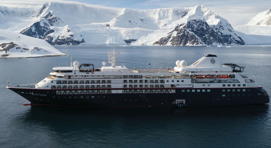
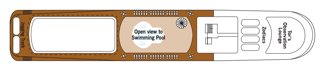

The images shown are for illustration purposes only and may not be an exact representation of what you find on the ship.
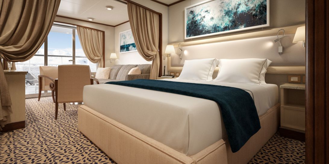
A Silversea signature, with a preferred central location, the Veranda Suite is spacious and welcoming.Floor-to-ceiling glass doors open onto a furnished private teak veranda from where you can contemplate anything from the midnight sun to an antarctic sunrise. The Deluxe Veranda Suite offers preferred central location with identical accommodation to a Veranda Suite.
One bedroom: 27 sq.m. including veranda
Two bedroom: 27 m² including veranda
Images are intended as a general reference. Features, materials, finishes and layout may be different than shown.
Essentials
Characteristics
Furniture
Media & Communication
Onboard Services
Amenities
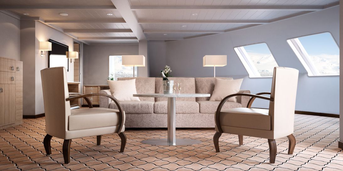

Expertly designed and exquisitely appointed. The ideal space for sharing stories with fellow explorers and new friends. With enough space to roam both in and outside, this suite is perfect relaxing and recounting the highlights of your day. Available as a one-bedroom configuration or as two-bedroom by adjoining with a Veranda Suite.
One bedroom: 95 sq.m. including veranda
Two bedroom: 122 sq.m. including veranda
Images are intended as a general reference. Features, materials, finishes and layout may be different than shown.
Please note that the 3rd guest will sleep on a comfortable sofa bed in the reception area of the suite.
Essentials
Characteristics
Furniture
Media & Communication
Onboard Services
Amenities
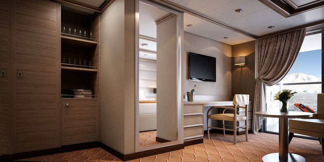
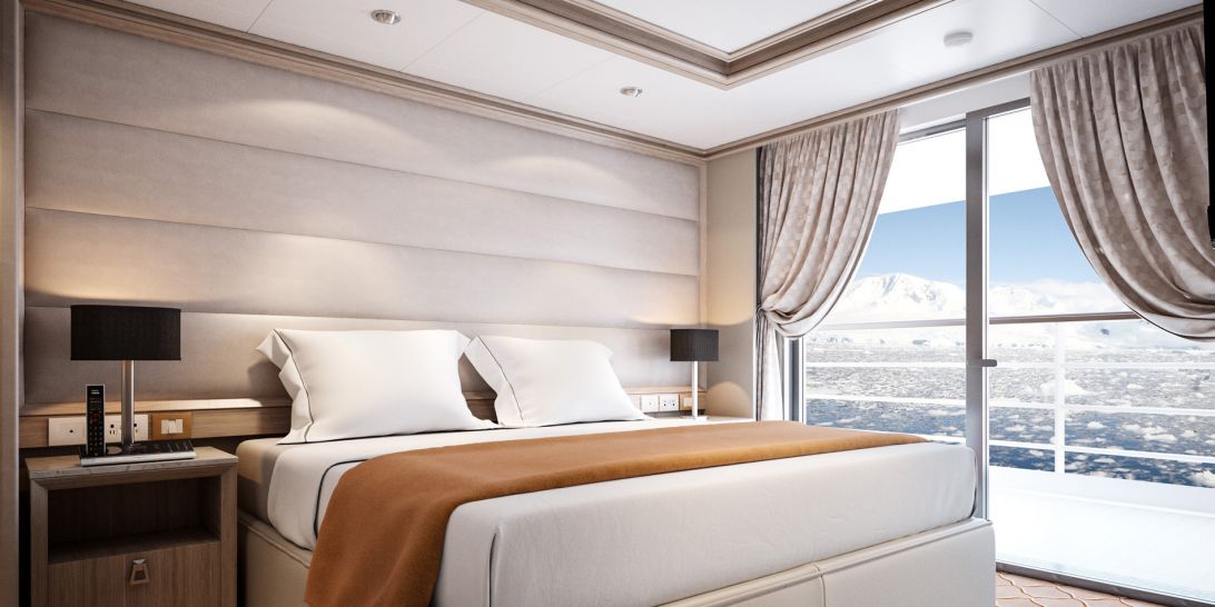
With a room configuration that favours watching the sun rise from the comfort of your bed and losing yourself in the mesmerising seascapes, this suite is the perfect answer to adventure cruising. A large walk-in wardrobe, and an expansive living make the Medallion Suite a your home away from home on the high seas. Medallion Suites accommodate three guests.
One bedroom: 48 sq.m. including veranda
Images are intended as a general reference. Features, materials, finishes and layout may be different than shown.
Please note that the 3rd guest will sleep on a comfortable sofa bed in the reception area of the suite.
Essentials
Characteristics
Furniture
Media & Communication
Onboard Services
Amenities
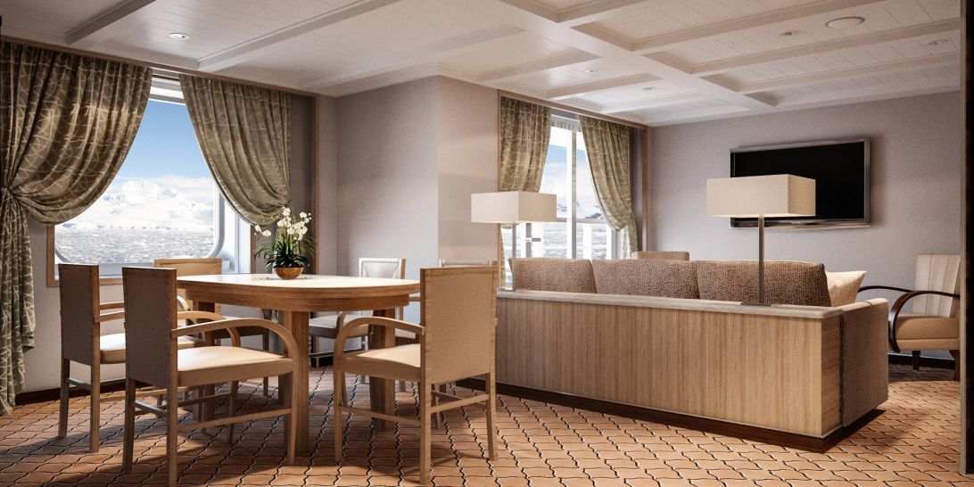
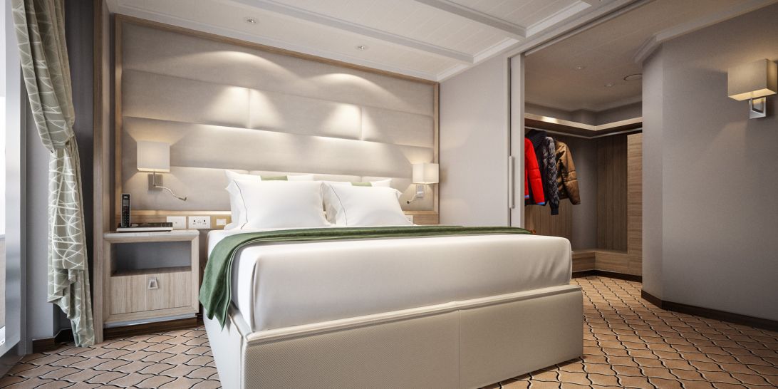
This stylish apartment offers the superlative in levels of space, comfort and service on board. A perfect mix of expedition experience with luxury lifestyle. Available as a one-bedroom configuration or as two bedroom by adjoining with a Vista Suite.
One bedroom: 55 sq.m. including veranda
Two bedroom: 77 sq.m. including veranda
Images are intended as a general reference. Features, materials, finishes and layout may be different than shown.
Please note that the 3rd guest will sleep on a comfortable sofa bed in the reception area of the suite.
Essentials
Characteristics
Furniture
Media & Communication
Onboard Services
Amenities
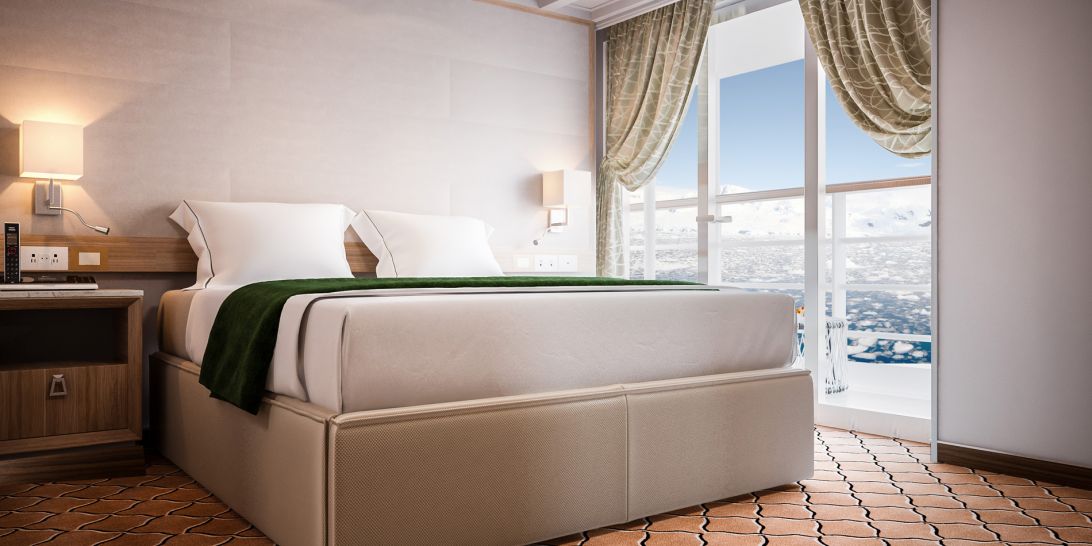
Stately. Commanding and majestic. Perfect for relaxing after a days’ exploring and looking through your photos. With lectures being streamed live to your room, this is the pinnacle of good living at sea. Available as a one-bedroom configuration or as two-bedroom by adjoining with a Veranda Suite.
One bedroom: 69 sq.m. including veranda
Two bedroom: 96 sq.m. including veranda
Images are intended as a general reference. Features, materials, finishes and layout may be different than shown.
Please note that the 3rd guest will sleep on a comfortable sofa bed in the reception area of the suite.
Essentials
Characteristics
Furniture
Media & Communication
Onboard Services
Amenities

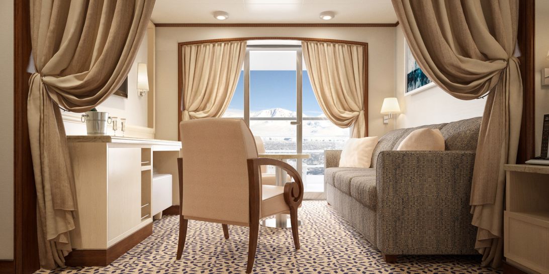
A Silversea signature, the Veranda Suite is spacious and welcoming. Floor-to-ceiling glass doors open onto a furnished private teak veranda from where you can contemplate anything from the midnight sun to an antarctic sunrise. Some Veranda Suites accommodate three guests (Suites going from 505 to 510 and from 605 to 610).
One bedroom: 27 sq.m. including veranda
Images are intended as a general reference. Features, materials, finishes and layout may be different than shown.
Please note that the 3rd guest will sleep on a comfortable sofa bed in the reception area of the suite.
Essentials
Characteristics
Furniture
Media & Communication
Onboard Services
Amenities
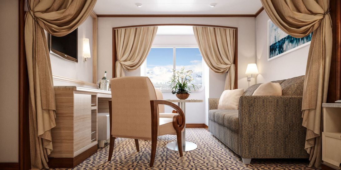
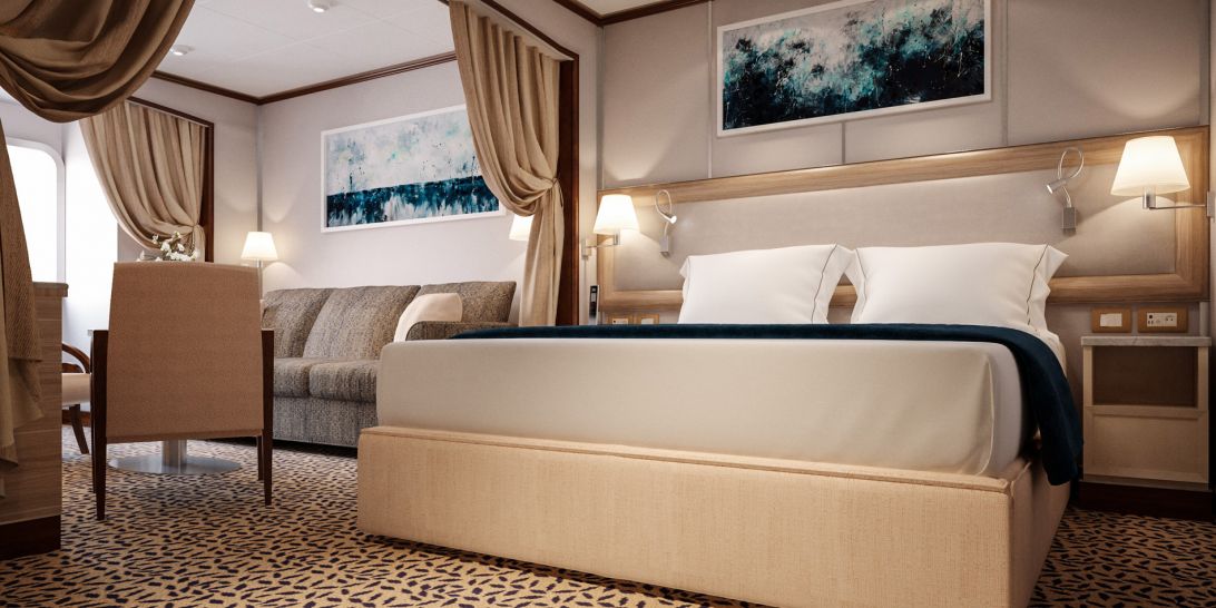
Your home away from home while you embrace the intrepid explorer within. The suite’s seating area has plenty of room to relax while you go over your notes, ready for the next adventure. Large picture windows frame panoramic ocean views, ideal for appraising the local wildlife.
One bedroom: 22 sq.m.
Wheelchair accessible suites: 449 and 451
Images are intended as a general reference. Features, materials, finishes and layout may be different than shown.
Essentials
Characteristics
Furniture
Media & Communication
Onboard Services
Amenities
The images shown are for illustration purposes only and may not be an exact representation of what you find on the ship.
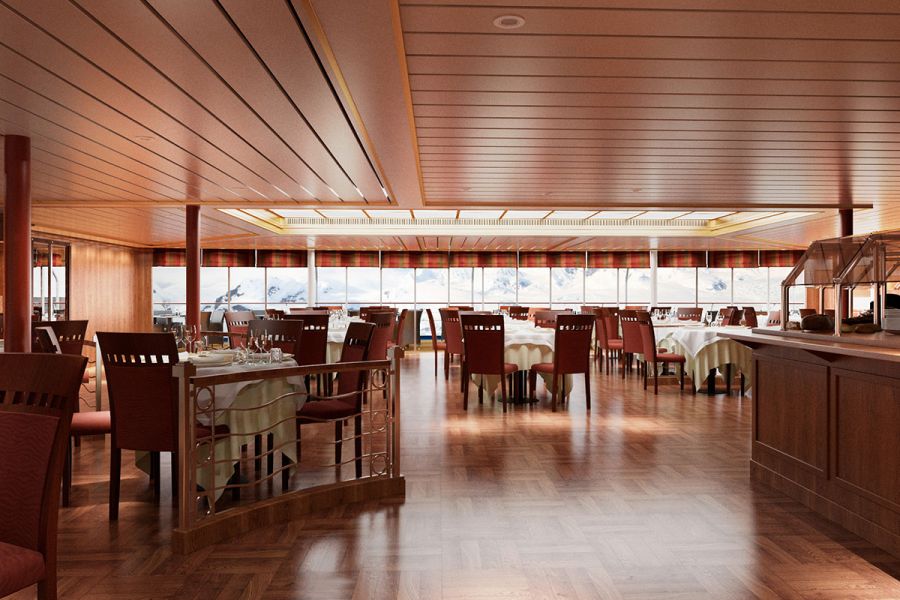
Authentic Italian recipes and the freshest, sustainable ingredients come together in this restaurant at sea.
Offering the very best of Italian cuisine, La Terrazza’s freshly made authentic a la carte dishes are complimented by a wide range of complimentary wines, even in the most remote of destinations! Using only the best seasonal produce, La Terrazza offers buffet restaurant for breakfast and lunch with indoor or al fresco seating and is transformed into an intimate Italian restaurant for dinner.
Soft breezes and ocean views beckon at the Grill, especially as the sun goes down when cruise guests gather for cocktails at the outdoor bar and talk about the day’s events.
One of the healthiest cuisines to exist, The Grill features lava stone cooking at its finest. Sourced from volcanic rock and placed in an oven to reach an optimum temperature of 400˚C, The Grill invites guests to cook their food directly at their table. Place your meat, fish or vegetables on top of the grill stone or inside the soup bowl, and then simply cook to your very own taste. Every bite is cooked to perfection, time after time. With the stone cooking available in the evenings only, The Grill becomes a daytime rotisserie and gourmet salad and burger bar, offering build your own burgers from the best selections of meat.
Dress code: Casual
Casual wear consists of pants, blouses or casual dresses for women; open-neck shirts and slacks for men are appropriate.
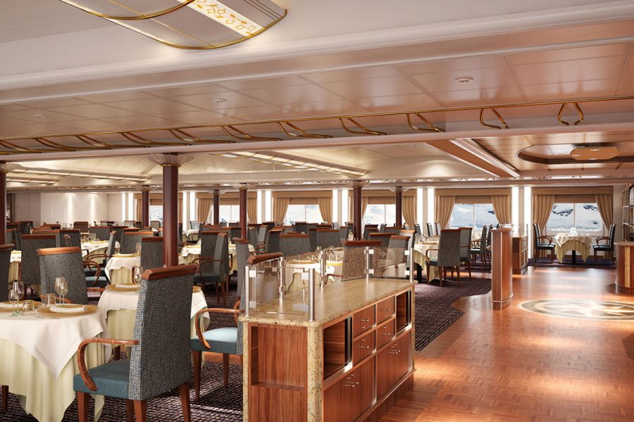
Enjoy Continental and regional specialities, as well as sweeping ocean views in our main dining room.
Sparkling with tales of adventure, bonhomie and like-minded friends, The Restaurant offers contemporary, international cuisine created by our most talented chefs. Menus feature regional specialities unique to the destinations guests visit on their cruise, so don’t be surprised to see a roasted Chilean Sea Bass while cruising the Chilean fjords.
The images shown are for illustration purposes only and may not be an exact representation of what you find on the ship.
Perfect for presentations, lectures and video screenings, this is where our team of dedicated experts share their knowledge on their specialised subject, not to mention their infectious passion and energy. Multi-tiered Explorer Lounge and banquette style seating ensure that you enjoy every minute of the talk and with lectures being streamed live to your suite if desired, this is one of the very few lecture theatres at sea theatre to combine such comfort with such technology.
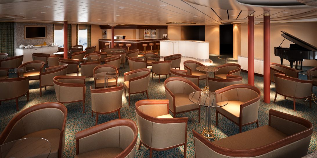
Relax and unwind in the Panorama Lounge, a sophisticated yet amicable space offering beautiful ocean views as you enjoy your cruise.
The Panorama Lounge is specially designed to provide an uninterrupted view of the day’s destination from the comfort of the luxury cruise ship’s interior. This is an ideal place to unwind on your cruise, enjoy afternoon tea, listen to the pianist and watch the setting sun. The drinks are complimentary, the music live and inviting. Enjoy dancing to a range of musical styles for every taste from standards to the latest club mixes.
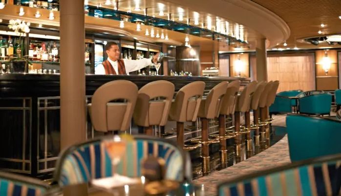
No cruise is complete without meeting new people. Enjoy complimentary drinks and live music at the bar while meeting other guests.
With complimentary cocktails and engaging conversation, live music and a dance floor, Dolce Vita on board Silver Cloud welcomes guests to mix and mingle. When living such unique experiences as these, there is never a dull moment!
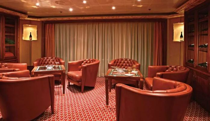
If you appreciate good cognac or premium cigars, be sure to visit the Connoisseur’s Corner to see the ship’s exceptional selection.
The Connoisseur’s Corner offers exceptional cognacs along with a premium selection of cigars for purchase.
The images shown are for illustration purposes only and may not be an exact representation of what you find on the ship.
The images shown are for illustration purposes only and may not be an exact representation of what you find on the ship.
Our Fusion packages are all ABTA & ATOL protected ensuring that your booking is safe with us
| Return flights including luggage allowance | |||
| Overseas Transfers | |||
| 74 nights aboard the Silver Cloud | |||
| Butler Service in Every Suite | |||
| Gratuities Always Included | |||
| Beverages In-Suite and Throughout the Ship | |||
| Gourmet Dining | |||
| In Suite Dining & 24-Hour Room Service | |||
| Intimate small size ships | |||
| Free Wifi Throughout the Ship | |||
| Free Zodiac, Land and Sea Tours & Activities & Complimentary Expedition gear | |||
| Port Taxes and Fees | |||
 | ABTA and ATOL Protection* | ||
Date 25th Aug 2024 |
Nts 74 |
Prices from £64,900pp |
Date 25th Aug 2024 |
Nts 74 |
Prices from £64,900pp |
Fusion Cruises when selling travel arrangements is a trading name of The Midcounties Co-operative Ltd. Fusion Cruises is an Accredited Body Member of Midcounties Co-operative Travel Consortium. (ABTA:P6652, ATOL:6053).
Book with Confidence. We are a Member of ABTA which means you have the benefit of ABTA’s assistance and Code of Conduct.
Some of the flights and flight-inclusive holidays on this website are financially protected by the ATOL scheme but ATOL protection does not apply to all holiday and travel services offered on this website. This website will provide you with information on the protection that applies in the case of each holiday and travel service offered before you make your booking. If you do not receive an ATOL Certificate then the booking will not be ATOL protected. If you do receive an ATOL Certificate but all parts of your trip are not listed on it, those parts will not be ATOL protected. Please see our booking conditions for information, or for more information about financial protection and the ATOL Certificate go to: www.caa.co.uk
