| | | | | Arrive | Depart |
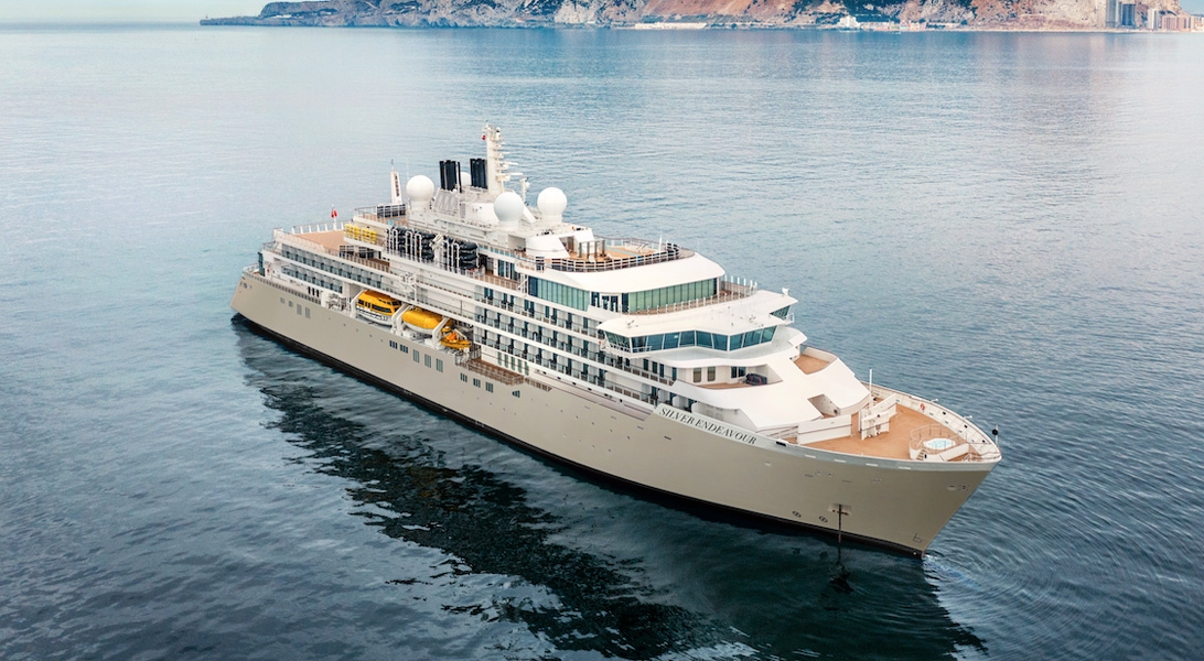
| 7th07 | SepSep | 202727 | Reykjavík, Iceland, embark on the Silver Endeavour | | 18:00 |
Sprawling Reykjavík, the nation's nerve center and government seat, is home to half the island's population. On a bay overlooked by proud Mt. Esja (pronounced eh-shyuh), with its ever-changing hues, Reykjavík presents a colorful sight, its concrete houses painted in light colors and topped by vibrant red, blue, and green roofs. In contrast to the almost treeless countryside, Reykjavík has many tall, native birches, rowans, and willows, as well as imported aspen, pines, and spruces.Reykjavík's name comes from the Icelandic words for smoke, reykur, and bay, vík. In AD 874, Norseman Ingólfur Arnarson saw Iceland rising out of the misty sea and came ashore at a bay eerily shrouded with plumes of steam from nearby hot springs. Today most of the houses in Reykjavík are heated by near-boiling water from the hot springs. Natural heating avoids air pollution; there's no smoke around. You may notice, however, that the hot water brings a slight sulfur smell to the bathroom.Prices are easily on a par with other major European cities. A practical option is to purchase a Reykjavík City Card at the Tourist Information Center or at the Reykjavík Youth Hostel. This card permits unlimited bus usage and admission to any of the city's seven pools, the Family Park and Zoo, and city museums. The cards are valid for one (ISK 3,300), two (ISK 4,400), or three days (ISK 4,900), and they pay for themselves after three or four uses a day. Even lacking the City Card, paying admission (ISK 500, or ISK 250 for seniors and people with disabilities) to one of the city art museums (Hafnarhús, Kjarvalsstaðir, or Ásmundarsafn) gets you free same-day admission to the other two. The capital of Iceland’s land of ice, fire and natural wonder, Reykjavik is a city like no other - blossoming among some of the world’s most vibrant and violent scenery. Home to two-thirds of Iceland’s population, Reykjavik is the island’s only real city, and a welcoming and walkable place - full of bicycles gliding along boulevards or battling the wind when it rears up. Fresh licks of paint brighten the streets, and an artistic and creative atmosphere embraces studios and galleries - as well as the kitchens where an exciting culinary scene is burgeoning. Plot your adventures in the city's hip bars and cosy cafes, or waste no time in venturing out to Iceland’s outdoor adventures. Reykjavik’s buildings stand together - below the whip of winter’s winds - together with the magnificent Hallgrímskirkja church, with its bell tower rising resolutely over the city. Iceland’s largest church's design echoes the lava flows that have shaped this remote land and boasts a clean and elegant interior. The Harpa Concert Hall’s sheer glass facade helps it to assimilate into the landscape, mirroring back the city and harbour. Its LED lights shimmer in honour of Iceland’s greatest illuminated performance – the northern lights. Walk in the crusts between continents, feel the spray from bursts of geysers and witness the enduring power of Iceland’s massive waterfalls. Whether you want to sizzle away in the earth-heated geothermal pools, or hike to your heart’s content, you can do it all from Reykjavik - the colourful capital of this astonishing outdoor country. |
| 8th08 | SepSep | 202727 | At Sea | | |
| 9th09 | SepSep | 202727 | Lindenow Fjord, Greenland | 15:00 | 19:00 |
| 10th10 | SepSep | 202727 | Prince Christian Sound, Greenland | 06:00 | 10:00 |
The transit through the Sound is one of this voyage’s highlights. Connecting the Labrador Sea with the Irminger Seat, Prince Christian Sound or “Prins Christian Sund” in Danish is named after Prince (later King) Christian VII (1749-1808). 100 km (60 miles ), long and at times just 500 m (1500 ft) wide, this majestic and spectacular fiord throws you back into a Viking era – flanked by soaring snow-topped mountains, rock-strewn cliffs and rolling hills, it is as if time has stood still and one easily forgets that this is the 21st century. As you marvel at the sheer size of the mountains that surround you, with the Arctic waters lapping deceptively at the hull, revel in the silence enveloping you. Icebergs float serenely by, carrying with them the ages of time. Be sure to wear warm clothing as this is one spectacle that you do not want to miss. The transit through the Sound is one of this voyage’s highlights. Connecting the Labrador Sea with the Irminger Seat, Prince Christian Sound or “Prins Christian Sund” in Danish is named after Prince (later King) Christian VII (1749-1808). 100 km (60 miles ), long and at times just 500 m (1500 ft) wide, this majestic and spectacular fiord throws you back into a Viking era – flanked by soaring snow-topped mountains, rock-strewn cliffs and rolling hills, it is as if time has stood still and one easily forgets that this is the 21st century. As you marvel at the sheer size of the mountains that surround you, with the Arctic waters lapping deceptively at the hull, revel in the silence enveloping you. Icebergs float serenely by, carrying with them the ages of time. Be sure to wear warm clothing as this is one spectacle that you do not want to miss. |
| 11th11 | SepSep | 202727 | Qaqortoq (Julianehaab), Greenland | 06:30 | 12:00 |
The largest town in southern Greenland, Qaqortoq has been inhabited since prehistoric times. Upon arrival in this charming southern Greenland enclave, it's easy to see why. Qaqortoq rises quite steeply over the fjord system around the city, offering breath-taking panoramic vistas of the surrounding mountains, deep, blue sea, Lake Tasersuag, icebergs in the bay, and pastoral backcountry. Although the earliest signs of ancient civilization in Qaqortoq date back 4,300 years, Qaqortoq is known to have been inhabited by Norse and Inuit settlers in the 10th and 12th centuries, and the present-day town was founded in 1774. In the years since, Qaqortoq has evolved into a seaport and trading hub for fish and shrimp processing, tanning, fur production, and ship maintenance and repair. The largest town in southern Greenland Qaqortoq has been inhabited since prehistoric times. Upon arrival in this charming southern Greenland enclave it's easy to see why. Qaqortoq rises quite steeply over the fjord system around the city offering breath-taking panoramic vistas of the surrounding mountains deep blue sea Lake Tasersuag icebergs in the bay and pastoral backcountry. Although the earliest signs of ancient civilization in Qaqortoq date back 4 300 years Qaqortoq is known to have been inhabited by Norse and Inuit settlers in the 10th and 12th centuries and the present-day town was founded in 1774. In the years since Qaqortoq has evolved into a seaport and trading hub for fish and shrimp processing tanning fur production and ship maintenance and repair. |
| 11th11 | SepSep | 202727 | Hvalsey, Greenland | 14:00 | 18:00 |
Northeast of Qaqortoq and at the end of a fjord, Hvalsey is one of the best examples of South Greenland’s many scattered ruins from the Norse period. Today the area is used for sheep-grazing, but until the 15th century the settlement at Hvalsey, and specifically Hvalsey’s church, played an important part. Christianity had spread its influence throughout Europe and eventually had reached remote Greenland, where it established itself in the country in 1000 AD. Hvalsey Church was built in the 14th century and is the best preserved of the churches in Greenland from that period. Apart from the church walls, historical ruins from the time of the Norse are just a few meters away. 18 kilometers northeast of Qaqortoq, Hvalsey is part of Qaqortukulooq, one of the five sites of the UNESCO World Heritage Arctic farming complex Kujataa. Between Eriksfjord to the north and Einarsfjord to the south, the Hvalseyfjord branches off from Einarsfjord. Although Hvalsey is better known for the well-preserved ruins of one of the sixteen churches in the Norse’s Eastern Settlement, the church was in a farmstead known as Thjodhild’s Stead. This farmstead at the northeastern end of the fjord included a large building with living quarters, a hall and livestock pens, as well as other livestock pens, a storage building and a warehouse –the ruins of which can still be seen. The Norse farming laid the foundation for the Inuit farming in later centuries, leading to the UNESCO World Heritage status in 2017. In the 14th century account “Descriptions of Greenland” the abundant fish, a reindeer farm on Reindeer Island and Hvalsey’s name “Whale Island” clearly indicate that the Norse had ample food sources at that time. The church was built in the Anglo-Norwegian style of the 13th century, but is known to have been built over an older graveyard. The farmstead is mentioned in the Icelandic “Book of Settlements” as property of the Kings of Norway, and the last documented event of the Norse in Greenland is a wedding which took place in the church in September 1408. After almost 600 years of abandonment, conservation work had to be done to prevent the seaward wall from collapsing. |
| 12th12 | SepSep | 202727 | At Sea | | |
| 13th13 | SepSep | 202727 | Saglek Fjord, Newfoundland and Labrador, Canada | 08:30 | 18:00 |
| 14th14 | SepSep | 202727 | Hopedale, Newfoundland and Labrador, Canada | 13:30 | 19:00 |
| 15th15 | SepSep | 202727 | Gannett Island, Labrador, Canada | 15:15 | 20:00 |
| 16th16 | SepSep | 202727 | Battle Harbour, Newfoundland & Labrador, Canada | 07:30 | 17:00 |
| 17th17 | SepSep | 202727 | Woody Point, Gros Morne National Park, Newfoundland and Labrador, Canada | 09:00 | 19:30 |
Acclaimed for its unearthly landscape, Woody Point is probably as close to Mars as you will ever get in this lifetime. Situated on the west coast of the island, the Tablelands behind Woody Point in the Gros Morne National Park are composed of peridotite — like much of the surface of Mars — and NASA, the Canadian Space Agency, plus others are studying this unique land form searching for insights into possible bacterial life on the red planet. The story of the Tablelands earned Gros Morne its World Heritage Site status from UNESCO in 2010, and the area remains a geological wonder, showcasing a time when the continents of Africa and North America collided. When the plates struck 485 million years ago, the peridotite was pushed to the surface, and remained above sea level. The rock lacks the nutrients to sustain plant life, thus giving the Tablelands a barren, isolated appearance. As the name suggests, the flat topped mountains dwarf the tiny village (population 281!), yet Woody Point has retained its character and the historic houses and buildings dating from 1870 have been beautifully maintained. Acclaimed for its unearthly landscape Woody Point is probably as close to Mars as you will ever get in this lifetime. Situated on the west coast of the island the Tablelands behind Woody Point in the Gros Morne National Park are composed of peridotite — like much of the surface of Mars — and NASA the Canadian Space Agency plus others are studying this unique land form searching for insights into possible bacterial life on the red planet. The story of the Tablelands earned Gros Morne its World Heritage Site status from UNESCO in 2010 and the area remains a geological wonder showcasing a time when the continents of Africa and North America collided. When the plates struck 485 million years ago the peridotite was pushed to the surface and remained above sea level. The rock lacks the nutrients to sustain plant life thus giving the Tablelands a barren isolated appearance. As the name suggests the flat topped mountains dwarf the tiny village (population 281!) yet Woody Point has retained its character and the historic houses and buildings dating from 1870 have been beautifully maintained. |
| 18th18 | SepSep | 202727 | At Sea | | |
| 19th19 | SepSep | 202727 | At Sea | 13:00 | 20:00 |
| 20th20 | SepSep | 202727 | Grand Manan, New Brunswick, Canada | 06:30 | 12:00 |
| 21st21 | SepSep | 202727 | At Sea | | |
| This Cape Cod Canal Transit is a rare must for any travel savvy guest. With two fixed bridges over the canal, clearance is a problem for bigger ships but Silversea’s small size ships allow us to glide through as if we were a passenger yacht. For guests lucky enough to be travelling in the daylight, the surrounding scenic spectacle is something truly to behold. If you are travelling during migrating season, be on the lookout for temporary residents such as the Great Blue Heron and the Red-tailed hawk. As the cape is surrounded by a hybrid of temperate sub-tropical waters and polar ice floes, marine mammal spotters will rejoice as they vie to spot some of the huge variety of wildlife that lives in the canal including the endangered North American Right Whale. For guests traversing the canal at night, we assure you a smooth passage. With a maximum speed of just 8.5 knots authorised by the U.S. Marine authorities, you can be sure you’ll glide by the pretty New England shore side in plenty of Silversea comfort |
| 22nd22 | SepSep | 202727 | Bayonne, France, disembark the Silver Endeavour | | |